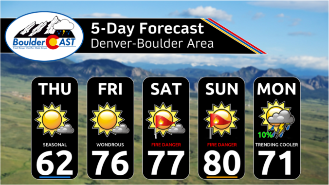
Warm temperatures, low humidity, and strong gusty winds will start our week with continued fire danger across the Plains. A strong area of low pressure will also bring the threat of rain showers late Monday into Tuesday to the Denver Metro area, with heavy snow piling up in the Mountains. Later in the week, a cold front will slide down ushering in below normal temperatures and upslope flow. A prolonged period of unsettled weather will follow this front, with even some late-season snow possible in the Metro area and heavy snow looking likely in the Foothills. Read on to find out more.
Category: Climatology (Page 1 of 42)
These posts contain information about the long-term weather patterns of Boulder County. Potential topics may include 30-day weather outlooks, El Nino/La Nina, and seasonal forecasts. You will find less about the day-to-day weather, with more focus on longer trends and patterns.
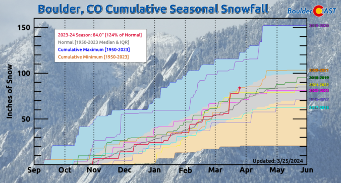
The month of March was fairly dry and chilly most of the time, but we can’t forget the historic El Niño snowstorm which slammed the entire Front Range around the middle of the month. Snow totals of 1 to 2 feet occurred in Boulder and Denver with up to 5 feet fell in the nearby Foothills. Here’s a quick and colorful graphical recap of our weather during March and how it relates to climatology.
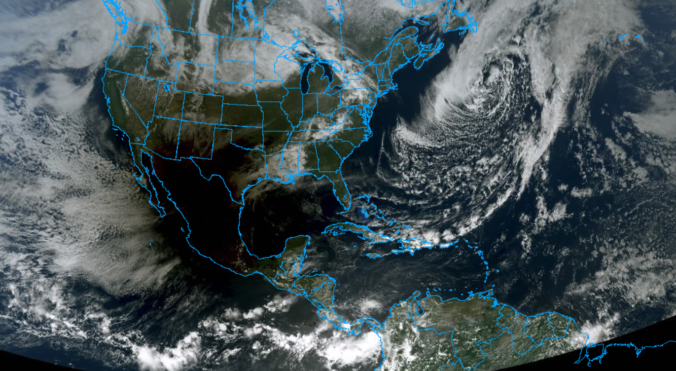
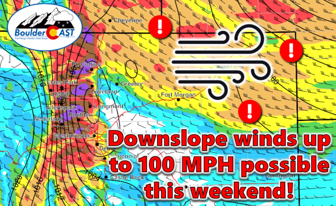
An exceptionally strong spring storm is approaching Colorado which will develop into a big ol’ blizzard in the coming days. However, unlike the last few storms which have been direct hits on the Front Range, this one will track further north leading to more wind than precipitation in our area. After a warm and gusty Friday with high fire danger, the incoming storm will bring colder temperatures and a brief chance of rain/snow showers on Saturday. The biggest impacts from this system, though, will come in the form of prolonged damaging downslope winds. We take a look at the large-scale atmospheric setup and discuss the potential snowfall amounts and which unlucky areas have a chance at wind gusts up to 100 MPH this weekend.
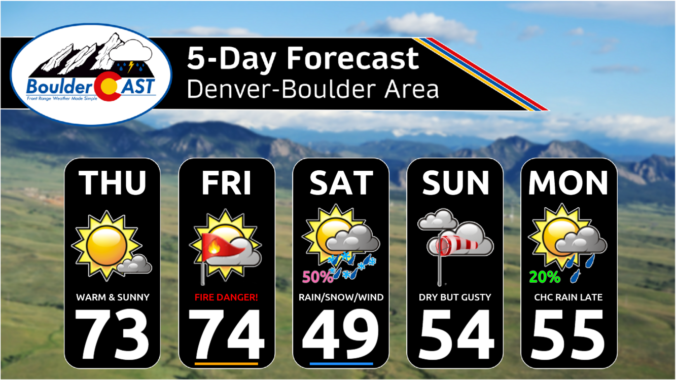
The week starts off on the chilly side with rain/snow showers for our Monday thanks to a passing area of low pressure. Snowfall amounts will be rather limited by marginal temperatures, with the best chance for a few inches of accumulation being in the Foothills. A trend toward above normal temperatures will take over by mid to late week as an omega blocking pattern sets up over the central United States. We are watching the potential for not only fire weather concerns late in the week but also a rain/snow chance for the weekend as another strong storm system moves in. Let’s take a look!

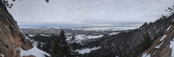
Liew View of Boulder

Current Conditions

Live Radar

Recent Premium Posts

BoulderCAST Daily – Fri 04/19/24 | Rain changing to snow later today and tonight with several slushy inches possible
⦁❶⦁ Highs in the low 40s with showers will trend colder with snow …
This Weekend in Colorado Weather: A few days of winter weather ahead, but we’ll be back into the 70s by Sunday!
⦁❶⦁ A dreary Thursday with drizzle, flurries and freezing drizzle lingering during the …
BoulderCAST Daily – Wed 04/17/24 | A breezy & mild Wednesday, but change commences this evening with the arrival of the first cold front
⦁❶⦁ One last mild spring day before we transition cooler and unsettled the …
3-Day Forecast

Air Quality

Trending Content


Live View of Boulder
Trending Content
© 2024 Front Range Weather, LLC