We recap the storm that dumped our desperately-needed inaugural snow of the season, and announce the winners of our “First Snow” Contest!
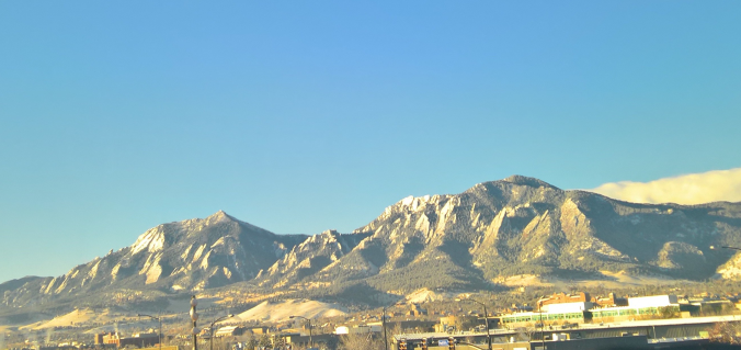
Hooray! It finally snowed!
After a historically warm fall, and breaking the all-time November temperature record on Wednesday, yesterday’s snow was a welcomed and missed sight across the Front Range. Don’t try to deny it…there’s definitely at least one crappy picture of some snow on your smartphone, likely depicting one or more pieces of patio furniture, or even worse, yourself in a snow selfie.
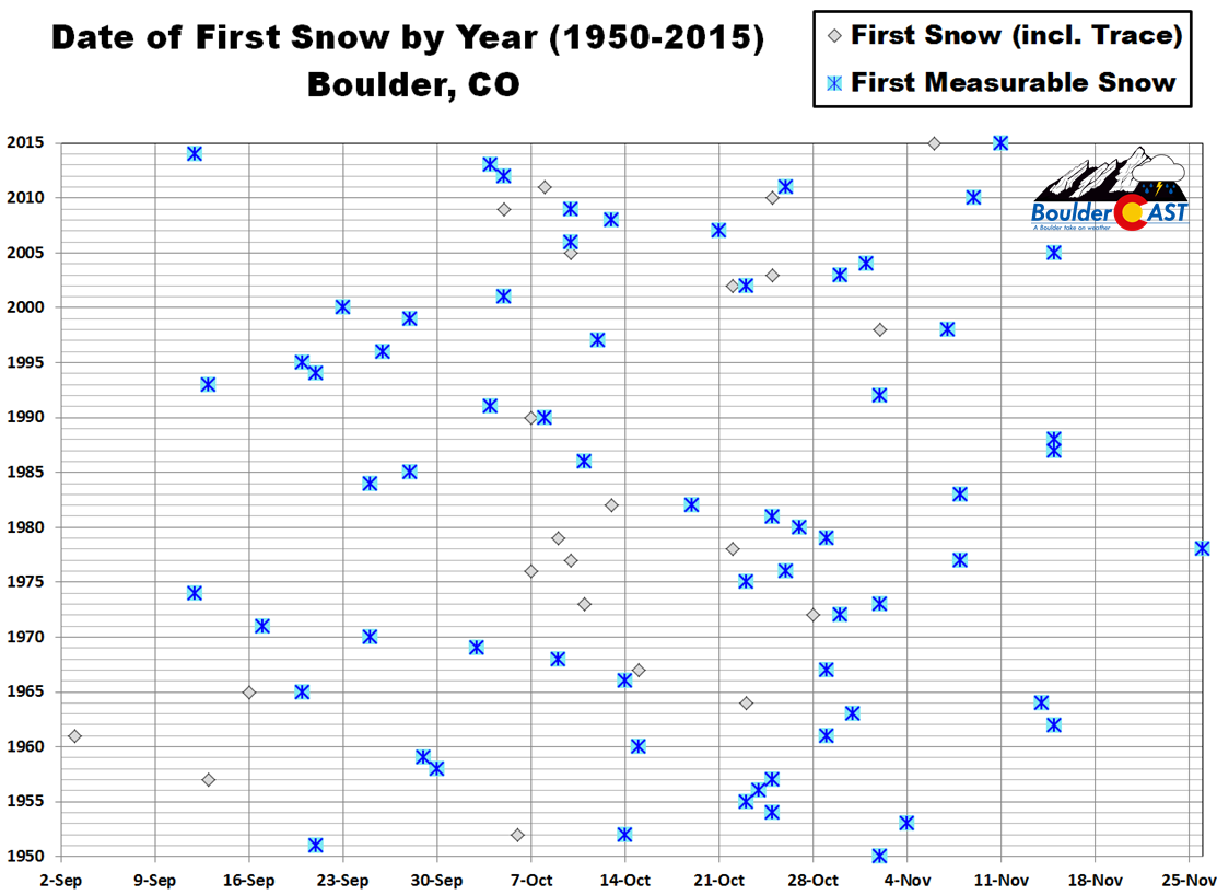
It’s hard to believe we made it all the way to November 17th without any snow. Since 1948, the year when Boulder’s historical climate station shifted to the NIST building (and snowfall records became more reliable), 2016 has delivered our second latest first measurable snowfall. 1978 still takes the cake, with those first accumulating flakes holding out until November 26th!
However, we did secure a secondary record this year…2016 had the latest APPEARANCE of snowfall (including trace amounts). Though parts of the city and surrounding areas had a few snowflakes mix in with rain back on October 7th, Boulder’s official station did not denote this, paving the way for this record-year.
We first alerted our Premium members to this particular storm nine days ago, and made our final forecast on Wednesday evening. While the system was set to rapidly intensity in eastern Colorado and had plenty of cold air, it was fast-moving and didn’t have an ideal track for us. We predicted a modest 1-2″ for most of the lower elevations, with 2-5+” in the Foothills and Mountains.
Shown below is our final forecast snow total map, with the observed storm totals per location contained in boxes. Green boxes indicate that the observed snowfall was within one inch of the given forecast range, while red was (regrettably) outside the scope of our forecast.
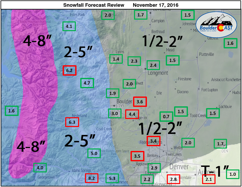
Overall, the storm was a bit of an “over-producer”, dropping 1-3″ for the Plains and 4-8″ in the Foothills. Most folks seem to have genuinely been caught off-guard by how much snow actually fell. It didn’t help that the NWS, even on Thursday morning, was forecasting for much of the early part of the storm to remain rain or a rain/snow mix on the Plains. Their discussion stated that most areas would see only one inch or less of snow. We also heard on the radio the night before that this storm would “mostly impact the mountains” and that “Denver would only see a few flurries.” Yeah, how those flurries added up….
So, as you can see, our 1/2-2″ forecast was actually on the high side compared to most other forecasts floating around, but still wasn’t even high enough for several locations.
Boulder officially recorded 4.4″ of snow, while Denver managed just 1.7″ (at DIA, downtown had more, as usual). At BoulderCAST Station in North Boulder, we measured 1.9″.
Why did this storm produce so much snow? We believe the answer is two-fold:
- Observations show that the storm landed in the top range of what the models were predicting as far as how much liquid equivalent would materialize (0.15-0.35″). This in itself should have pushed snow totals toward the upper bounds of many forecasts.
- The storm came in faster and colder than expected. While we didn’t think much rain would occur at the onset, we did expect that much of the snow that did fall during the day would melt and only accumulate on grassy surfaces. Some heavier early evening snow fell when temperatures were much colder, in the 20’s. In fact, there wasn’t even any diurnal signature in our temperature yesterday (no increase at all when the sun came up —see below time series of temperature and dewpoint). These colder temperatures definitely contributed to less melting and more overall accumulation.
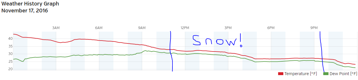
Graph of the temperature (red) and dew point (green) Thursday from BoulderCAST Station. The blue lines roughly denote the time snow started and stopped falling.
So in the end, it wasn’t an overly impactful storm. It was however a good starter for things to come as our snow season progresses…
Plenty of sunshine and warmer temperatures will make quick work to melt the snow. We’ll be back into the 60’s by Sunday. However, the warmth will be short-lived as we’re already tracking another potential snow-maker for early next week. This next system looks very similar to this last storm. Stay tuned!
BoulderCAST “First Snow” Contest Results
Thanks to those of you whom participated in the contest.
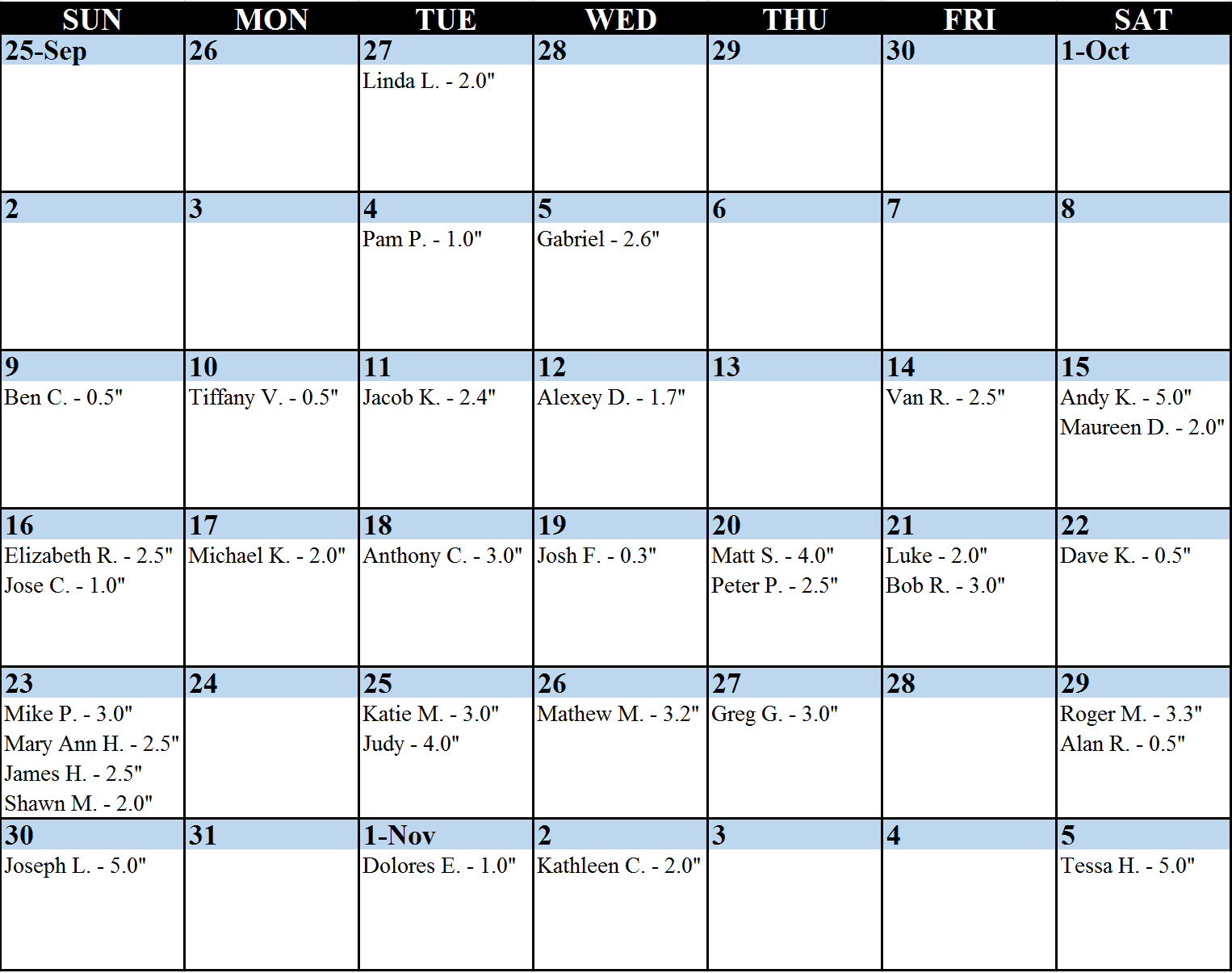
Calendar of all entries, showing names and amounts of all guesses
It seems most people were overly excited for the proposition of our first snow! The entries were definitely skewed towards an early first snow, rather than late. Technically the winning parties had be known for quite some time (since the latest guess was November 5th!). However, we decided to wait until everything was official to announce the winners. Without further adieu…
- 1st place: 6-month subscription to BoulderCAST Premium
- Tessa H.
- 2nd place: 3-month subscription to BoulderCAST Premium
- Kathleen C.
- 3rd – 5th places: 1-month subscription to BoulderCAST Premium
- Dolores E.
- Roger M.
- Alan R.
Four of the five lucky folks are new to BoulderCAST Premium! Winners will receive an email with further instructions in the next few days. Congrats, all! If you didn’t win, don’t fret. We’ll likely host more weather-related contests periodically throughout the year.
And remember, we currently have a promotion running through the end of November offering a year-long BoulderCAST Premium subscription at 30% discount.


