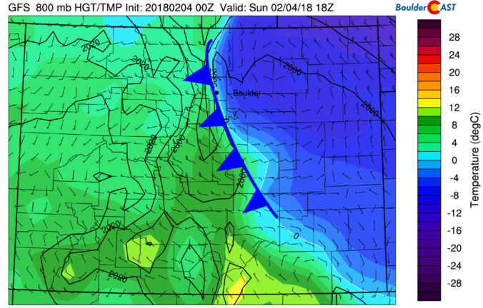
Yet another shallow Arctic front has backed into the Metro area this morning, with light snow and freezing drizzle now falling across the region. We detail the weather for the next 48 hours, including the chance of more wintry weather Monday night.
We first mentioned this cold air last Monday in our weekly outlook. By Thursday, model uncertainty remained high in regards to WHEN and IF this front would reach the Denver Metro area. Sure enough, around 4:00 AM this morning the front moved through, with temperatures falling from near 50 degrees into the teens at BoulderCAST Station:

As of 10:00 AM Sunday, temperatures across the Metro Area are in the low to middle teens across the Plains. However, once you get above about 7500 feet elevation, temperatures are in the 30’s!
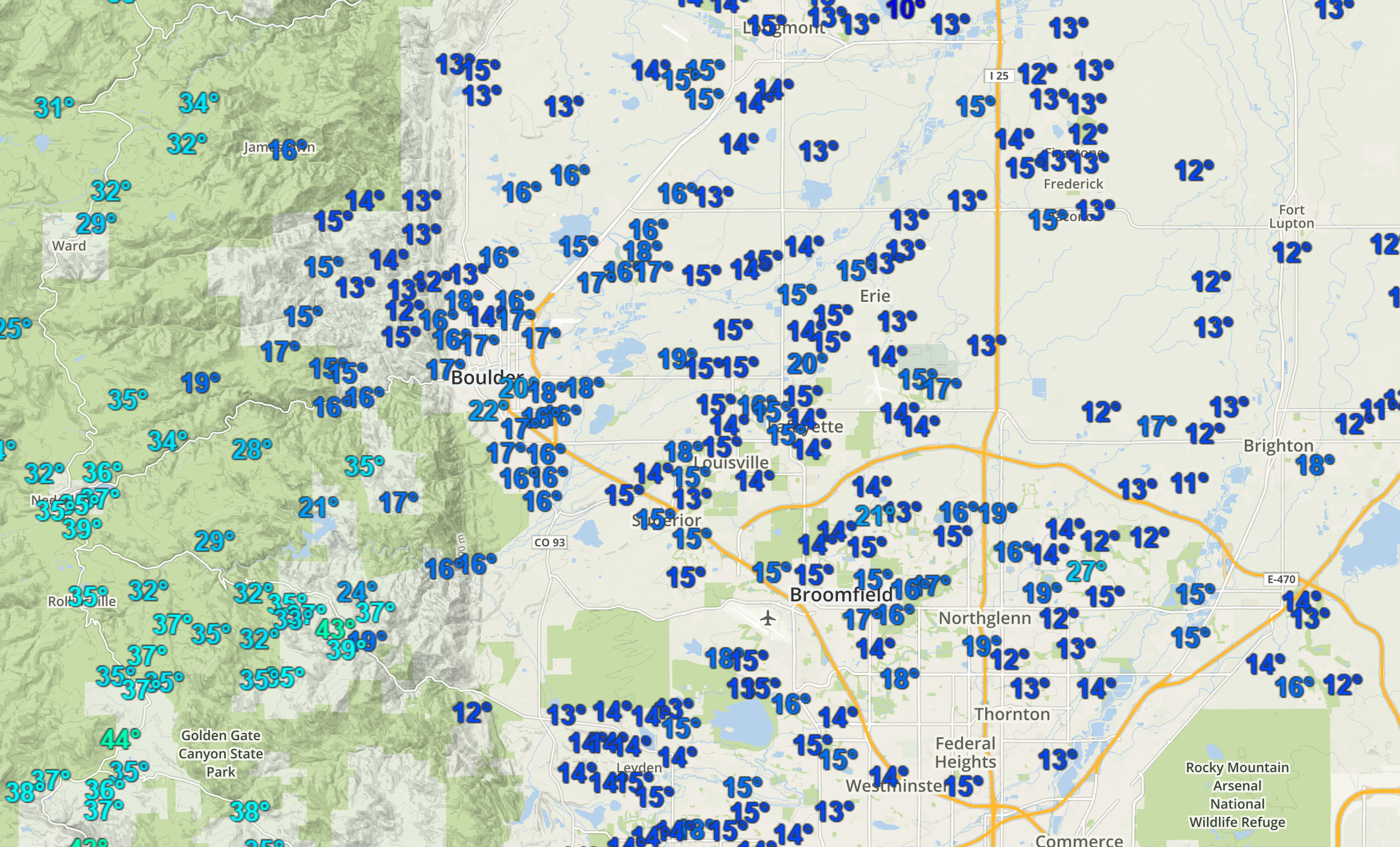
Current temperatures as of 10:00 AM across the Metro area. Frigid across the Plains, warmer higher up.
As the day progresses, we expect the west-northwest winds aloft to win out and erode the shallow cold air, bringing an end to the freezing drizzle and snow. Temperatures should also quickly jump back above freezing as sunny skies return. The animation below from the HRRR model shows this Arctic air eroding, with 30’s and (likely over-done) 40’s for this afternoon.
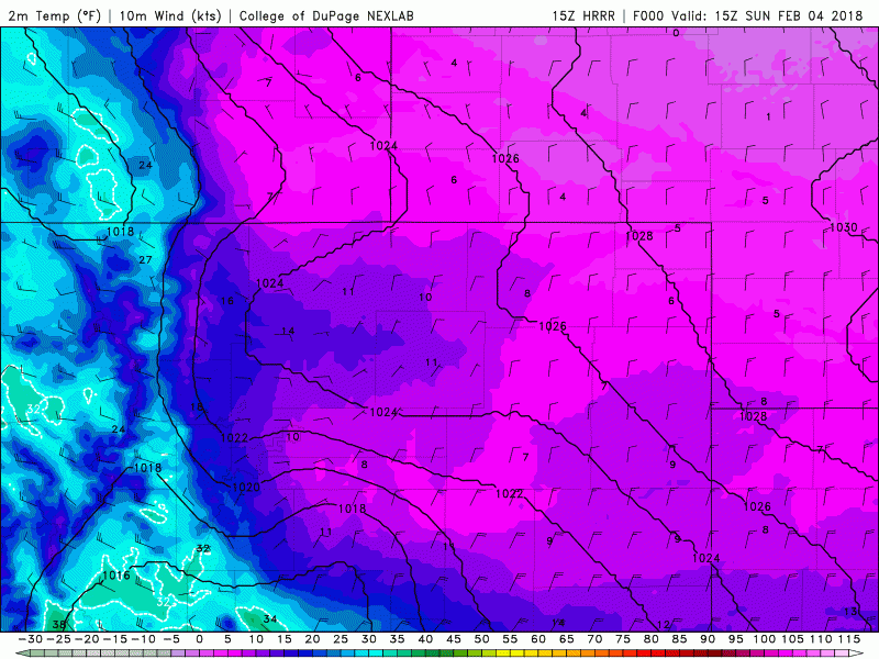
High-resolution HRRR model surface temperature forecast for today. Notice the cold air eroding and temperatures quickly warming this afternoon.
Models notoriously have a challenging time with these shallow air masses, so this warm-up isn’t a guarantee. We’d say there is still a 10 to 20% chance things stay frigid through the day. Nonetheless, travel conditions will greatly improve this afternoon just in time for any Super Bowl festivities! Since my hometown is in western Pennsylvania, I have a strong disdain for the entire eastern portion of the state, including Philadelphia. Therefore…

Our attention then turns to another weakly-organized system streaming into Colorado. It’s embedded in the northwest flow and will be moving through Monday afternoon into Tuesday afternoon. Moisture is limited and models are not yet producing much consolidated energy. However, it will bring slight chance of rain showers Monday afternoon and evening, with the potential for a few snowflakes overnight into Tuesday morning.
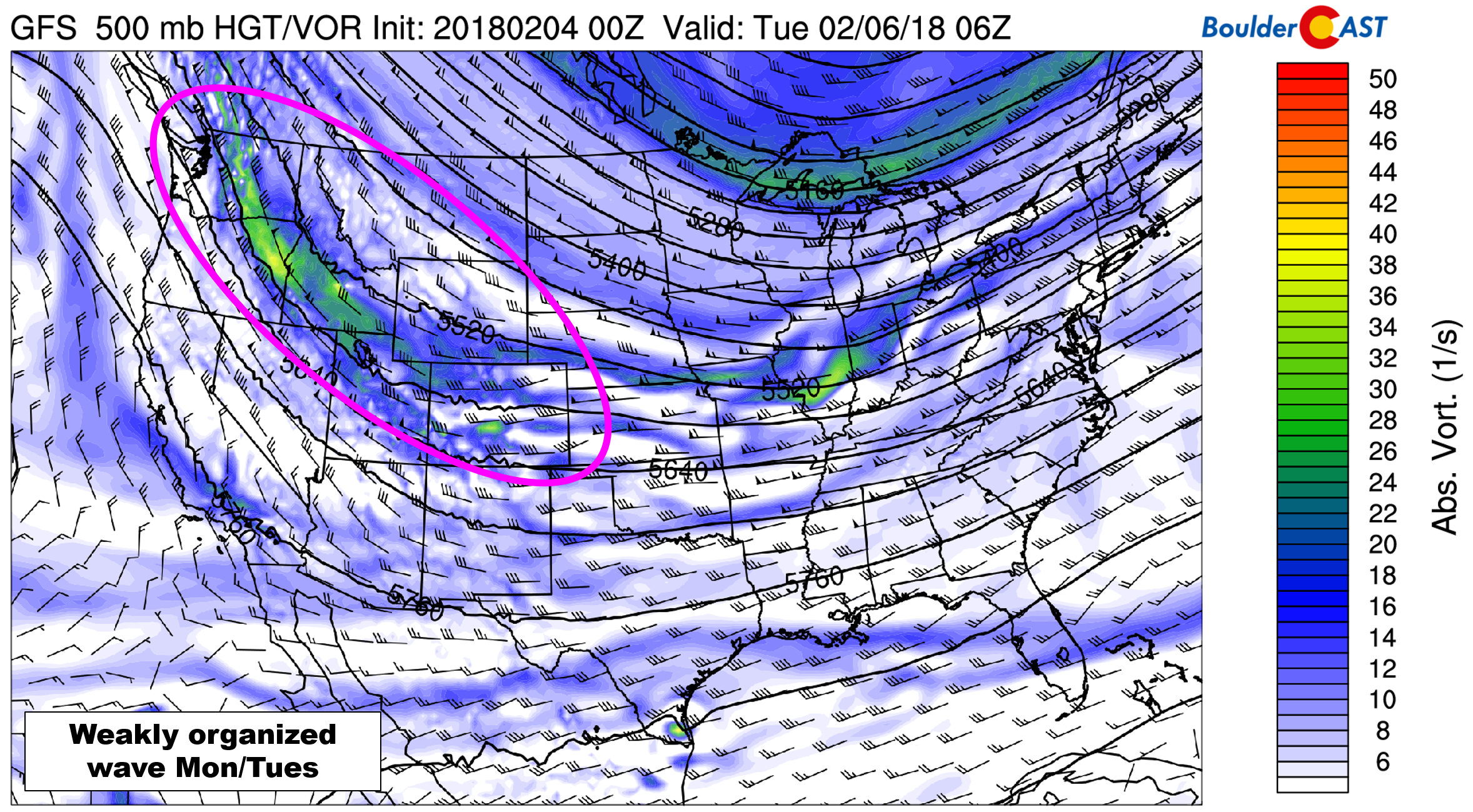
There is also uncertainty in the position of a developing jet streak Monday night. Models currently have this feature too far south, which brings the best chance of jet forced snow to southeastern Colorado. Given everything we are seeing right now, any snow accumulation for the Boulder/Denver area should be light, generally less than 2″.
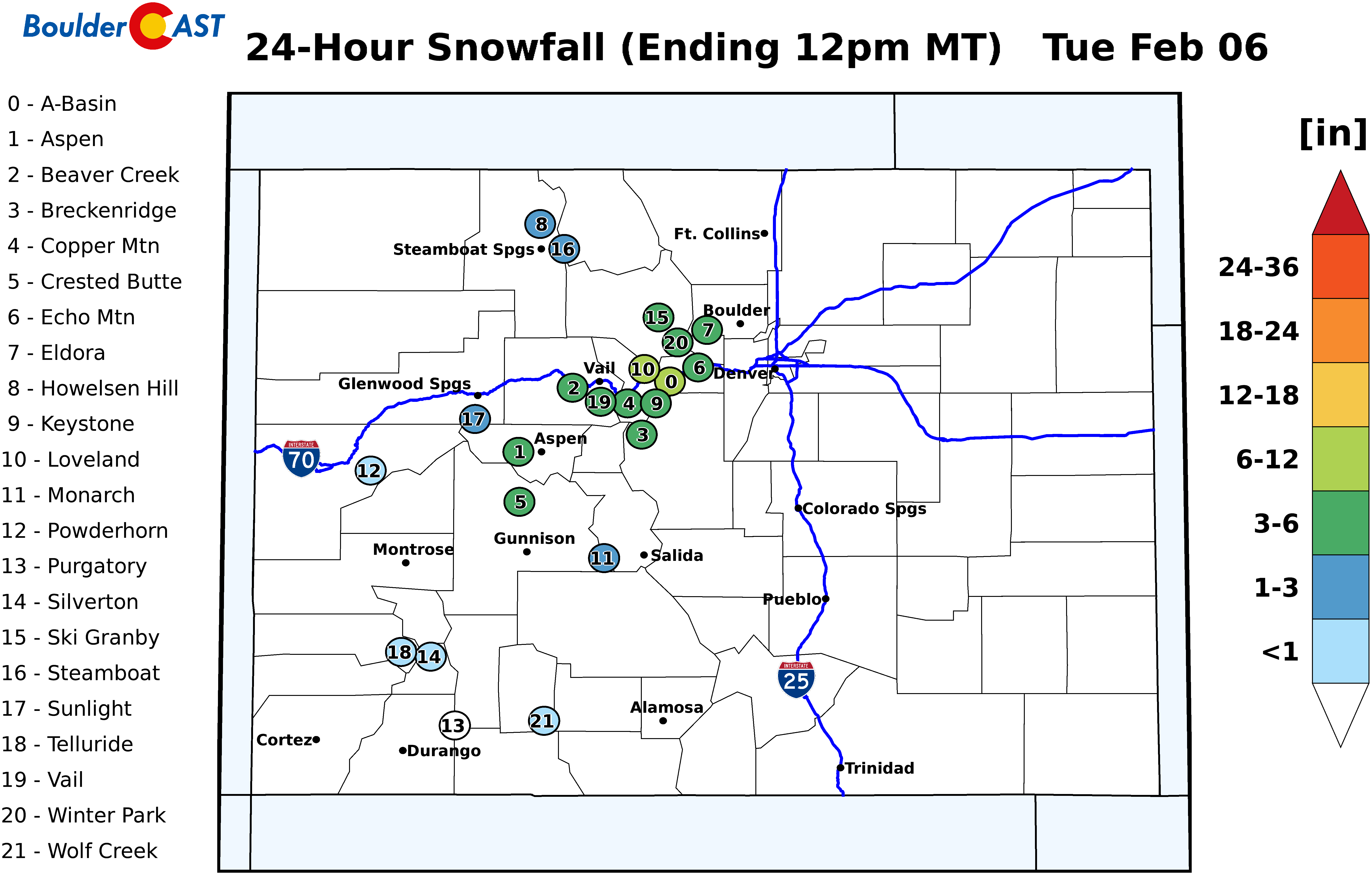
Regardless of how the finer details play out, the Mountains will do fairly well from a prolonged period of orographic lift. Many of the ski resorts are looking at 6-12″ of powder Monday into Tuesday.
We’ll have more details on this in our weekly outlook tomorrow. Enjoy the rest of the weekend!
.


