With the legendary storm system responsible for the rain, tornadoes, wind, hail, snow, graupel, and thunderstorms having finally departed from NE Colorado, it is a great time to take a look back at a storm we’re all sure to remember (for a few years at least)!
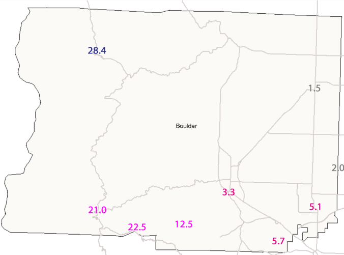
Here are some of the snowfall totals out of Boulder County:
- 28.4″ – Allenspark
- 22.7″ – Jamestown
- 22.5″ – Pinecliffe
- 21.0″ – Nederland
- 12.5″ – Gross Reservoir
- 5.7″ – Superior
- 5.1″ – Louisville
- 3.3″ – Boulder (NWS Official Observation)
- 2.0″ – Erie
- 1.5″ – Longmont
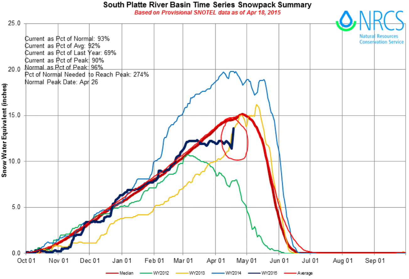
While snow is great, liquid is what really matters for hydrology. All of Boulder County received at least 1.50″ of (melted) liquid precipitation, with the highest elevations recording more than 3.50″, and the city of Boulder itself coming in at around 2.50″. This spring storm brought relief to the region from a bit of a dry stretch that caused most of the county to fall below normal for precipitation thus far in 2015. Below is the time series of snow pack for the South Platte River Basin, the major basin that includes Boulder County. The dark blue line is this year’s running basin-averaged snow pack. Notice that around March 1st, the 2015 snow pack was actually above normal (the thick red line). However, many weeks of above normal temperatures and minimal storm activity have driven the basin well below normal. This storm’s impact is clearly visible, circled in red, as a huge jump in snow water equivalent. While it did not provide enough of a boost to get us back to “normal,” it will definitely help the situation!
As we look forward to a busy weather week (at least in the mountains), we leave you with this photo, taken during this storm in the mountains on Friday, appropriately titled by the taker, “Snow sitting in a Chair.”


