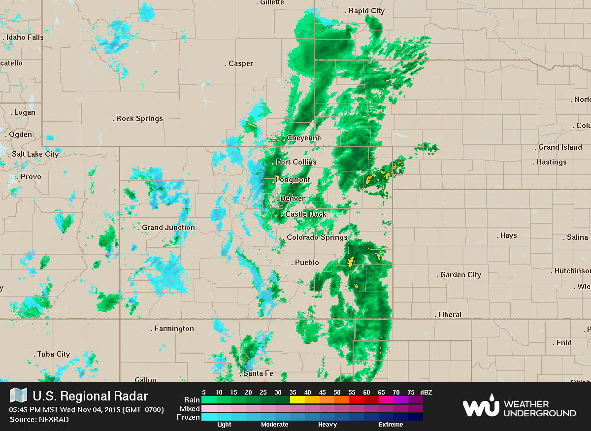
Moderate precipitation has already enveloped much of Boulder County with snow flying in the higher elevations. We provide a brief update on the approaching storm system, detailing where and how much snow will fall across the region.
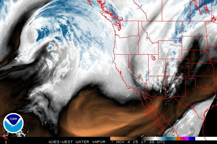
By now you have probably noticed the cooler weather infiltrating the state. As of 7:00 pm this evening, the temperature is a chilly 41 degrees at BoulderCAST Station. Snow levels are down to around 7,000 feet, and will continue to fall through the night and into Thursday morning, as cooler air is drawn southward by a developing surface low east of Denver. From the infrared satellite image below, the upper-level low pressure driving this weather can be seen, spinning over Las Vegas and southern Utah.
Compared to the forecast we issued on Monday, not much has changed. The Plains will become just cold enough to support some snow later tonight, but not cold enough for all that much accumulation. However, the models have been trending a bit wetter with this system for Boulder County!
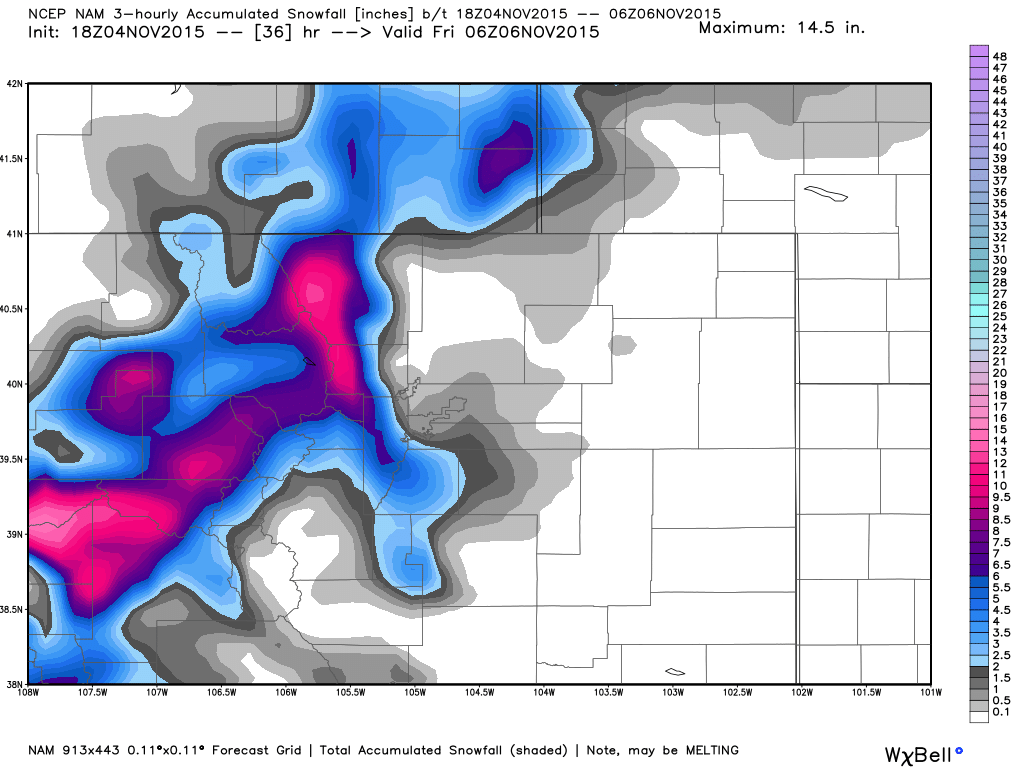
We expect snow levels to bottom out at the Plains between 1am and 4am tonight. The question then becomes: how much precipitation will be left at that point? We aren’t entirely sure. The location of the best dynamics for snowfall will remain to our north, in southeast Wyoming. And, with the recent warm temperatures, any snow we do get will largely be confined to the grassy surfaces. Truly, we believe Boulder proper will probably end up on the fringe of the more substantial snowfall. Our thoughts are roughly represented by the forecast snowfall from the NAM, shown below. The NAM is somewhere in the middle for snow potential, while the GFS produces a little less, and GEFS and SREF (ensembles) come in a little snowier.
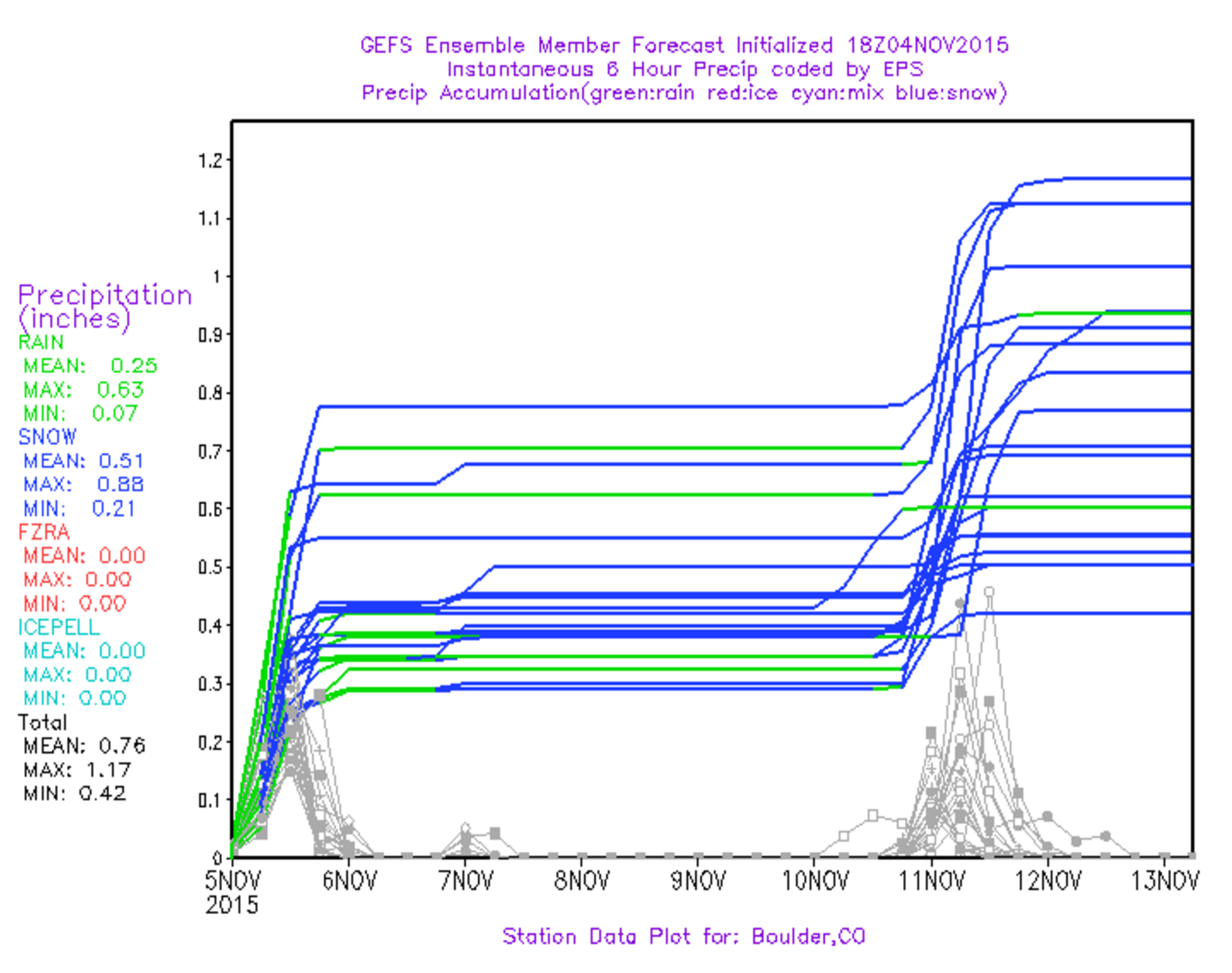
GEFS ensemble precipitation plumes. From this storm, most members have 0.25 – 0.40″ of precipitation, with ~50% of that falling as (mostly melting) snow. This hints at 1-2″ for Boulder.
BoulderCAST SNOWFALL FORECAST:
- Plains: Up to 2″ (particularly in the areas closer to the Foothills)
- Foothills: 3 – 8″
- Mountains (above 10,000 feet): 6 – 12“
Snow showers will taper off tomorrow in the late morning for most areas as the system pulls away, opening the door for northwesterly downslope flow. Snow showers will transition to rain as temperatures warm back up into the low 40’s during the day. There may even be a few peaks of sunshine later on.
An inch or two of snow will seem like nothing come February, but for now, we will give this storm its fifteen minutes of fame. Whether you like it or not, this WILL be our first snow of the year!
Enjoy and drive safely!


