
To suggest that the 2012 wildfire season in Colorado was utterly devastating would be an understatement. Nearly a quarter million acres were charred, more than 600 homes damaged, and at least 35,000 people were evacuated statewide. This year, the narrative is much different. We provide an update on the 2015 fire season so far and discuss the forecast heading forward.
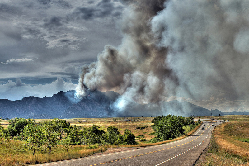
More than a dozen large fires burned across the state in 2012, including the Flagstaff Fire just two miles southwest of Boulder. It ignited on June 26th, a date that fell during one of the hottest/driest stretches of weather in Boulder on record. Temperatures were primed to exceed 100 degrees for the fourth consecutive day, in a month which went down as the hottest June ever (average high was 92 degrees, 11 degrees above normal!). There had only been a meager 0.19″ of precipitation since mid-May, priming the landscape with parched vegetation. An extremely high-base monsoon thunderstorm developed around 1:00pm and approached Boulder. A few drops of rain and numerous lightning strikes later, a plume of smoke began to rise behind Green Mountain. Check out our time-lapse below. The fire burned approximately 300 acres and took about a week to fully-contain.
Fast forward to August 2015. With drought extinguished from the state, it is not surprising that there has been next to no media coverage on Colorado wildfires this year. There really hasn’t been much significant to report on. The cumulative graph below, provided by the National Interagency Fire Center (NIFC), tells the story. The blue line represents this year, while the dashed grey line is “normal.” Data contained in this graph is from the entire “Rocky Mountain” fire district, which encompasses most of Colorado, Wyoming, Kansas, Nebraska, and South Dakota. Nothing screams “ROCKY MOUNTAINS” like Kansas, right?
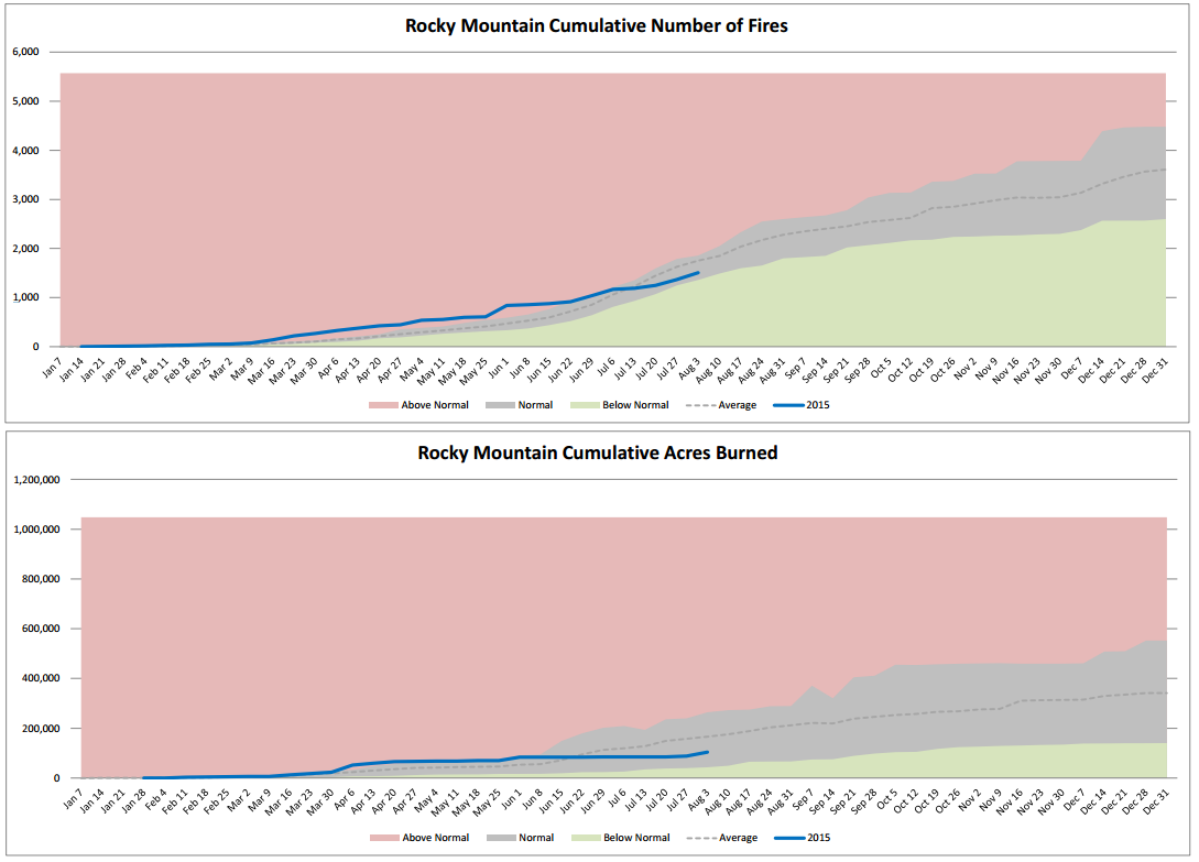
As of August 6, 2015, our fire district sits at 84% of normal for raw number of fires (top graph). However, an even better gauge of fire impact is the total acreage burned, which to date is only 57% of normal (bottom graph). This distribution suggests there has been slightly less fires than normal, and those that did form were smaller than average. In fact, there are just 5 active fires currently burning in Colorado right now, the biggest of which is the Toe Fire in the far southwest corner of the state (400 acres burned, 0% contained).
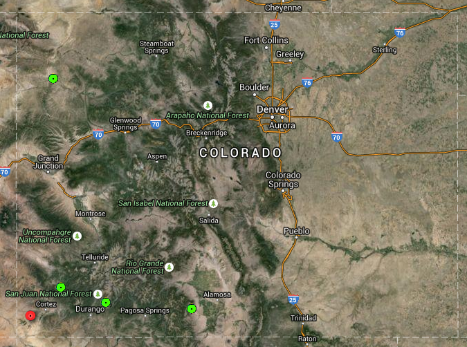
Active fires burning in Colorado as of August 6 | NIFC
Of course, you didn’t need this graph to tell you that the fire season has been thankfully tame this year. Just look to the sky, maybe towards the majestic Long’s Peak. Visibility this summer has been exceptional, save the few days that smoke sunk southward into Colorado, compliments of large wildfires in Canada.
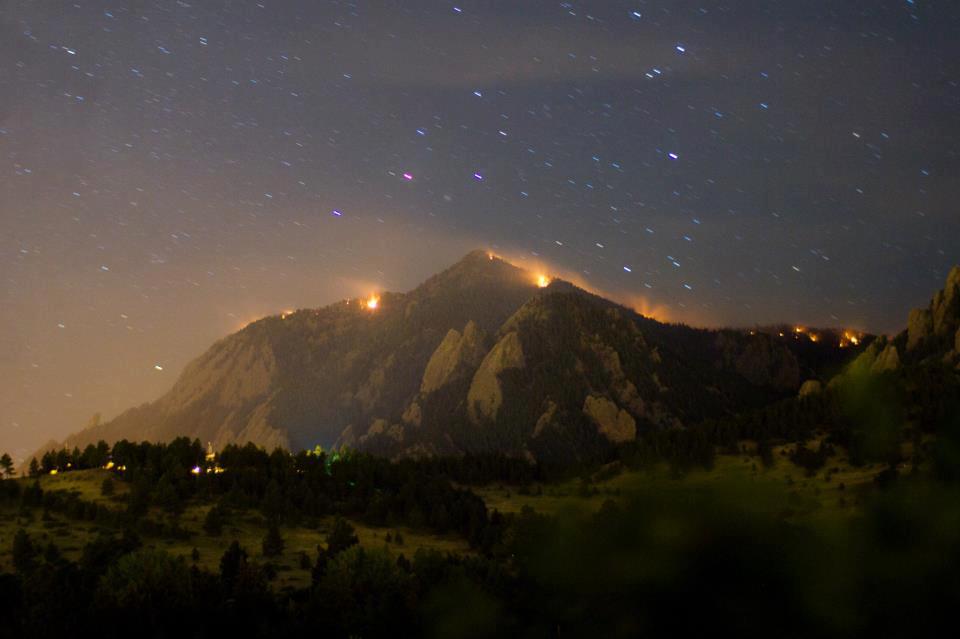
Bear Peak in flames | Flagstaff Fire | Boulder | June 26, 2012
Looking forward, we don’t expect much to change through the end of the year. The NIFC issued this statement for our fire district:
They specifically mention that northern Colorado and southern Wyoming will see below normal fire potential moving forward. Though the Front Range has been starved for rain the last couple weeks, woodland fuels in the high country are far from dry. Medium-range weather forecast models indicate monsoon rains returning in full-force by the middle of next week, particularly for southern and western Colorado. The map below shows the GFS model forecast precipitation forecast for the next two weeks. Combined with a cool and wet outlook for the rest of August and the fall, we should be in good shape heading into 2016.
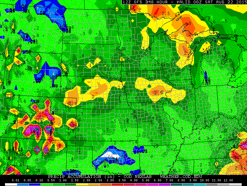
GFS model forecast precipitation totals through August 21, 2015


