The forecast for this week features a series of backdoor cold fronts moving through Eastern Colorado. A low pressure system moving ashore from the Pacific will also impact the forecast Thursday into Friday.
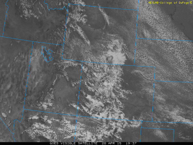
The image above is the current visible satellite over Colorado, showing a stream of cumulus clouds are over the High Country, Plains, and Foothills. These clouds are moving from northwest to southeast across the state, with some embedded showers, mostly over the Mountains. The satellite image shows a glimpse of what we will see this week over Colorado. The cause of these clouds in the Mountains and Plains are due to two main factors. The first is daytime heating and cold air aloft, which is creating the instability. The other factor is a backdoor cold front that has pushed through eastern Colorado today, producing northwest to northeasterly winds and weak upslope, providing added enhancement to the shower activity this afternoon.
Check out the current surface map over the region. Light rain/snow showers are present in the mountains with northwest winds over eastern Colorado in association with the cold front. The weather into Wednesday will feature this same pattern, with weak instability during the daytime, leading to rain/snow showers in the high country and isolated showers in the lower elevations.
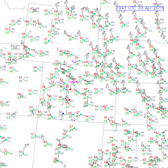
Surface observations over Colorado as of 2pm this afternoon. From NCAR.
Forecast for Boulder:
Temperatures will warm up into the 60’s tomorrow, Wednesday, and Thursday (may reach 70!), after highs in the low 50’s today. Highs in the Foothills will increase from the upper 40’s today to the upper 50’s by Thursday. Tomorrow, the flow will shift more west-northwesterly, a downslope flow. This will lead to warming in Boulder with only a slight chance of a shower, thus most of us will stay dry. A secondary backdoor cold front will push through eastern Colorado Tuesday night into Wednesday morning. This may lead to some clouds early on Wednesday, followed by a mix of clouds and sun in the afternoon with highs in the mid to upper 60’s and isolated afternoon showers, but again, most areas will remain dry. A system coming in from the Pacific Thursday evening will increase rain chances for the region. Shown below is the 500 mb pressure level map of vorticity and geopotential heights. Vorticity is a measure of circulation in the atmosphere. The map shows an upper level low pressure system centered over southeastern Colorado by Friday morning. This coupled with a cold front from the north, destabilizes the atmosphere late Thursday into Friday, and brings with it some precipitation. It appears at this point that the best chance of showers or thunderstorms will be Thursday evening and Friday afternoon. Another shortwave feature may approach Saturday as well, but is more uncertain at this point.
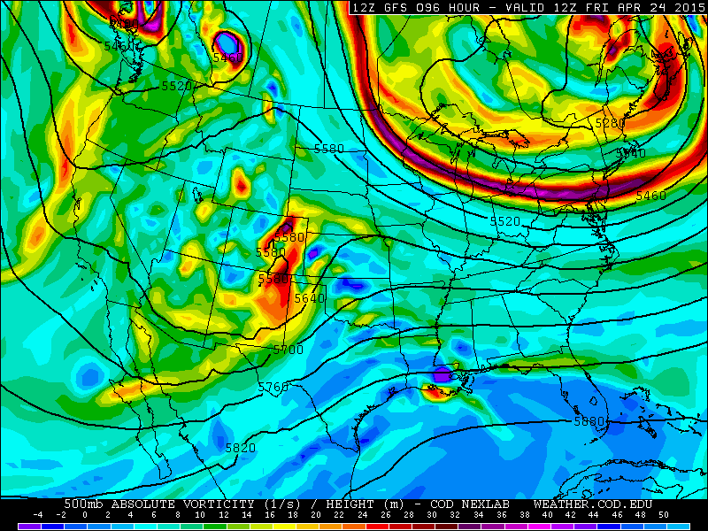
500mb Vorticity and Geopotential Height from the GFS Model valid at 6am Friday. The axis of the upper-level low pressure is over Colorado, with widespread vorticity advection over Eastern Colorado.
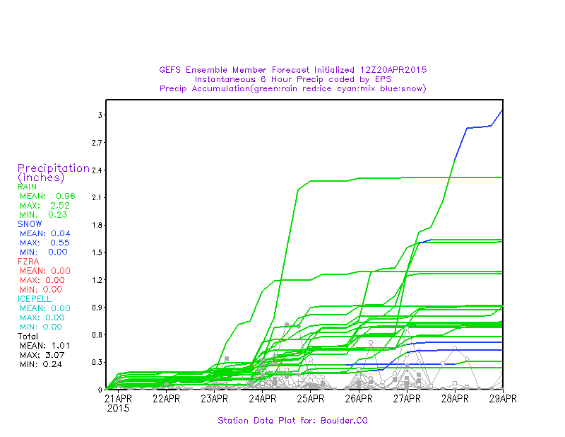
Overall, the week will be marked by a slight chance of showers and an occasional rumble of thunder through Thursday, when the chance for rain will increase. Below is the Global Ensemble Forecast System plume diagram for precipitation in Boulder through the week. Most ensemble members show a small amount of rain each afternoon, but cumulatively, not amounting to all that much, 0.2″ or less through Thursday, with a slight jump in amount into Friday.
 Forecast for the high country:
As mentioned earlier, cold air aloft coupled with daytime heating in the mountains will lead to afternoon/early evening scattered rain/snow thundershowers. These showers will be isolated, but they could produce a quick hit of precipitation. It wouldn’t be surprising if some of the higher elevations pick up a couple inches of snow through the week. However, these storms will be hit or miss and not widespread over the whole area. Chances of mountain snow increase Thursday night, Friday, and Saturday, as the upper level low pressure system advances through Colorado. This could produce a light accumulation of snow to the ski resorts, mainly Thursday night and Friday.
–
Stay tuned to BoulderCAST as we continue to track the next storm system arriving by the end of the week! As always, follow us on Twitter/Facebook for live weather updates, and subscribe to our site to receive email notifications for each of our posts!


