After a three-week snow hiatus, the flakes have returned! While most of us awoke to only a few inches of snow, some spots got dumped on by more than a foot. We review our forecast and go over the snow totals from across the region.
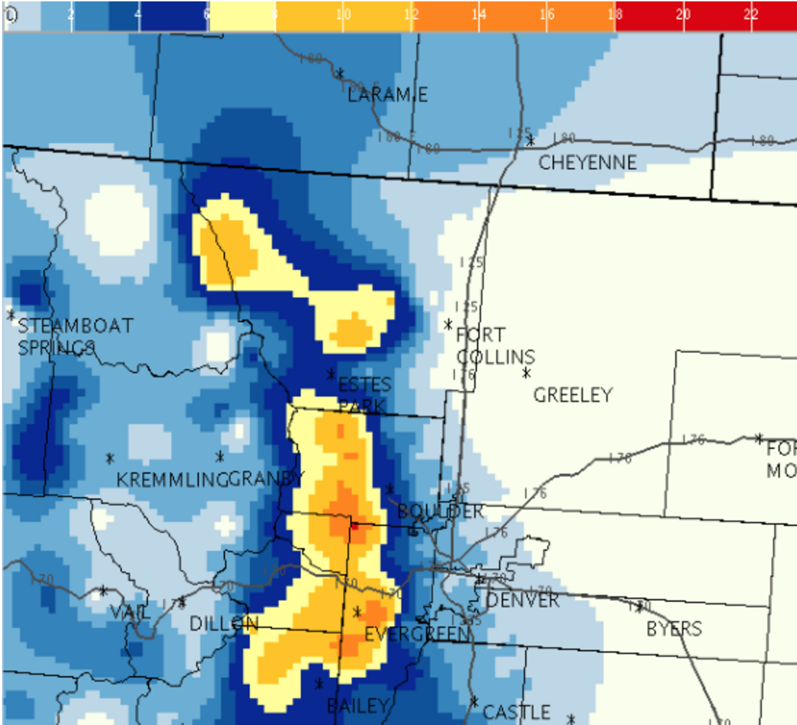
In our forecast posted yesterday, we stressed the main forcing for the event would be upslope. As such, we expected most of the snow to fall across the higher terrain and the immediately adjacent Plains. Snow amounts were projected to rapidly drop off moving away from the Foothills, to almost nothing in east Denver.
Things went mostly as planned
After a high near 50 yesterday in Boulder, temperatures fell abruptly behind the cold front, with rain beginning around 5:30pm, quickly changing to moderate snow around 6:30pm. Despite some melting at the onset, temperatures quickly dropped below freezing by 8:00pm, allowing for ample accumulation. Snow continued, on and off, until about 3:00am as drier air invaded the area.
Shown below is our original forecast snow map (issued Monday morning), with the observed storm totals per location contained in boxes. Green ones indicate that the observed snowfall was within one inch of the given forecast range, while red was outside the scope of our forecast.
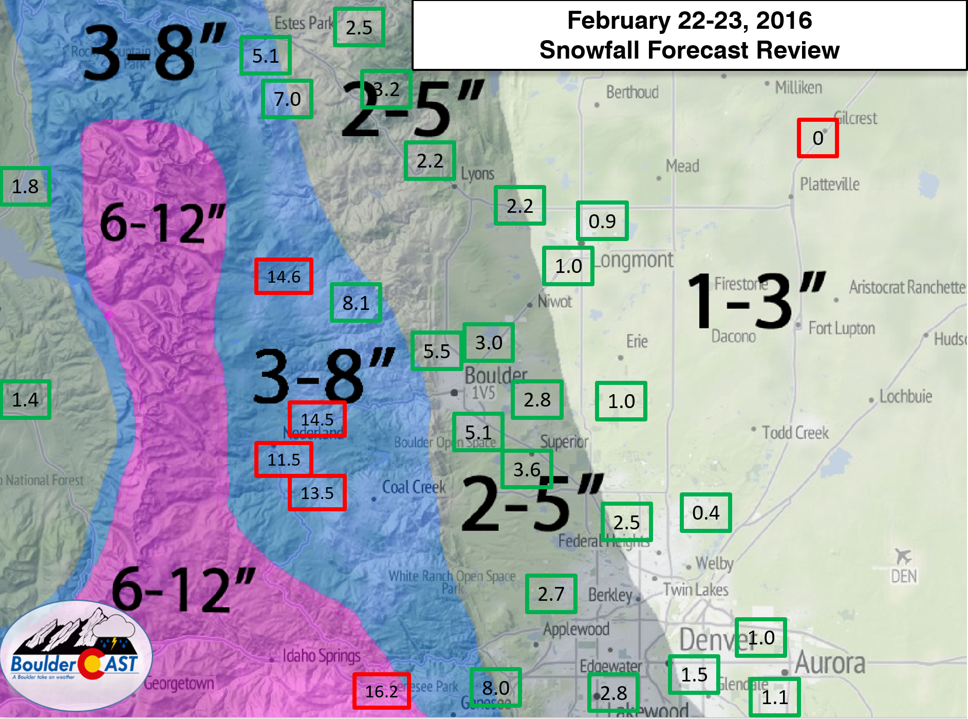
Boulder’s snow total was 5.2″ officially, with 0.49″ of liquid equivalent (melted snow), which puts the snow-to-liquid-ratio around 12:1 (when also considering the onset was rain), lower than our most recent slew of storms if you recall. As we head into March and the atmosphere begins to get it’s warmth back, we expect 12:1 to become the norm.
Most of Denver was in the 1 to 3″ range for snow for this storm, with the western suburbs a little higher. This was right on track with our expectations, breeding lots of green on the map above.
The biggest bust ended up being in the higher Foothills, where 12-16″ accumulated as heavy, orographic snow persisted through much of the evening and overnight hours. In the hours leading up to the storm, the HRRR model was indicating this very setup, but it was really too late to make forecast adjustments, especially considering the only area needing a boost in snow amounts was some of the Foothills. The NWS didn’t even have any advisories out for the Nederland area until hours after the snow began (later added a Winter Weather Advisory for 6-10″). Winter Storm Warning criteria was definitely met in many Foothills locations.
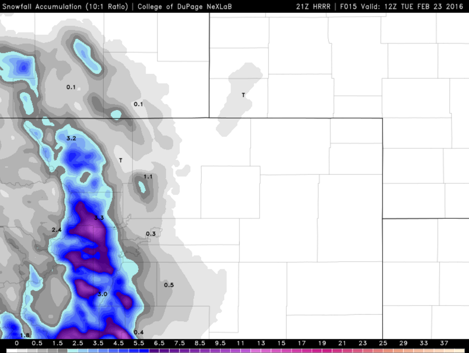
Total snowfall forecast from the 2pm run of the HRRR yesterday, showing some our the first indication that snow totals could be running higher in the Foothills
Temperatures will rebound to near or above 50 the rest of the week, and into the 60’s for Saturday. The next weather feature of potential impact arrives as for the middle of next week. Too early to place any bets yet, though. Enjoy the sunshine for now!
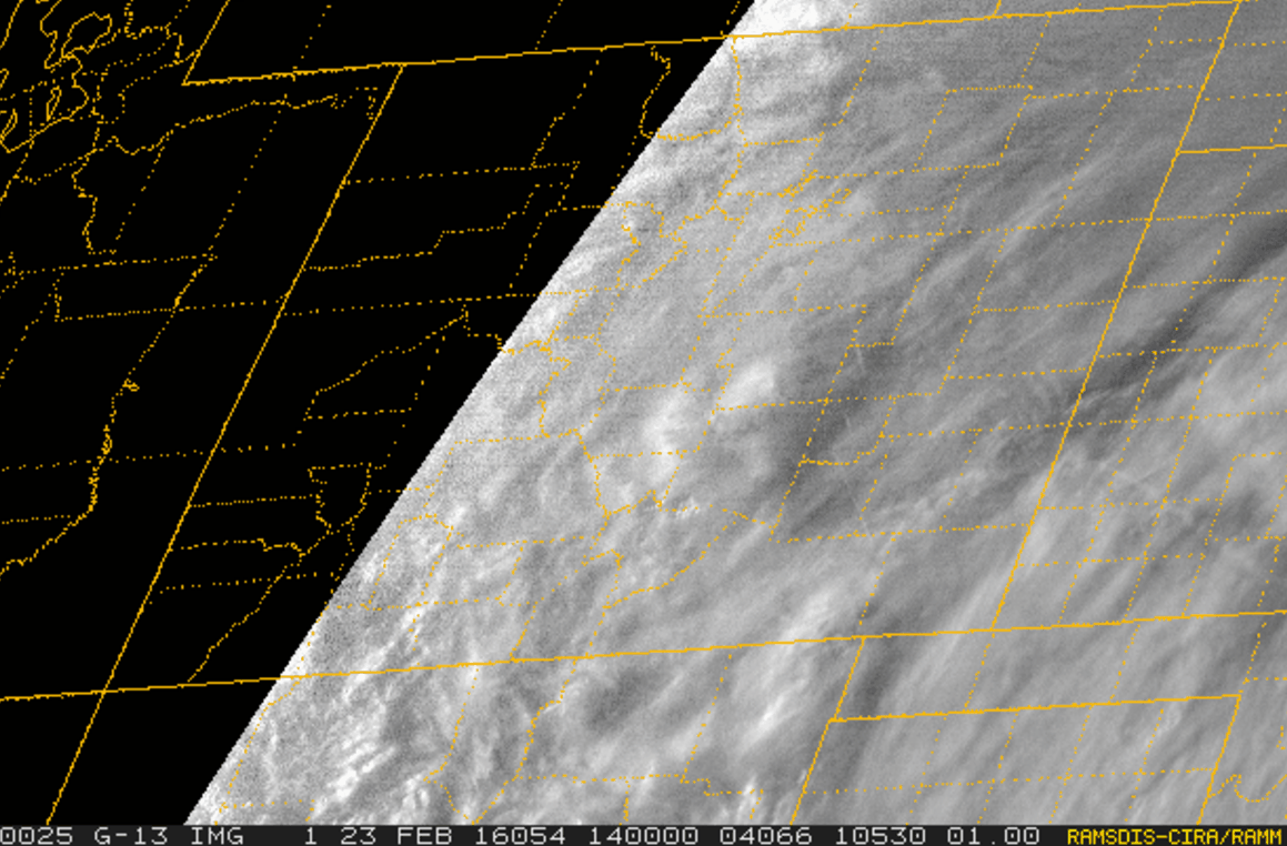
Visible satellite loop from Tuesday showing the fresh snow cover rapidly melting across Boulder County.


