Ideal atmospheric conditions will combine to produce the first heat wave of the year for the Front Range! How hot will it get and when will we cool off? Read on to find out.
We warned of the impending heat in our weekly outlook on Monday. The reason for the shockingly warm temperatures this weekend is two fold:
RIDGE: A large mid-level ridge forms and persists across the state through the weekend. The shape of the ridge provides a direct pipeline for hot air from the Arizona/Mexican Desert to move into Colorado.
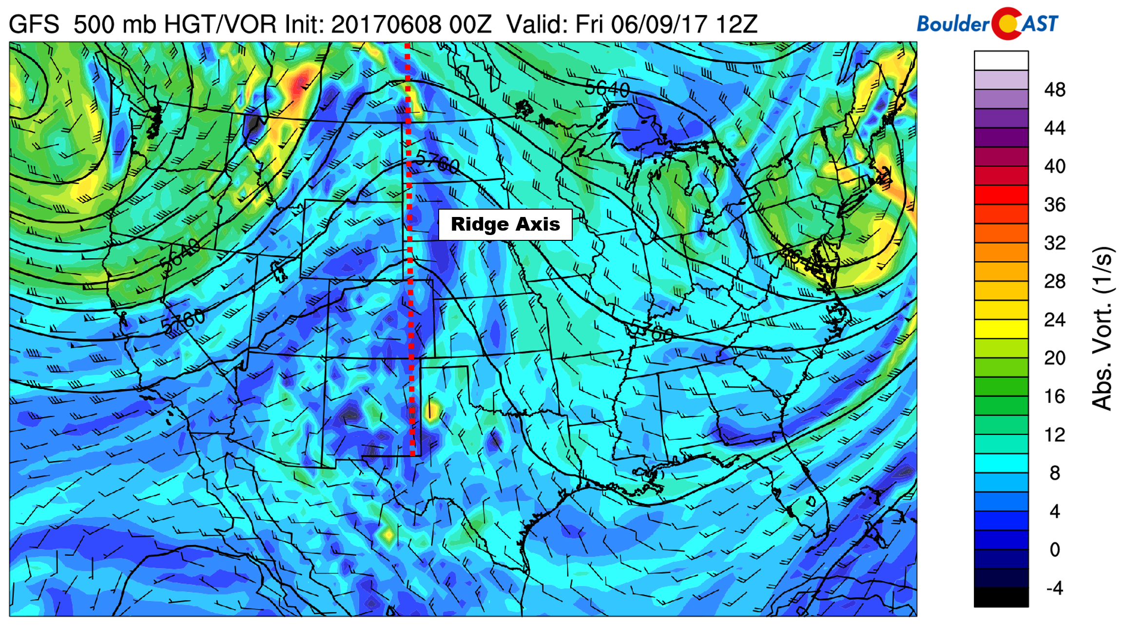
GFS 500 mb forecast for Friday showing the ridge centered across Colorado
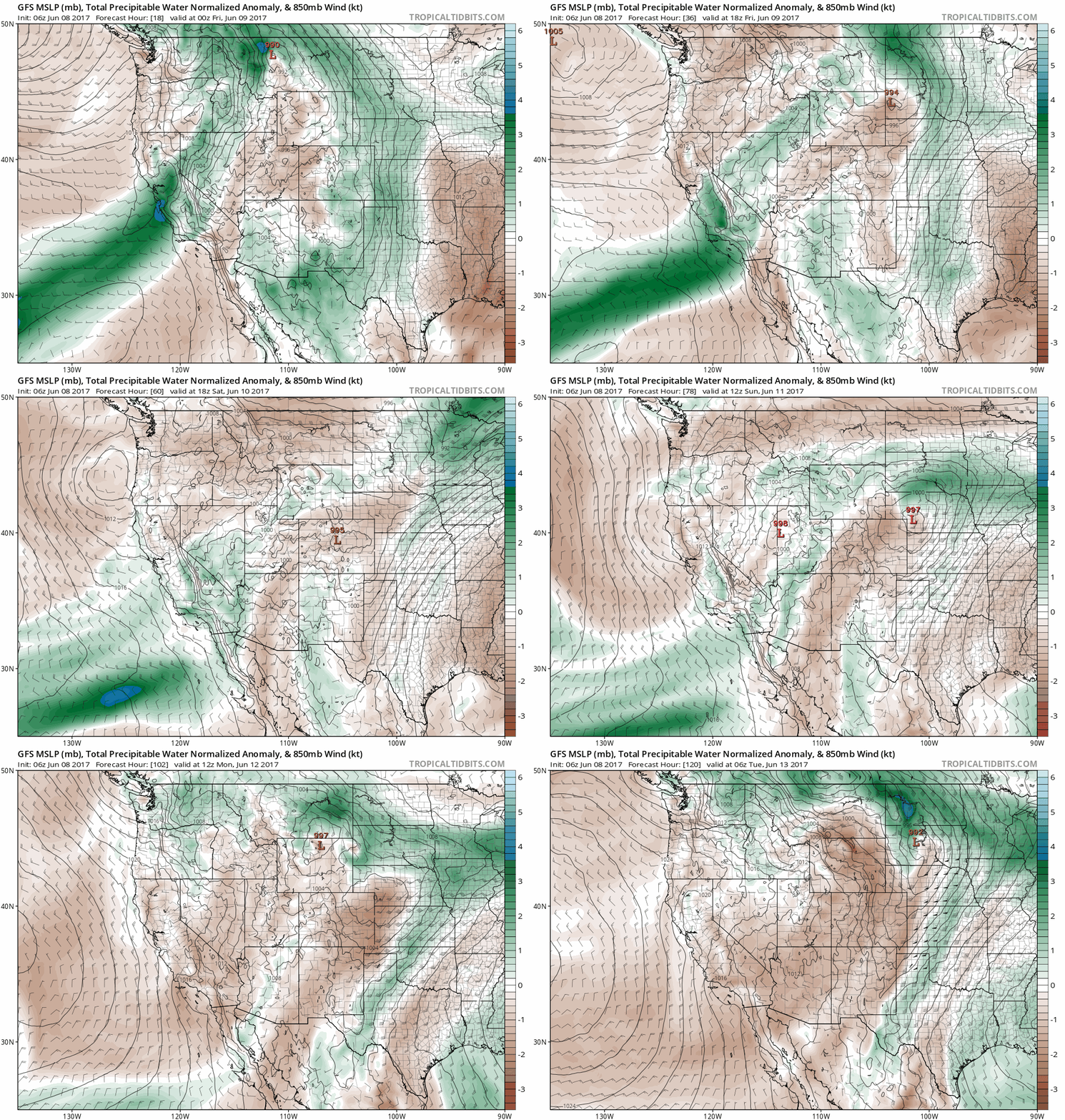
DRY AIR: The air will also be starved of moisture. The animated loop of total column water vapor anomaly below shows very dry air funneling into Colorado. Combined with the large-scale subsidence from the ridge and very warm air aloft preventing convection, these ingredients will spell out a distinct lack of precipitation (and in many cases, cloud cover) for the upcoming weekend. Without the afternoon clouds and storms to cool things off, it will feel like a “real” heat wave out there!
The 800 mb temperature map for Friday below shows the heat building underneath the ridge. The warmest air is actually right over Denver on Friday (notice the tiny patch of purple coloring).
Our reprieve from the heat, cooler air, can be seen off the coast of the Pacific Northwest. It will take several days to get here, however.
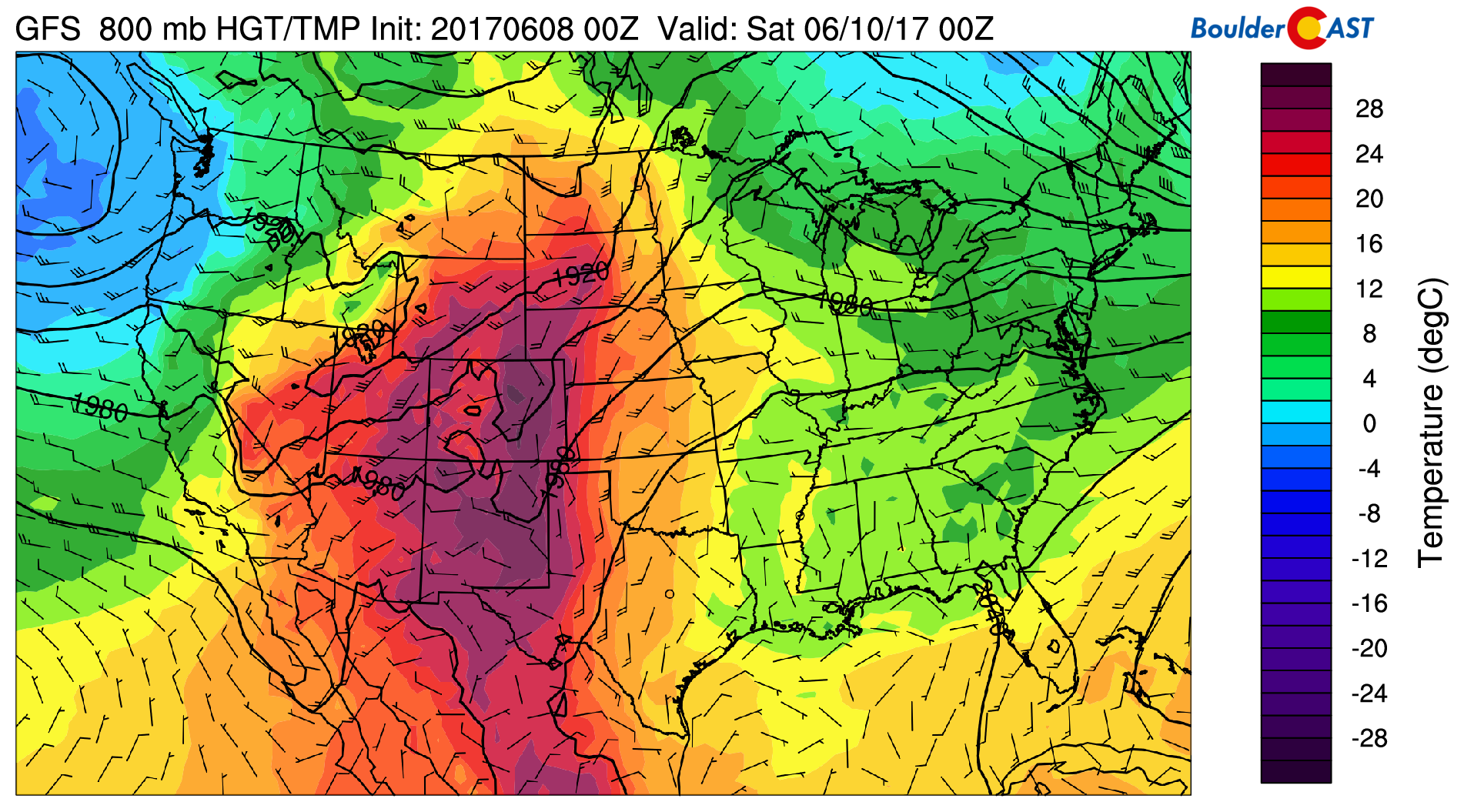
GFS 800 mb temperature forecast map for Friday afternoon
Here is another 800 mb temperature map, but for Sunday. The Pacific storm system has made some progress eastward, but very warm air is still present across Colorado. At this time, it looks as though the cold front won’t arrive until Monday night or Tuesday morning. Until then, it’s going to be HOT, HOT, HOT!
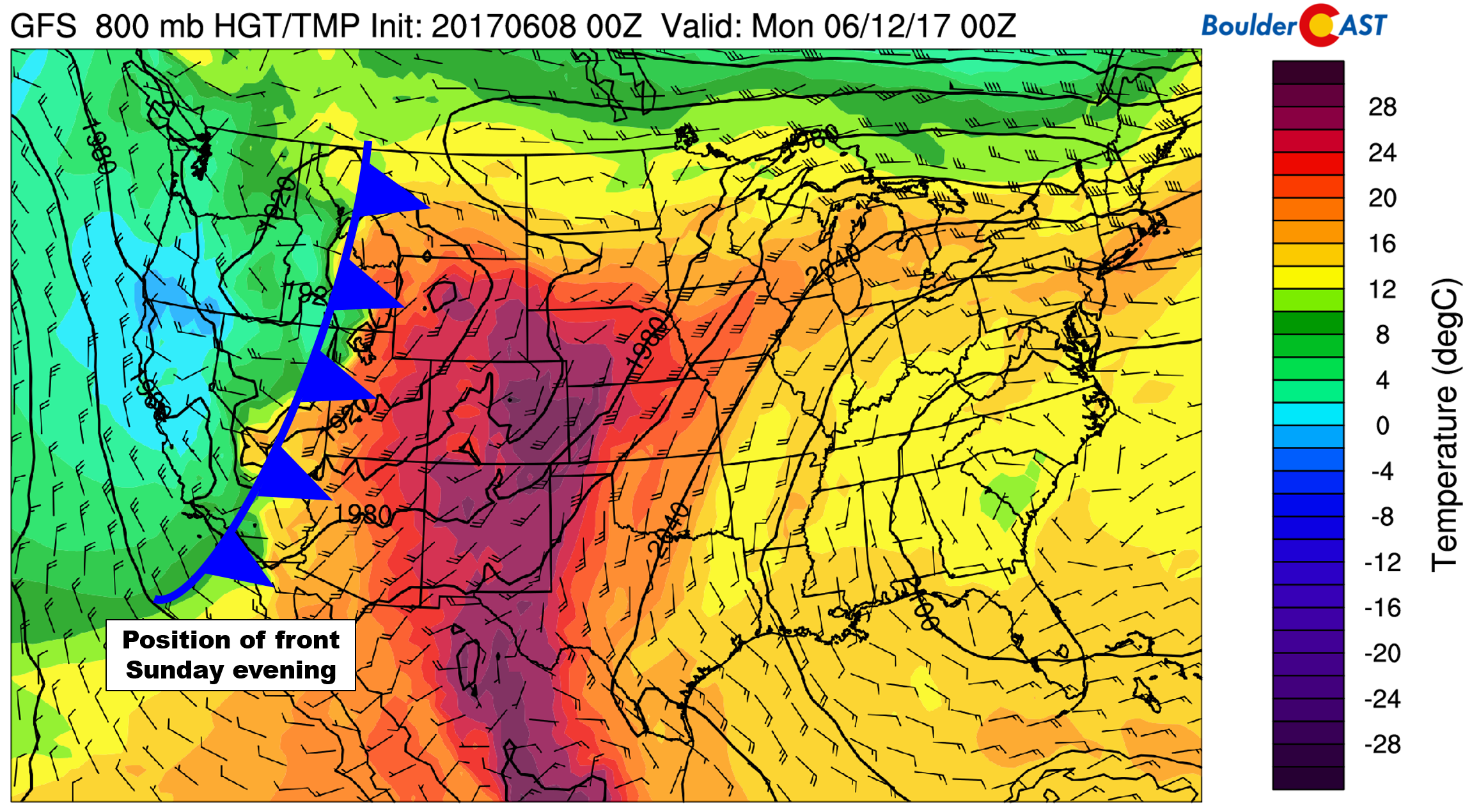
GFS 800 mb temperature forecast map for Sunday afternoon. The Pacific system and cooler air are still well to our west.
Despite the favorable setup for heat, we’re not expecting any records to be broken, at least in Boulder or Denver. We’ll come within a few degrees of record values each day, but probably won’t exceed them. Our warmest day will likely be Saturday, but could be Sunday if clouds don’t cut into the solar heating too much.
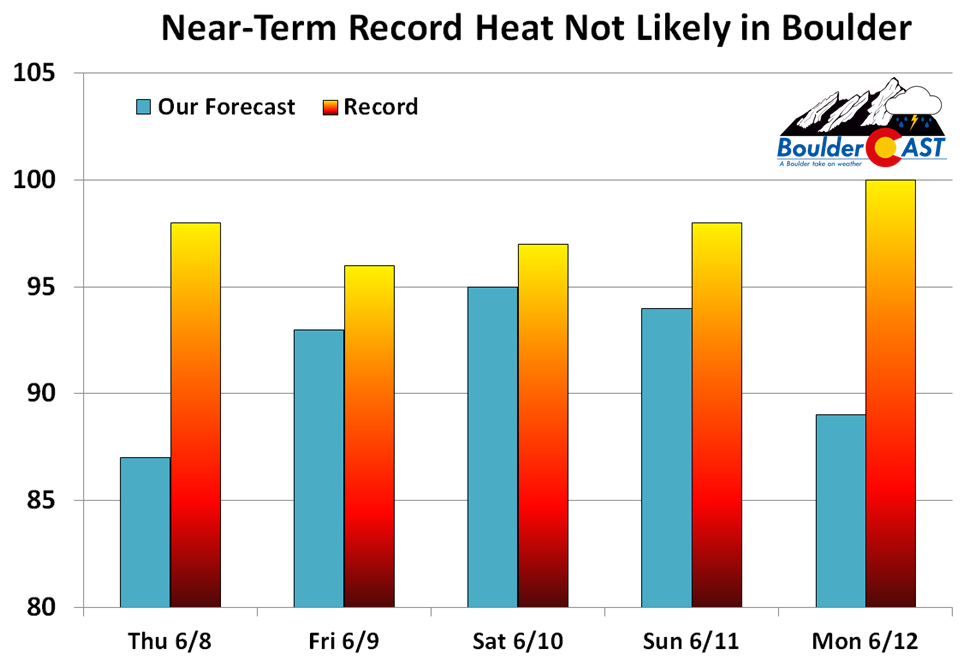
While it will be hot this weekend, it won’t be all that uncomfortable. Drier air will also be moving in at ground-level, lending to decreased humidity. Thursday will see dew points in the 50’s across the Denver Metro area, which is quite humid by our standards. As the desert air moves in Friday, dew points will decrease into the 30’s and possibly even 20’s for the weekend. This will lead to heat indices that are actually LOWER than the ambient air temperature! Take that Florida! Temperatures post heat wave should fall back to near 80 degrees by Tuesday and beyond.
Right now there is good agreement for a dry and warm pattern taking shape across Colorado for the next week to ten days. Not a single GFS ensemble forecast has measurable precipitation in Denver through Tuesday, while 90% of members remain dry through next Friday (June 16th). After a wet end to spring, gardens and lawns will finally need to be watered in the coming days to maintain their prosperity.
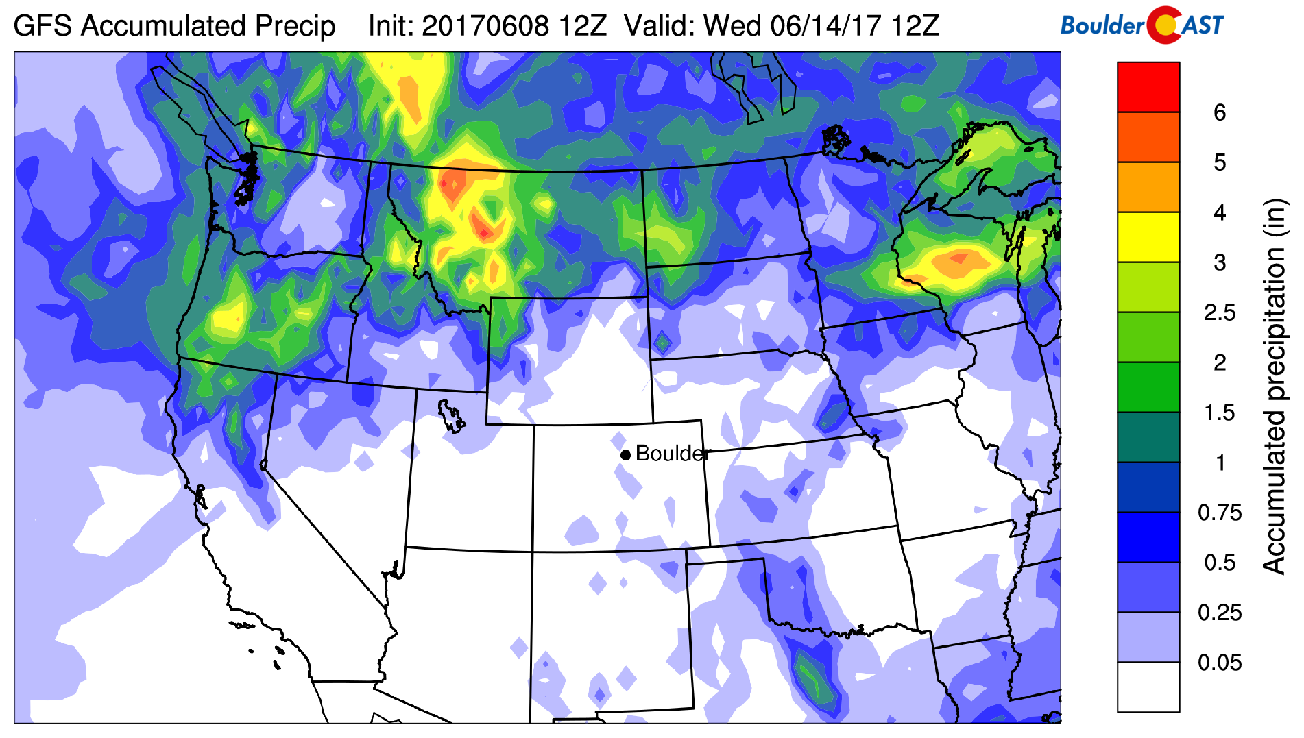
GFS model forecast total precipitation through next Wednesday.
It’s hard to believe just over two weeks ago we had snow on the ground, and now we’re talking about 90’s. Have a great weekend and stay cool if you can!

Thu
Fri
Sat
Sun
Mon


Temperature
87
93
95
94
89


Precip Chc (Plains)
10%
0%
0%
0%
0%

