
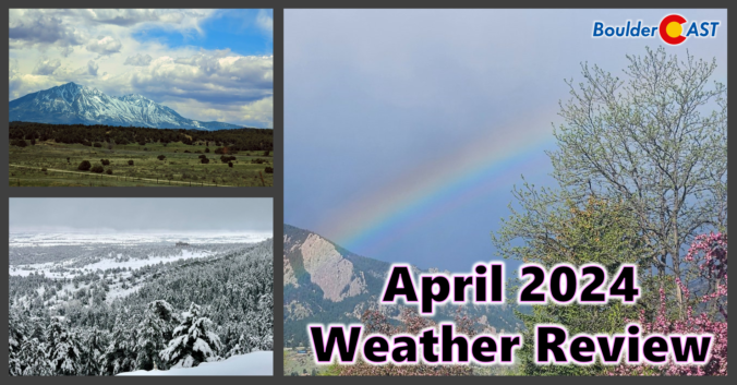
Despite having a two-week-long dry stretch thrown into the mix, the month of April concluded wetter than normal for most of the Front Range. However, much of this moisture came from a soaking rainstorm (with a little snow) near the end of the month. Nonetheless, 2024 has begun as one of the all-time wettest in Boulder. We also endured an intense downslope windstorm near the beginning of April, but who could forget that? Xcel Energy customers sure wouldn’t! Here’s a quick and colorful graphical recap of our weather during April and how it relates to climatology.

The weather pattern across the western United States stays exceedingly active throughout the week ahead with impacts across Colorado ranging from Mountain snow, to cooler than normal temperatures, to elevated fire danger to days of strong downslope winds. Here in the Front Range, we will catch a little bit of everything this week. Read on for all the details.

Liew View of Boulder

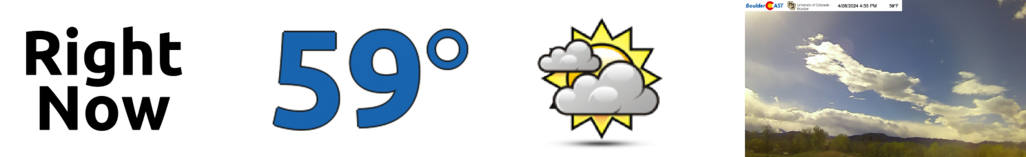
Current Conditions

Live Radar

Recent Premium Posts

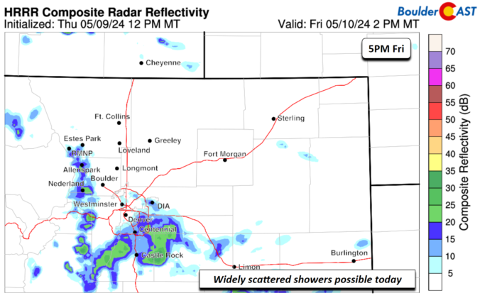
BoulderCAST Daily – Fri 05/10/24 | Staying chilly with a few widely scattered showers
⦁❶⦁ Temperatures remain chilly to end the work week with 50s once again …
This Weekend in Colorado Weather: Temperatures trend up this weekend, but so do the rain chances
⦁❶⦁ A stalled trough will remain over Colorado through the weekend ahead with …
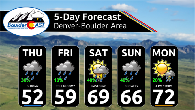
BoulderCAST Daily – Wed 05/08/24 | Sunny and a bit breezy today, the best chance of rain for the week comes tomorrow
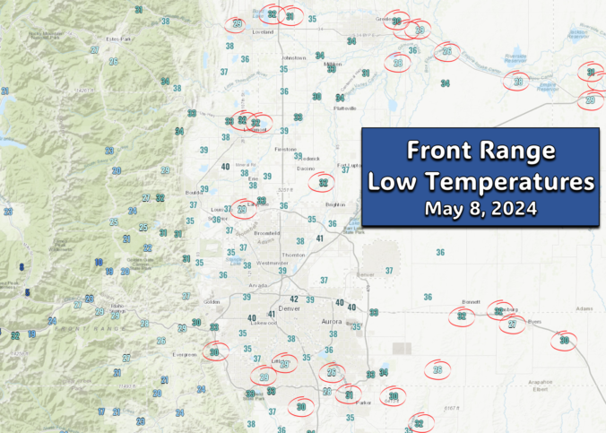
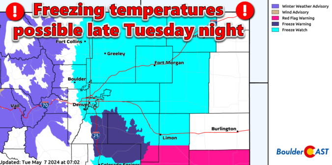
⦁❶⦁ Overnight temperatures dropped below freezing in parts of northeast Colorado, but most …
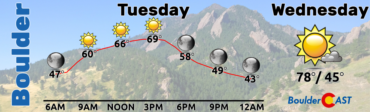
3-Day Forecast

Air Quality

Trending Content


Live View of Boulder
Trending Content
© 2024 Front Range Weather, LLC