
Happy Friday everyone! Let’s check in on the forecast for the upcoming weekend. The mountains are in store for another round of snow, but things should remain quieter on the Plains. Will Peyton and the fans be dealing with snow on Sunday at Mile High? Read on to find out.
Light snow has already begun falling across much of the High Country, and will continue into Saturday morning. The driving force are two shortwaves moving across Colorado, bringing moist northwesterly flow to the region and some upper level dynamics. One in New Mexico, and another that will materialize from the energy over Wyoming.
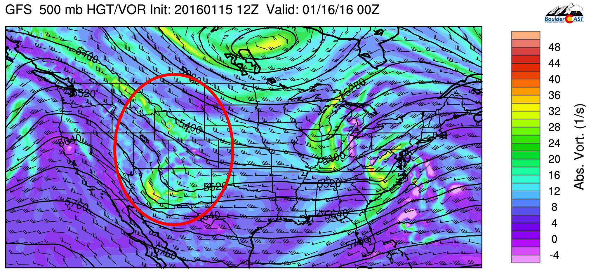
500mb vorticity map from the GFS, valid Friday night at 5pm. Circled in red is the system that will be impacting us tonight.
While the heaviest snow will remain west of the Divide, the highest elevations of Boulder County will pick up several inches tonight. For the Plains, chances of snow are substantially lower, as conditions are much less favorable. We do see a little bit of instability, but upslope just isn’t there tonight. Therefore, we expect patchy light snow with isolated heavier bands to form across Northeast Colorado. It isn’t entirely clear if the bands will be over Boulder/Denver area, or a little bit more northeast, from Ft. Collins into Fort Morgan.
The GFS shows most of the snow north of Denver.
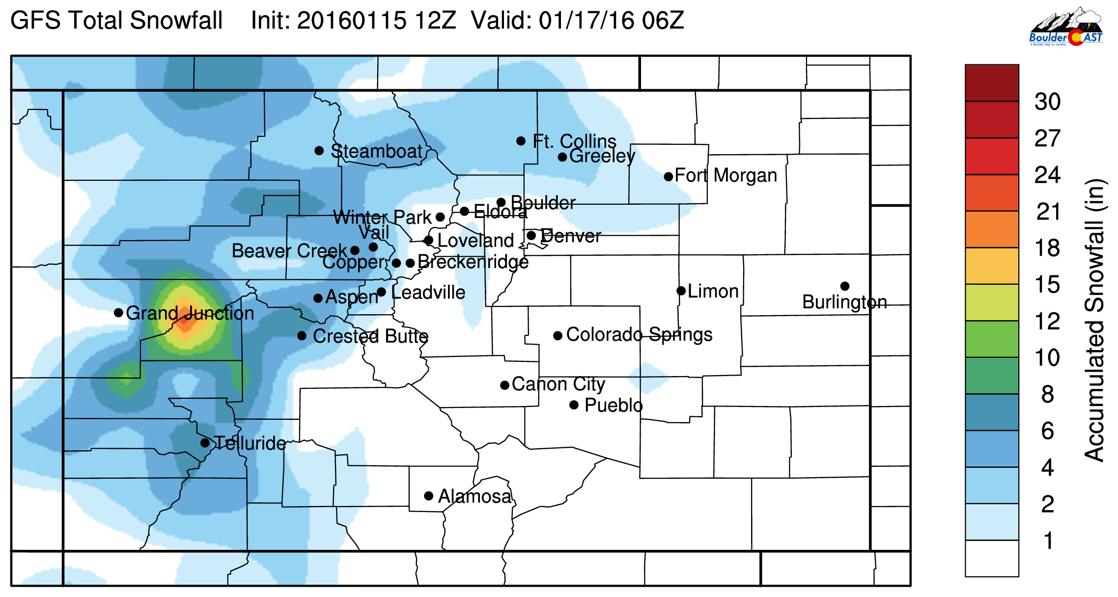
GFS snowtall totals through Saturday evening
The latest HRRR run shows the snow bands remaining just north and east of Denver (see below), while the NAM keeps the Plains largely snow-free.
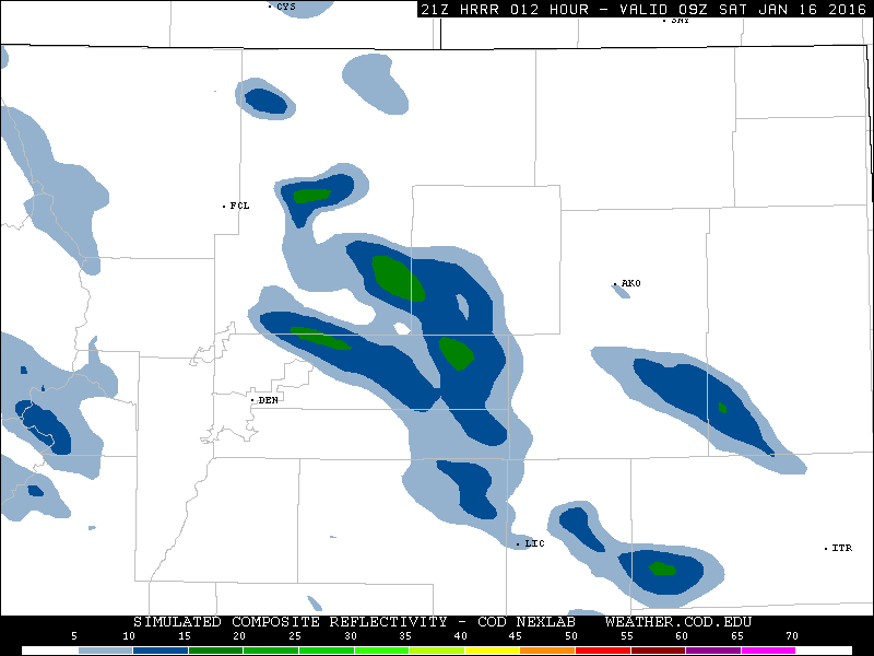
HRRR simulated reflectivity valid at 2am tonight, showing the development of a few heavy snow bands
At any rate, chances for snow will increase after 10pm tonight and persist until about 6am Saturday morning across the Plains. Some clearing will take place Saturday, but skies will remain mostly cloudy and cold, with highs in the mid 30’s.
Our snow forecast map through Saturday afternoon is shown below.
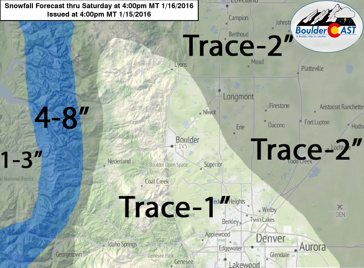
As you can see, not much of an impact for the Plains. The big thing is fresh snow in the mountains. Get out there and ski it if you can!
Another piece of energy slides across the state Saturday evening into Sunday morning. It is weaker, but will still produce more light snow in the mountains and even a chance of flurries on the Plains. The flakes should be long gone by the start of the Broncos game. Expect clearing skies and a kickoff temperature near 32 degrees. However, if you’re tailgating, or plan to stick around for the end of the game, dress with layers as temps will most certainly be in the 20’s.
The truly cold, sub-zero air gets funneled into the middle of the county. After a chilly weekend across the Front Range, things warm up back into the 40’s for Monday.
Travel safe and stay warm. Go Blue and Orange!


You must be logged in to post a comment.