
After a cool and “autumn-like” weekend, this week will feature milder temperatures and lots of sunshine, at least through midweek. A fly in the ointment will be a weak system approaching from Baja California which will increase clouds and lead to the chance of isolated rain or storms late in the week. These should be confined mainly to the mountainous areas, however. Read on for our full weekly forecast to end the month of September!
Warm and sunny through Wednesday
As mentioned in our prior forecast focused on this past weekend, the mountains were expected to receive their first real snow accumulation above 9,500 feet. Below shows a picture from part of the BoulderCAST team hiking up Quandary Peak (14,265 ft) this past Saturday. There was anywhere from a dusting to a few inches on the ground, with the higher peaks in the distance seeing 2-3 inches. Temperatures were 15 to 25 degrees with wind gusts up to 35 mph. Snow season is here!
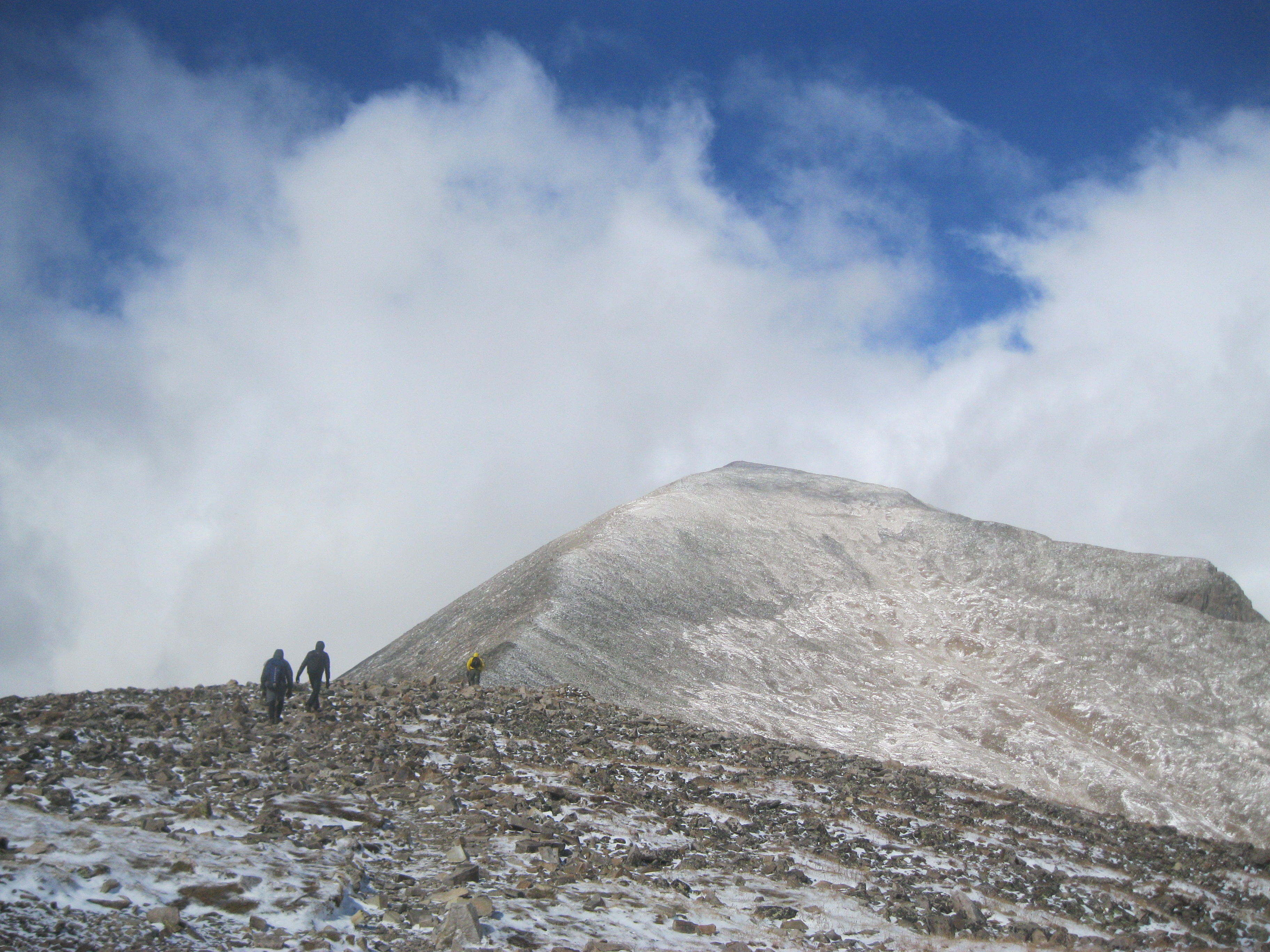
The BoulderCAST team hiking the final route to Quandary Peak this past Saturday with fresh snow evident
At the lower elevations for us, temperatures Monday through Wednesday will see a warming trend from 70 on Sunday to the 80’s soon enough. Below shows the mid-level flow for this afternoon. The storm system which brought snow to the higher elevations Saturday and a cooldown for the Plains has now pushed into the Great Lakes. Behind it, we are under the influence of a building high pressure ridge. 800 mb temperatures are shown below, which depict a warming trend with light and variable winds. Warm air advection should bump our highs into the middle 70’s today on the Plains.
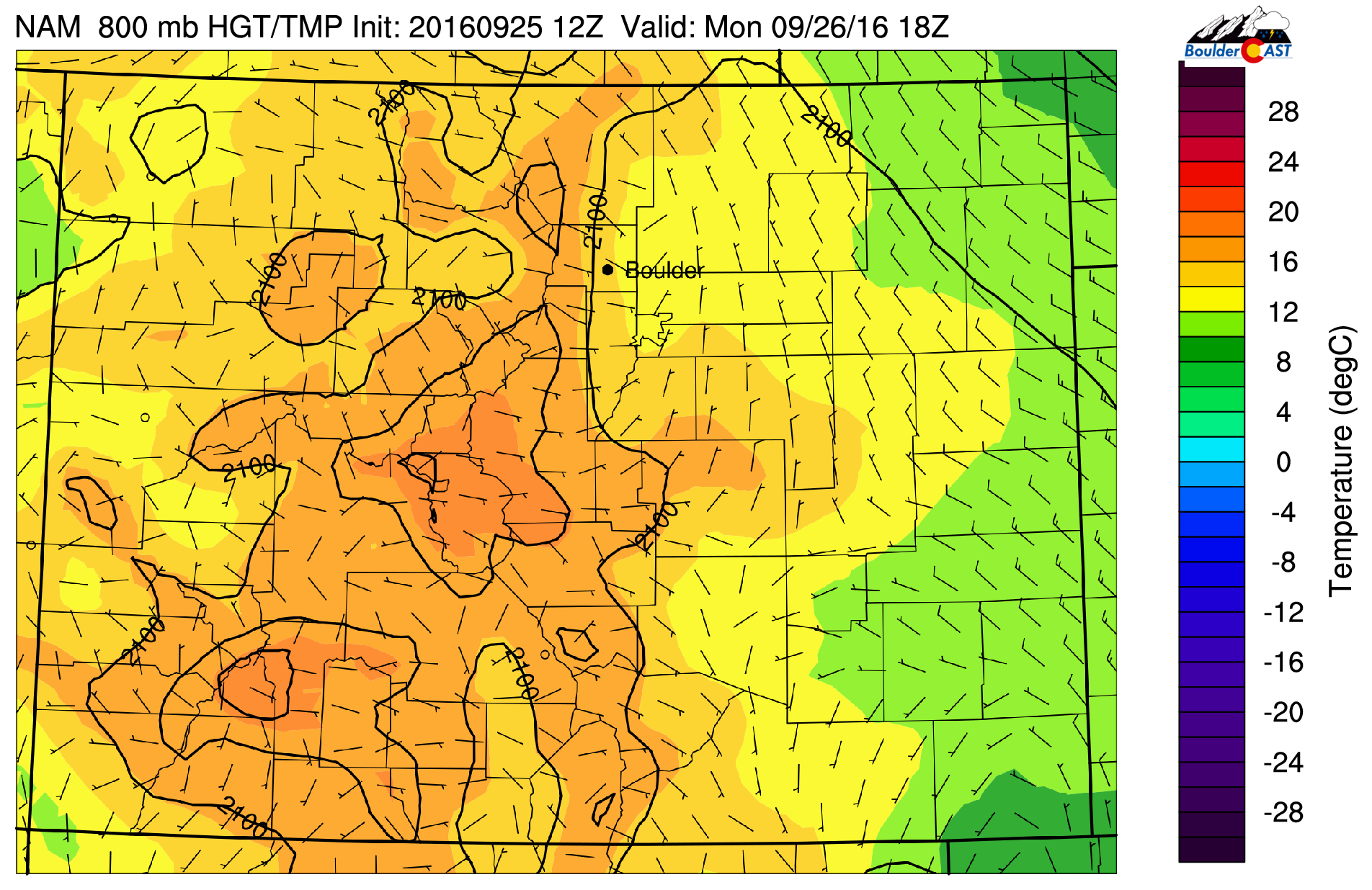
NAM 800 mb temperature and wind pattern today
Not much changes on Tuesday, as the ridge inserts itself more prominently, leading to abundant sunshine and further warming. We are expecting lower 80’s on the Plains. Below shows the warmer near-surface temperatures on Tuesday compared to Monday.
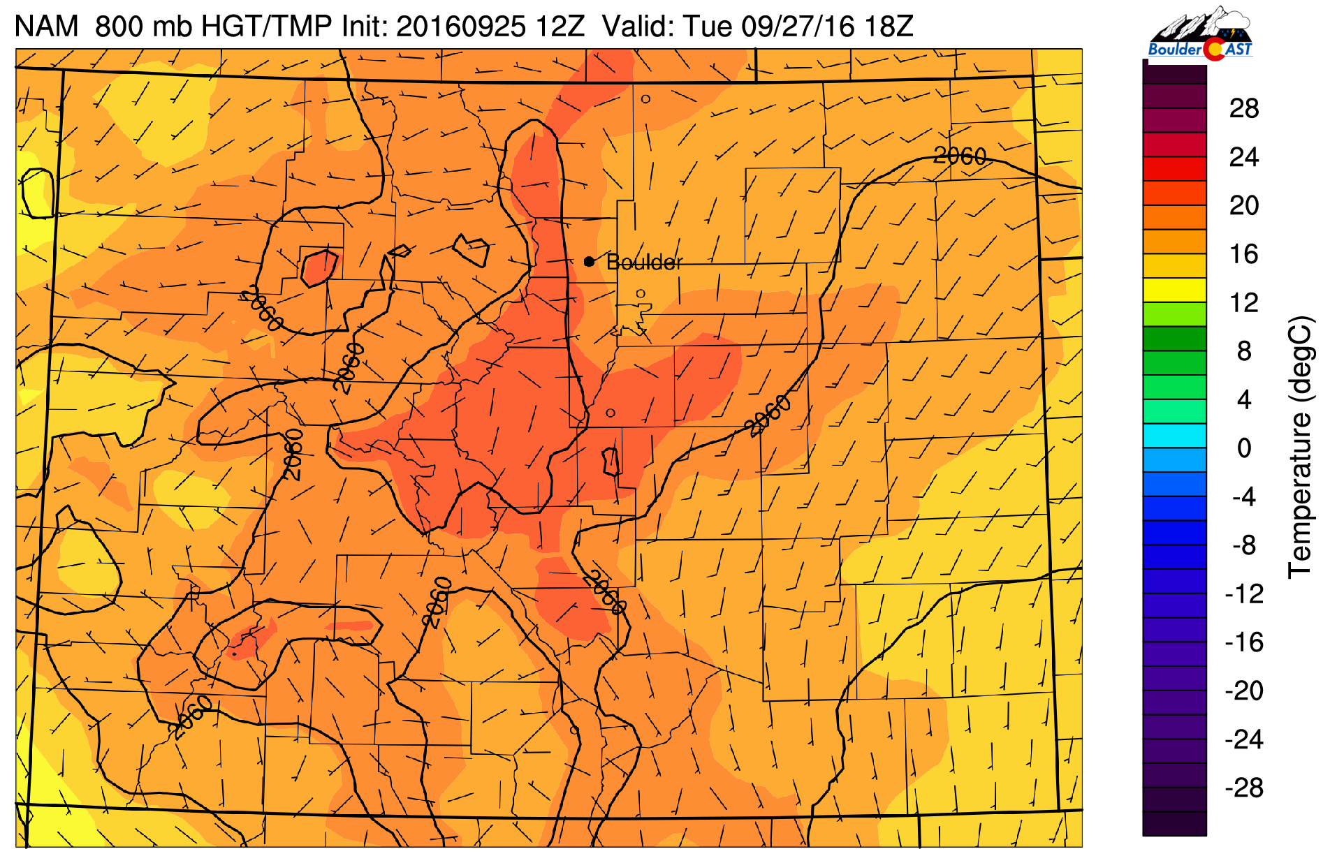
NAM 800 mb temperature and wind for Tuesday
Baja storm system approaches Wednesday
On Wednesday, as evident below, the ridge is still in place, but the weak Baja storm disturbance has moved northeastward into western Arizona. This system will not influence eastern Colorado except in the way of increasing high clouds Wednesday night. Over western Colorado, rain and snow showers will be likely Wednesday night and Thursday with the approach of the system.
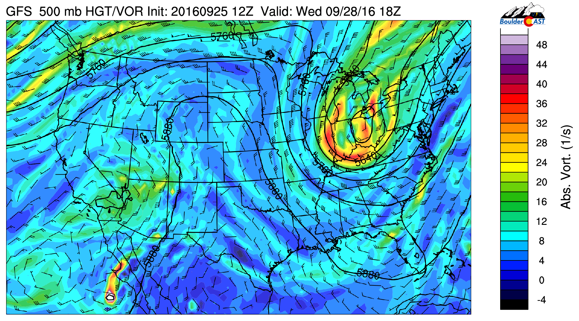
GFS 500 mb vorticity and wind field for Wednesday
With a very similar atmospheric flow, expect highs on Wednesday to again be near 80 degrees. As a result of this storm system in Arizona, easterly flow at the surface will be present. It’s hard to say if this is a cold front or not, or just weak upslope cooling. Either way, this may shave the high temperature off a degree or so, but overall expect the same conditions as Tuesday.
Thursday and Friday: cloudier with chance of isolated showers/storms
On Thursday, the weak low-pressure system approaches Colorado, as shown below. There is no longer a circulation, but there is advection of lift ahead of the decaying storm over western and central Colorado. This energy will track east-northeast Thursday afternoon and evening.
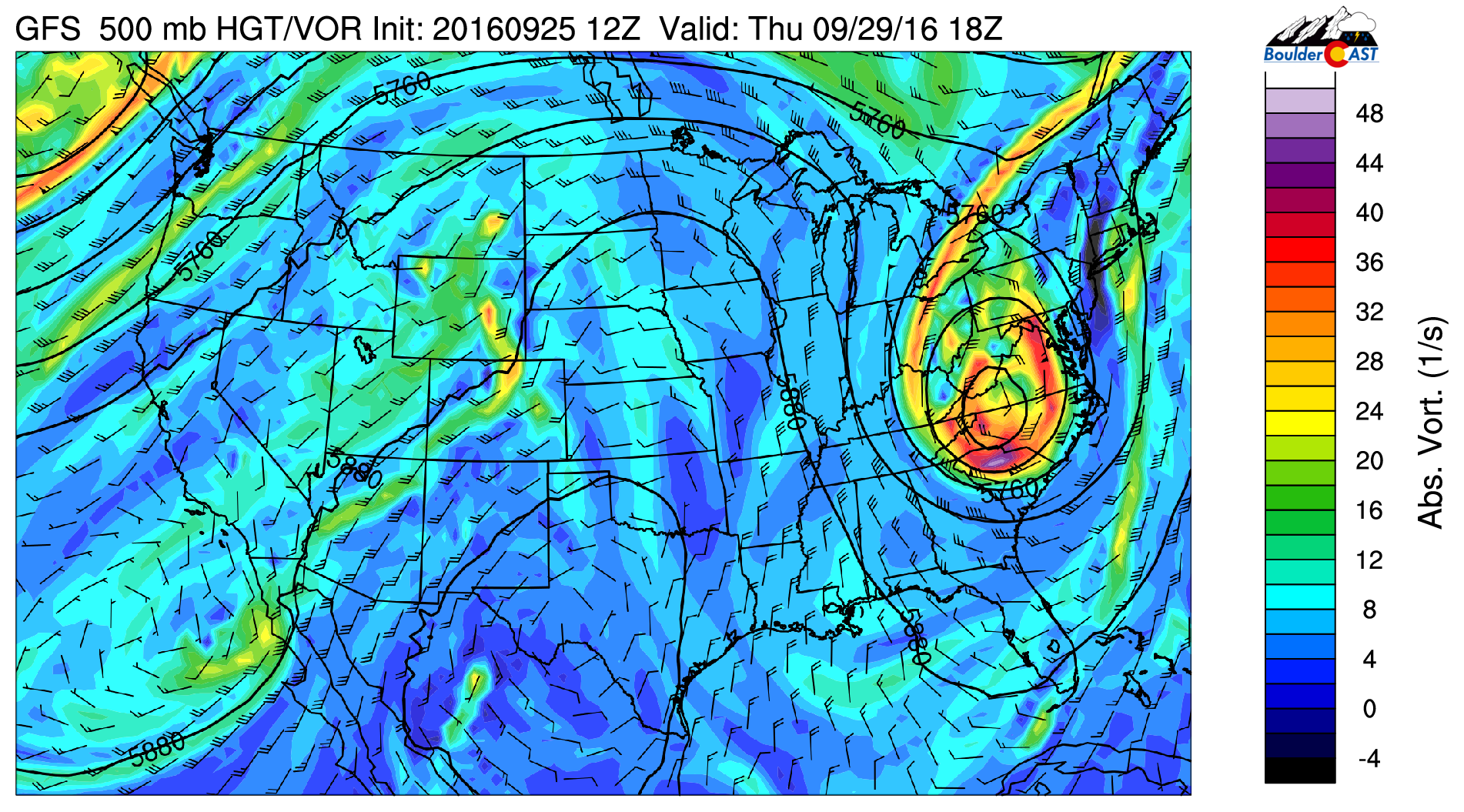
GFS 500 mb vorticity and wind for Thursday
The influence of the system on our weather for Thursday is shown in the below figure as a time/height plot of relative humidity centered on Boulder (from the GFS model).
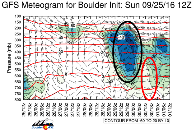
Time/height plot of relative humidity and wind centered on Boulder for the week from the GFS model
Notice the area circled in “black”, which shows high relative humidity on Thursday from 250 mb to ~ 700 mb, indicating lots of high level clouds engulfing the region. As a result, we’re expecting highs cooler Thursday by just a tad with mid to upper 70’s. The area circled in “red” is the relative humidity on Friday, showing less cloud cover with highs ending September near 80 degrees.
There is also a chance of a few spotty showers or a storm, as indicated by the accumulated precipitation plot over Colorado on Thursday. As mentioned earlier, the better likelihood of unsettled weather will be over western Colorado and the High Country. We don’t expect much on the Plains, but don’t be surprised if a spotty shower/storm briefly brings a few rain drops.
On Friday, the storm system is well out of the region, but daytime heating and weak instability will produce showers over the higher terrain that will traverse east toward the Plains. With downslope surface flow, storms will be isolated at best.
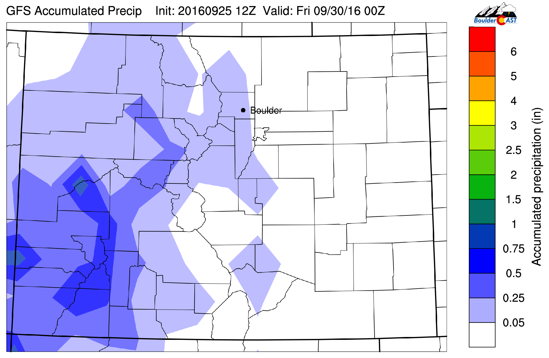
GFS accumulated precipitation through Thursday
Over the High Country Thursday and Friday, expect rain and snow showers. Below shows two plots, one for the regional accumulated precipitation through Friday, and a second plot for the accumulated snowfall through Thursday. The top plot shows the majority of precipitation will remain over western Colorado. Part of this will be snow as well, with a dusting to a few inches possible near Aspen and Crested Butte (bottom plot). Snow levels should be above 11,000 ft, though.
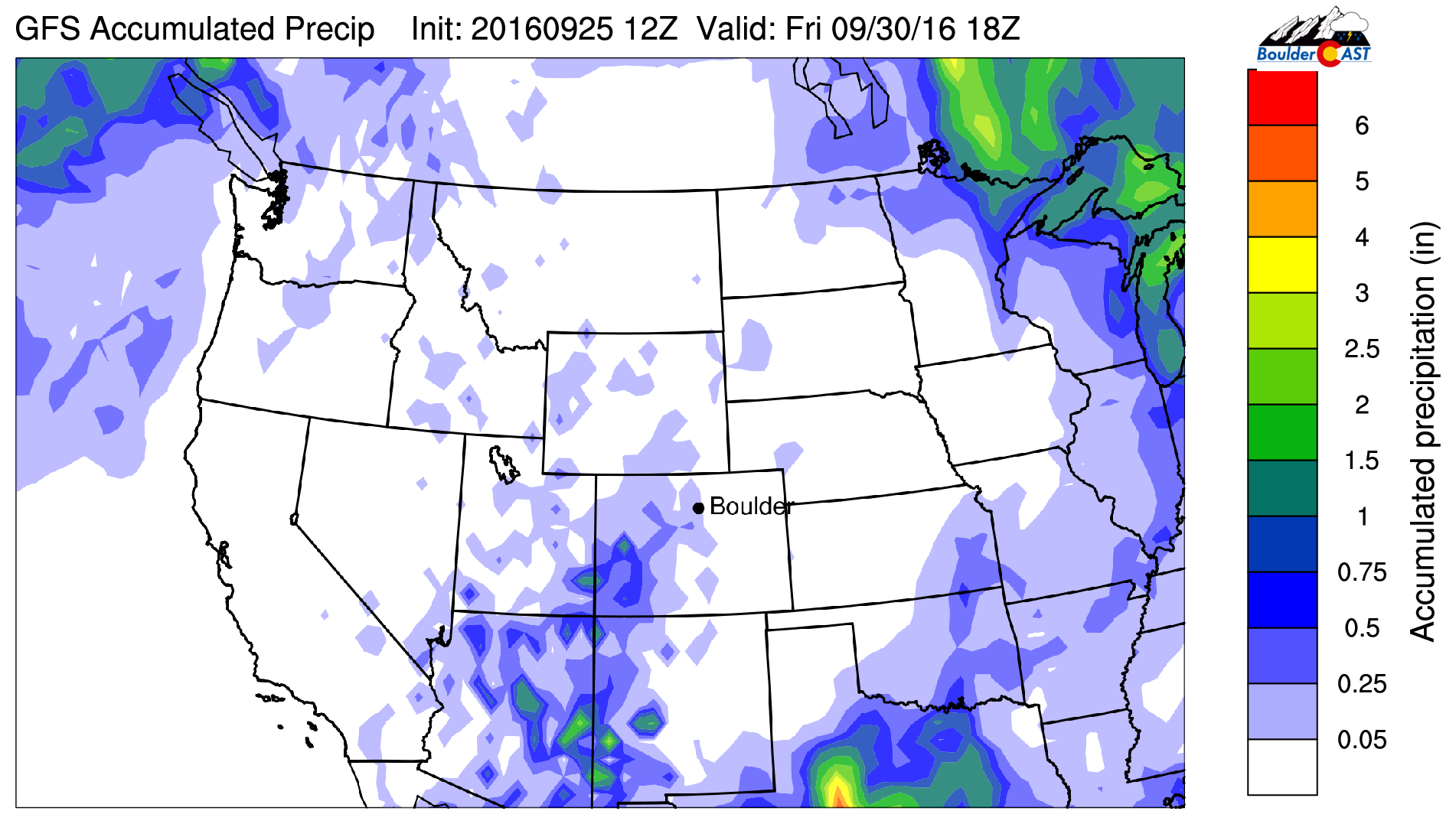
GFS accumulated precipitation through Friday over the western United States
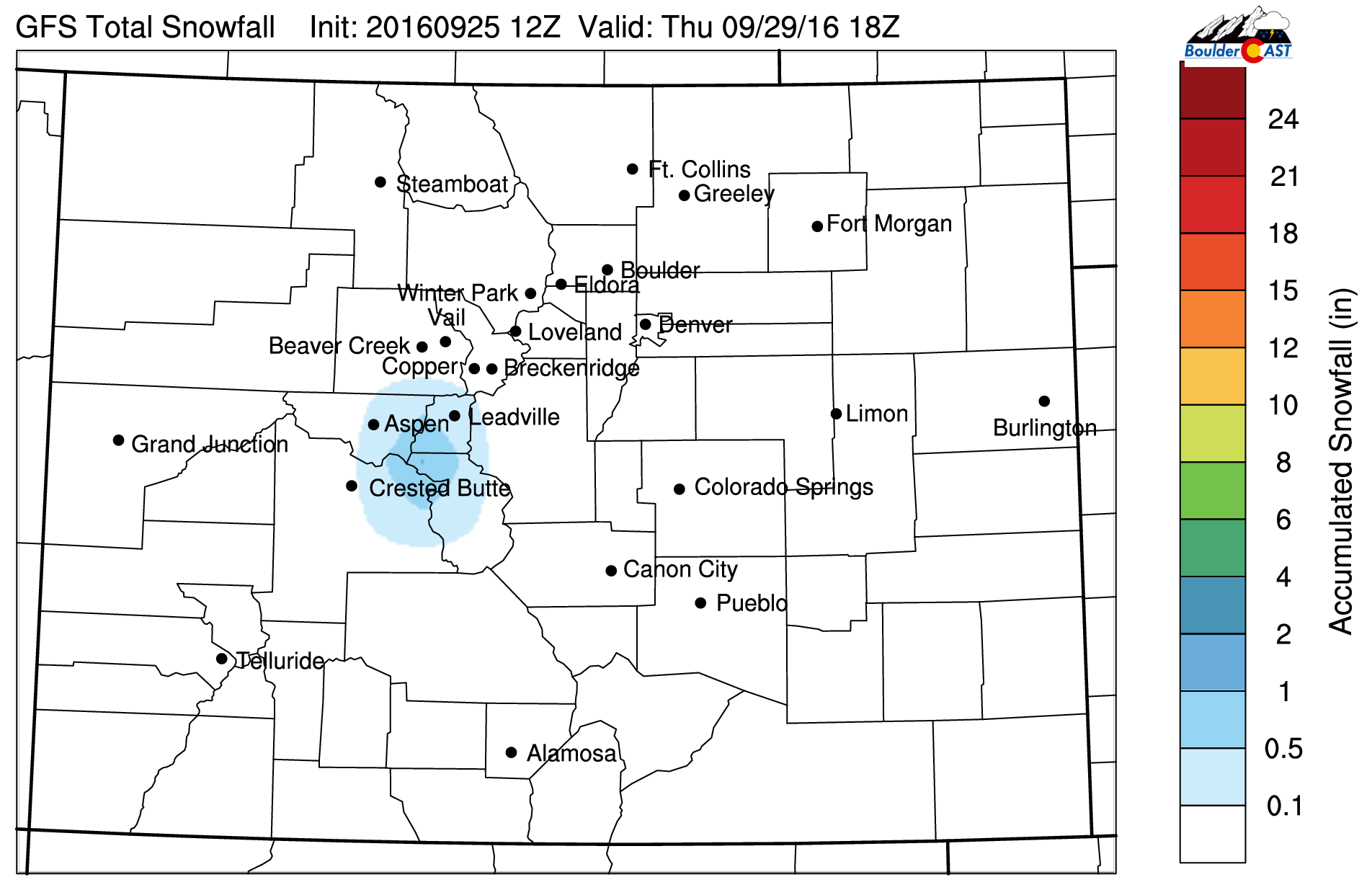
GFS snowfall on Thursday for Colorado
Forecast Specifics:
Monday: Sunny skies with light easterly winds becoming variable. Mild with highs in the middle 70’s for the Plains, and middle 60’s in the Foothills.
Tuesday: Lots of sunshine and warmer with highs in the low 80’s on the Plains, and near 70 in the Foothills.
Wednesday: Sunny skies leading to a few high clouds late in the day. Highs near 80 for the Plains and in the upper 60’s in the Foothills.
Thursday: Mostly cloudy with an isolated shower/storm possible in the late afternoon or early evening. Most of us to remain dry. Highs in the mid to upper 70’s across the Plains and upper 60’s in the Foothills.
Friday: Partly sunny with a few isolated showers or storms across the Foothills and Plains by early evening. Highs near 80 on the Plains and upper 60’s in the Foothills.
High Country: Tranquil conditions will be present over the higher terrain Monday through Wednesday. Conditions deteriorate Wednesday night through Friday with windy conditions, rain and some snow showers, with a few embedded rumbles of thunder.
14er CAST: With snow already showing up on the 14,000+ ft peaks, 14er season may be over for many of us. However, if you plan to go out, the best time this week will be Monday-Wednesday, with Tuesday the best day. Winds will be relatively light at 10-15 mph with possible gusts to 20 mph, highs in the 30’s-40’s, with lots of sunshine. Conditions rapidly deteriorate Thursday and Friday with rain and snow showers and possible storms Thursday and Friday
Extended: While we end the month of September on the mild and dry side, the extended outlook is looking to trend colder and more active. Early indications point to similar weather Saturday and Sunday with isolated afternoon storms and temperatures above normal. But there are signs colder weather and maybe our first chance of snow on the Plains could occur by mid to late next week. Stay tuned!
Mon
Tue
Wed
Thu
Fri


Temperature
76
81
79
76
80


Precip Chc (Plains)
0%
0%
0%
10%
10%


You must be logged in to post a comment.