
Dry weather has prevailed across northeast Colorado for the last several days, with temperatures moderating from the 60’s to near 90 degrees. This trend continues through much of this week’s forecast as a flat upper-ridge dominates our weather. However, the team-up of a potent trough and the remnants of Tropical Storm Paine will bring chances for rain just in time for the weekend. Read on for our complete weekly forecast.
High and dry to begin the week
As mentioned in the intro, we begin the week under the influence of a flattened mid-level ridge. In the 500 mb vorticity map below for this afternoon, we see the ridge centered across the Lone Star State with an axis extending through the Denver Metro area.
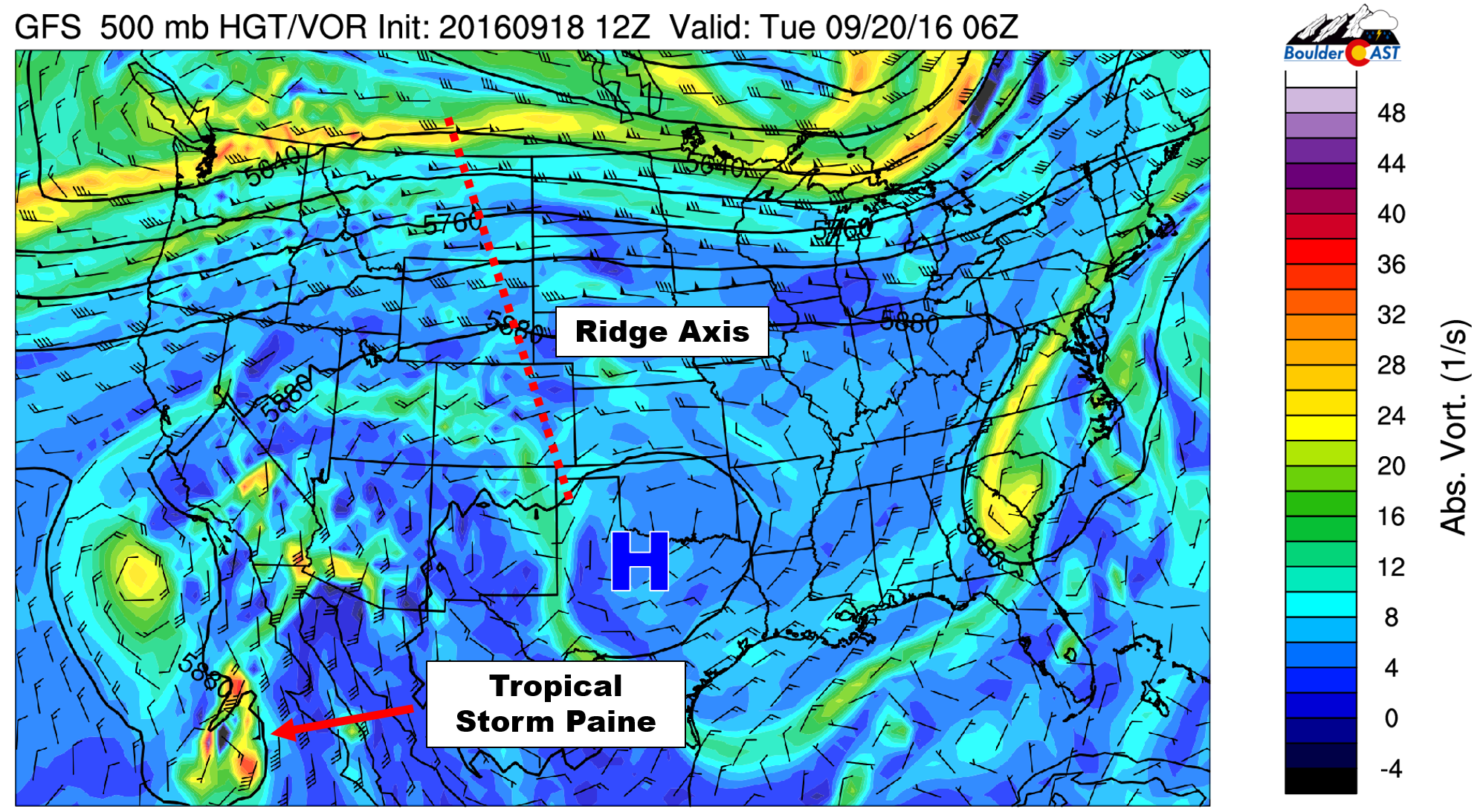
GFS 500 mb vorticity map for Monday. Shown is the ridge of high pressure centered over Texas and the mid-level representation of Tropical Storm Paine in the lower left
This will allow the warm and sunny weather to remain in place across the region for several more days. The ridge will also help keep the remnants of Tropical Storm Paine mostly to our west (seen above off the western coast of Mexico).
For Monday, expect another sunny and beautiful day for the region, with near-record heat across much of the Front Range. The lower levels have been and will remain very dry, as should be evident from relative humidity values less than 15% and the Red Flag Warnings the last few days. Boulder and Denver should top out near 90 degrees this afternoon.
A cloudy Tuesday
On Tuesday, we’ll see a splash of sub-tropical moisture embedded in the southwest flow move into Colorado. The lower levels will remain very dry, so we’re not expecting anything in the way of precipitation. That elevated moisture is evident in the time/height plot of relative humidity for Boulder below (from the GFS model).
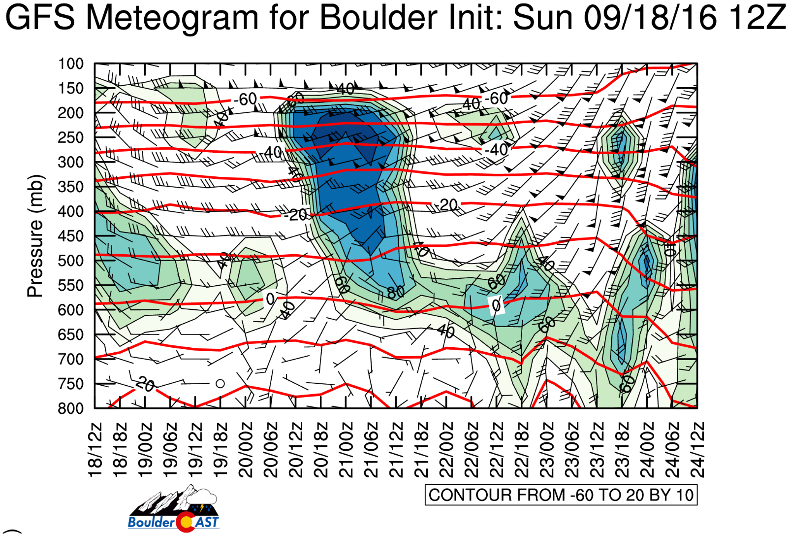
Boulder time/height plot of relative humidity for the week, showing the plume of mid and upper-level moisture for Tuesday (the “blue blob”).
Notice the large “blue blob” which lies above 600 mb in the atmosphere from 6AM Tuesday to 6AM Wednesday. This spells out layers of high-level stratus clouds during the day Tuesday. Though the air mass will largely be the same as Monday, with the added cloud cover, expect Tuesday to be a few degrees cooler, with highs landing somewhere in the mid to upper 80’s.
Tropical Storm Paine remnants feed into a system to our northwest
By the middle for the week, Tropical Storm (or possibly Tropical Depression) Paine should nearly be making landfall to the south of San Diego.
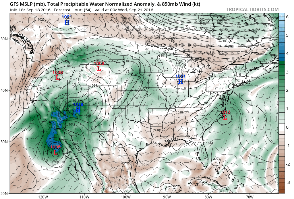
GFS surface pressure and moisture anomaly for Tuesday evening. Notice Tropical Storm Paine in the lower left, as well as the large plume of moisture out ahead of the storm surging into the southwest U.S.A.
Ahead of Paine, deep moisture will be streaming into Utah and parts of western Colorado. This should allow a few storms to return to our state, particularly in the southern and western portions. The Front Range will remain dry under downslope flow with mostly sunny skies and temperatures in the mid 80’s (downslope seen below in Wednesday evening’s 500 mb vorticity forecast map).

GFS 500 mb vorticity map for Wednesday evening, showing westerly flow across Colorado and a storm system coming ashore in Washington/Oregon.
Changes just in time for the weekend
In the map just above, take note of the developing trough across the Pacific Northwest. By Friday, models agree on a basic level that it will explode into a formidable autumn cut-off system for Friday (see Friday’s map below!).
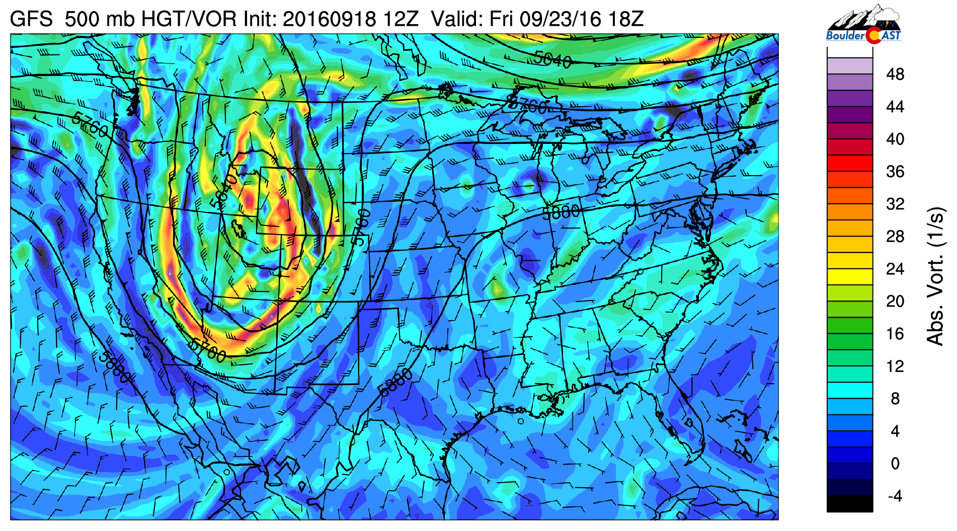
GFS 500 mb vorticity map for Friday, showing a deep trough set-up across the western United States
Before it arrives, however, Thursday will be a day of transition, which is fitting for the first day of FALL! Ahead of the trough, it looks like a weak cold front will move in early Thursday morning. This will knock our temperatures down a little, but likely only into the mid to upper 70’s for Thursday’s high (about normal for this time of year).
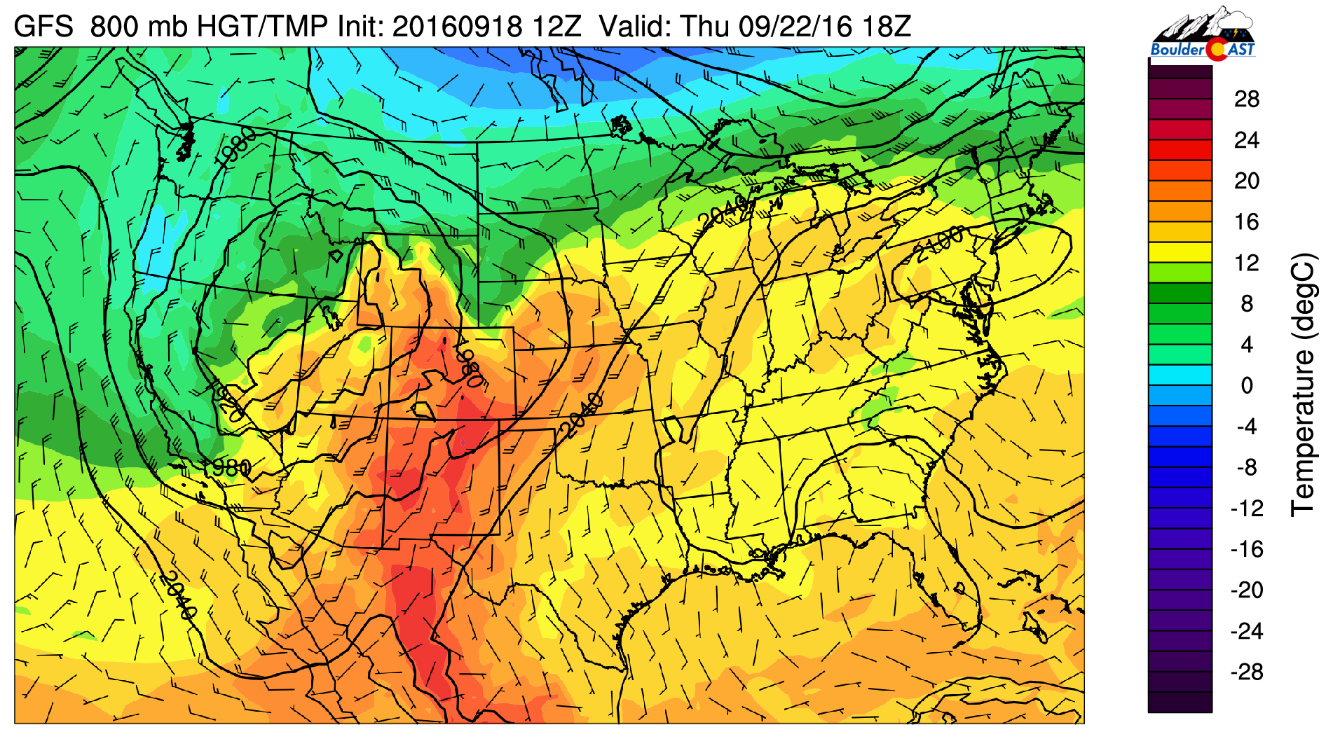
GFS 800 mb temperature forecast map for Thursday afternoon. Notice the encroaching cooler air in northeast Colorado and the easterly flow. This is a weak cold front
Under strong southwesterly flow, Thursday should remain mostly dry, outside of a few isolated storms in and near the Foothills.
On Friday, things get more intriguing as that big trough approaches. The map below shows 500 mb height lines from the 20 ensemble members of the latest GFS. Surprisingly, the GFS has a rather good handle on the position of the 5760-meter height line across Colorado on Friday (relatively small spread in green lines across the state). As of now, it appears that it will take a northward track across Wyoming and Montana, which would bring only limited precipitation to the Front Range (alongside a slight cool down).
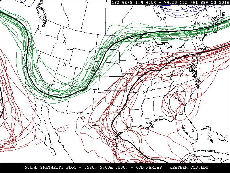
GEFS 500 mb height “spaghetti” plot showing good agreement among the ensemble members for Friday’s system across Colorado.
Right now, we’ll go with widely scattered showers and a few storms for Friday across northeast Colorado. Though Friday does offer our greatest odds of rain this week, don’t cancel any plans just yet. Any precipitation should be the spotty afternoon/evening variety…not an all day or “everywhere” event by any means. That type of precipitation should stay well to our north in Wyoming and Montana where moist and prolonged upslope will exist (and likely heavy mountain snow).
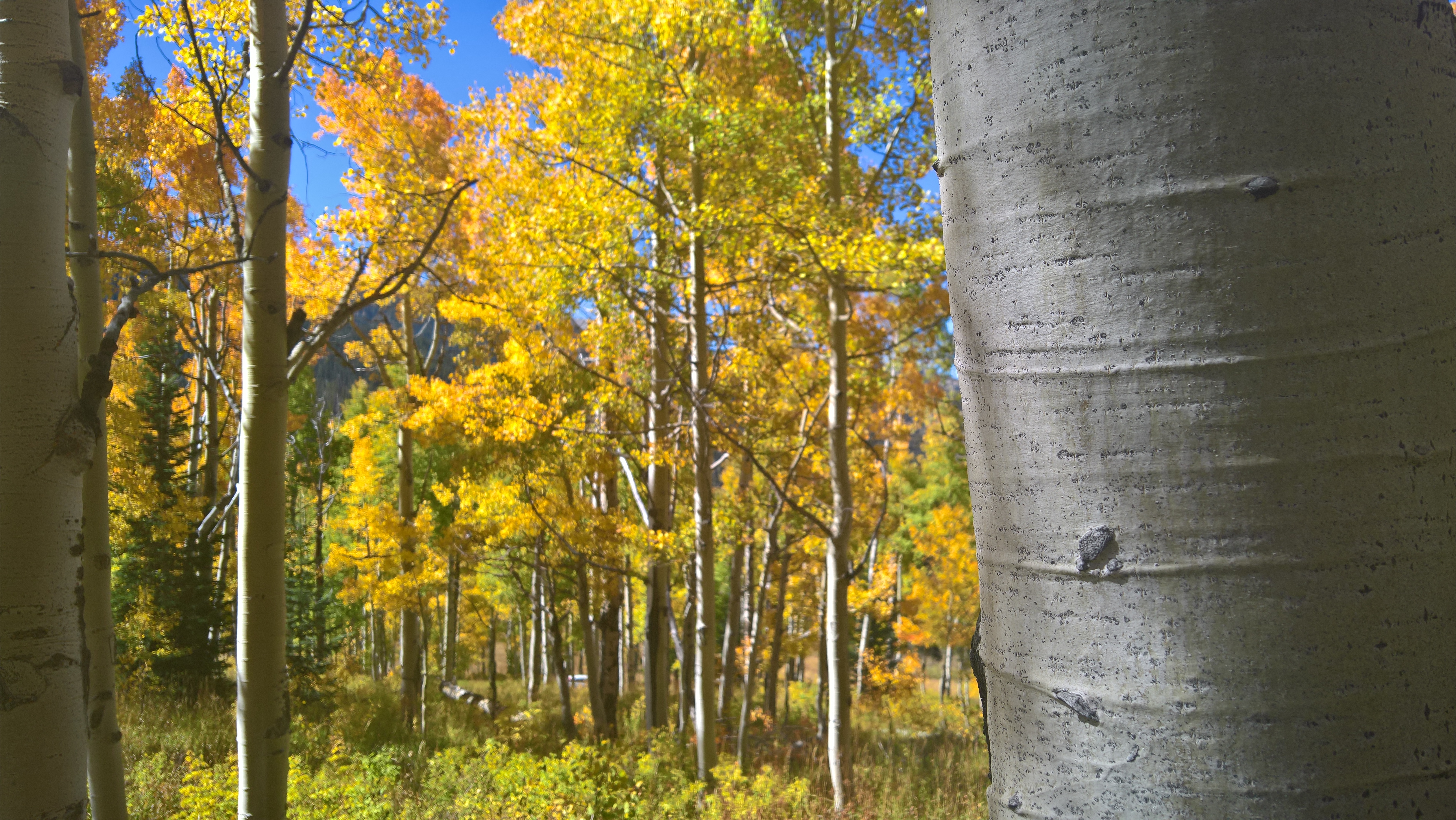
Enjoy another great September week! Peak fall colors are almost here!
Forecast Specifics:
Monday: Sunny and dry with near record-setting heat. High temperatures will soar to near 90 degrees on the Plains with near 80 in the Foothills.
Tuesday: Warm and dry, with a thick upper-level cloud deck persisting throughout the day. Highs in the mid 80’s for the Plains, with mid 70’s in the Foothills.
Wednesday: Mostly cloudy in the morning followed by clearing in the afternoon. Just a slight chance of a thundershower across the higher elevations, especially south of Denver. Highs in the low to mid 80’s across the Plains, low 70’s in the Foothills.
Thursday: Mostly sunny and seasonal with isolated afternoon storms, primarily over the Foothills and Mountains. High temperatures in the middle 70’s for the Plains, with mid 60’s in the Foothills.
Friday: Increasing clouds with widely scattered afternoon showers and a few thunderstorms, particularly for areas north of Denver. Highs in the mid 70’s on the Plains and low 60’s in the Foothills.
High Country: Overall, the higher elevations should see a great week. After dry conditions Monday and Tuesday, there will be a slight chance of showers and storms Wednesday through Friday, with temperatures generally above normal. Get out there if you can!
Extended: After a few lingering storms across the higher elevations Saturday, seasonal and dry weather returns for the region as another flattened ridge builds in Sunday through the middle of next week. Based on everything we are seeing now, it looks like September will end on a dry and warm note.
Mon
Tue
Wed
Thu
Fri


Temperature
90
86
84
77
75


Precip Chc (Plains)
0%
0%
10%
10%
20%


You must be logged in to post a comment.