
In the wake of a cold and soggy weekend, the main weather-player for the week ahead in Colorado will be a slow-moving trough across the western United States. It will facilitate continued precipitation for the Front Range, in the form of both rain and snow, through much of the week. However, warmth is on the horizon. Read on as we detail the forecast for the next seven days.
Messy start to the week
We begin the week under the influence of a broad upper-level trough. The location this evening is shown below, with the upper-low centered across northern Nevada and Utah. This trough is in no hurry to move eastward, so we’ll likely be dealing with its effects through Thursday.

GFS 500 mb vorticity map for this evening, showing the approaching storm system to our west
The most substantial and sustained precipitation for the week begins very shortly, as a surface low deepens in southeastern Colorado (shown below), swinging a cold front through our neck of the woods later this morning.

GFS pressure and precipitation forecast for Monday at 6PM. Notice the upslope and widespread precipitation beginning to develop across eastern CO
As we have seen so many times this winter/spring, this storm track is favorable for upslope in Boulder/Denver, which can be seen in the wind barbs in the map above.
The cold front will be through be through the entire Denver area by mid to late morning today, with cool and moist upslope taking over thereafter.
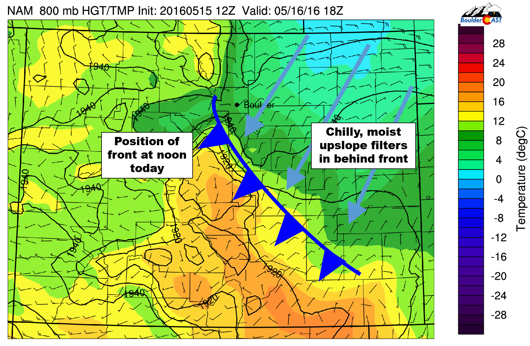
NAM 800 mb temperature forecast for Monday at noon. Shown is the position of the front, with cooler air and upslope on the backside
We expect precipitation to begin before noon, with coverage and intensity expanding through the afternoon and into the evening. Light to moderate precipitation will continue into Tuesday morning or early afternoon.
Models are in relatively good agreement as far as how much precipitation this system produces. The NAM and GFS generally agree on 0.5-1.3″ of precipitation for most of the Front Range, with the highest amounts in the Foothills. Overall, the upslope is not that deep or intense, but the shear amount of moisture available should be enough to counteract this.
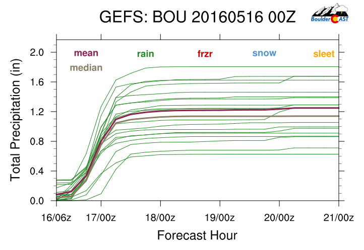
GFS ensemble plumes for total precipitation. Mean/median just exceeding 1″ of liquid for the event
While we are fully expecting an all rain event for the Plains, there is a favorable overlap between the precipitation, cooler air, and the night time hours for snow levels to drop overnight tonight into Tuesday morning. Shown below are the 700 mb temperatures from the GFS (left) and NAM (right). The NAM is running several degrees colder across all of Colorado, which would support lower snow levels overall.
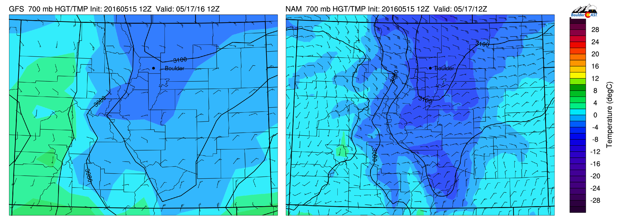
700 mb temperature forecast for Tuesday morning at 6AM from the GFS (left) and NAM (right). The NAM is running about 2 degrees C colder everywhere
Snow levels will begin high, near 10,000 feet this morning. As the cooler air filters in, they will drop trough the day, and especially after sunset tonight. A rain/snow mix will be possible down to ~7,000 feet elevation tonight. However, accumulating snow, possibly several inches worth, will be confined mostly to areas above ~8,000 feet.
Our snowfall forecast map is given below. Will this be our last one of the season? Probably, but no guarantees!

With the extensive cloud cover, precipitation, and cooler air mass, both Monday and Tuesday will see highs only in the 40’s.
Unsettled weather lingers…
With the trough slow to progress, weak low-level southeasterly flow will continue to bank the cool/moist airmass up against the Front Range mountains into Thursday morning, keeping skies mostly overcast and temperatures cool on Wednesday. With the trough axis still to our west on Wednesday, the threat of continued scattered showers stays in the forecast. Highs will remain well below normal, only in the 50’s across the Plains.
GFS 500 mb vorticity map for Wednesday evening
Thursday’s forecast will be tricky as it will be a day of transition. The trough axis looks to move east of our region by mid-day, which should facilitate downslope and drying for the region. With a little more sunshine, expect a bump in temperatures back into the 60’s, maybe even low 70’s. We can’t fully rule out a few isolated afternoon storms either, but most places will likely be dry.
A welcomed warm-up to end the week!
By Friday, another expansive trough is coming ashore in the Pacific Northwest (seen below). Ahead of this system, strong SSW-erly flow helps to build a narrow, but potent, ridge across Colorado.

GFS 500 mb forecast Friday afternoon
With this ridge in place, we’ll see mostly sunny skies and a hefty bump in temperatures to near 80 degrees. We again can’t rule out isolated storms across the Mountains and Foothills, but the Plains should remain dry.
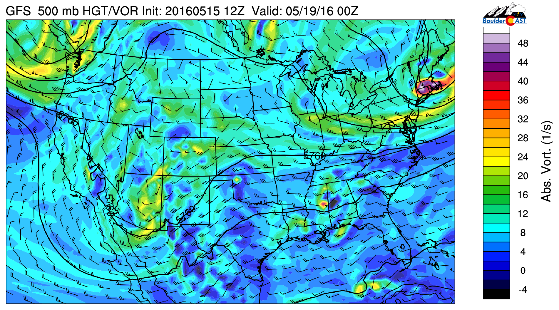
As for that next system, the models disagree (not surprising). The GFS wants to keep it well to our north and west all the way into next week, with continued warm air advection and ridging across Colorado (dry and beautiful!), while the Euro brings the system into Colorado on Monday (more wet weather!).
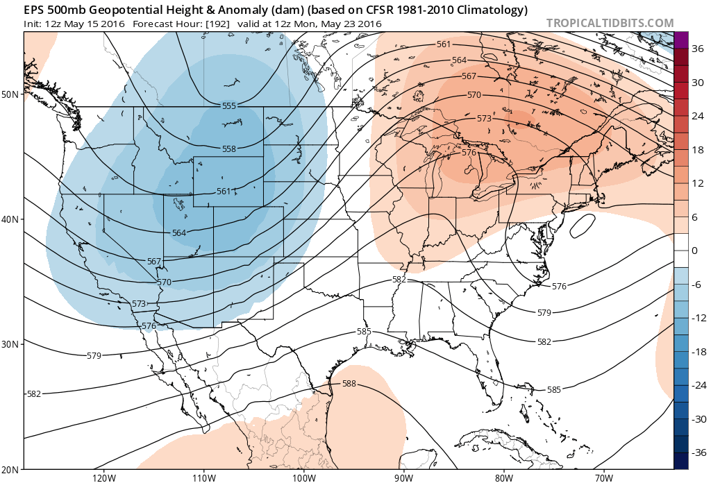
Euro ensemble 500 mb forecast for next Monday, showing that trough kicking across Colorado
Regardless, the second half of Thursday through the first half of Sunday look superb. This may be the weekend to finally put your green thumb to work! Enjoy the week!
The Forecast:
Monday: Overcast and chilly behind a morning cold front. Precipitation increasing in coverage and intensity through the day, continuing into Tuesday. Snow levels falling from ~10,000 feet in the morning down to ~7,500 feet by Tuesday morning. Up to 3″ of slushy accumulation will be possible in the Foothills above 8,000 feet. Highs in the mid 40’s across the Plains, with upper 30’s in the Foothills.
Tuesday: Cloudy with light precipitation lingering through the day, especially in and near the Foothills. Areas to the east towards Denver will be drier. Highs in the mid 40’s across the Plains with mid to upper 30’s in the Foothills.
Wednesday: Partly to mostly cloudy with a few isolated afternoon showers. Highs in the upper 50’s on the Plains, with mid 40’s in the Foothills.
Thursday: Some clouds early, then clearing with a few isolated afternoon storms, mostly over the higher terrain. Warmer with a high in upper 60’s across the Plains, upper 50’s in the Foothills.
Friday: Mostly sunny and even warmer, with just a slight chance of an afternoon storm over the higher elevations. Highs in the upper 70’s for the Plains, with mid 60’s in the Foothills.
High Country: Snow increasing in coverage during the day today as the system approaches. Snow levels will be high initially, near 10,000 feet, but will fall by Monday evening and remain below this into Wednesday. We’re expecting significant snow above 10,000 feet from the Divide eastward, likely 8-16″ through Wednesday morning. Snow levels raise Thursday and Friday, with a chance of isolated storms both days.
Header photo credit: Zack Pyle


You must be logged in to post a comment.