After a weekend filled with sunshine, heat and wildfires, the week ahead will feature a slight cool-down across northern Colorado as zonal flow takes center-stage. With this, rain chances will be minimal and confined to the end of the week. Continue reading for a recap of the recent dry weather and our complete forecast for the upcoming week.
Arid times of late
It should be clear that increasingly dry times are now upon us in the Front Range. With one-third of the month of July now behind us, Boulder has recorded only 0.18″ of rain, and only 0.66″ since June 14th. Exacerbating the situation is the accompanying heat; Boulder is currently riding a week-long 90+ degree streak, which includes reaching nearly 100 degrees yesterday (Sunday’s high temperatures: BoulderCAST 99, Boulder Airport 99, Boulder official 99, DIA 102).
As we warned earlier in the month, the fuels in the Foothills are borderline volatile. Unfortunately, this became evident to the entire Metro area on Saturday with the ignition of the Cold Springs Fire near Nederland.
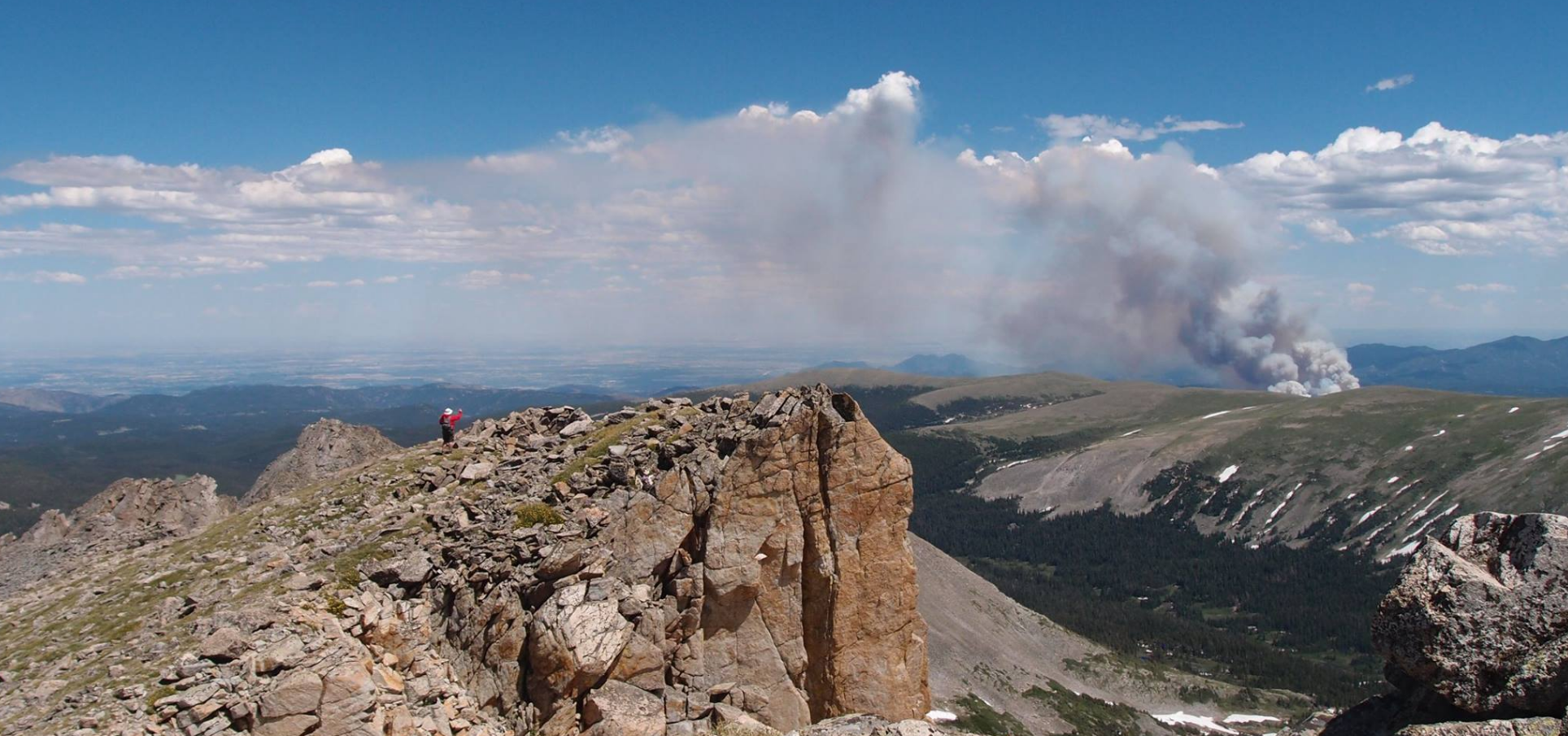
Cold Springs Fire – July 9, 2016 Photo credit: Brian Vanderwende
While the fire thus far has only burned ~650 acres, it could be a sign of things to come. Especially considering the forecast we are about to present, which as you will see, contains little in the way of liquid alleviation.
Zonal flow takes center stage
The week ahead will feature a persistent zonal flow across much of the country, including Colorado. By zonal, we mean that the winds follow a near-perfect west-to-east direction. This type of pattern generally leads to pleasant weather across Colorado, with near-normal temperatures. However, it’s often difficult to produce much precipitation with zonal flow in place, as it is a downslope flow. Combining this downslope with very limited moisture, the upcoming week’s weather will not provide much relief for the wildfire danger across the High County.
Shown below is the 500 mb vorticity map for today (Monday).
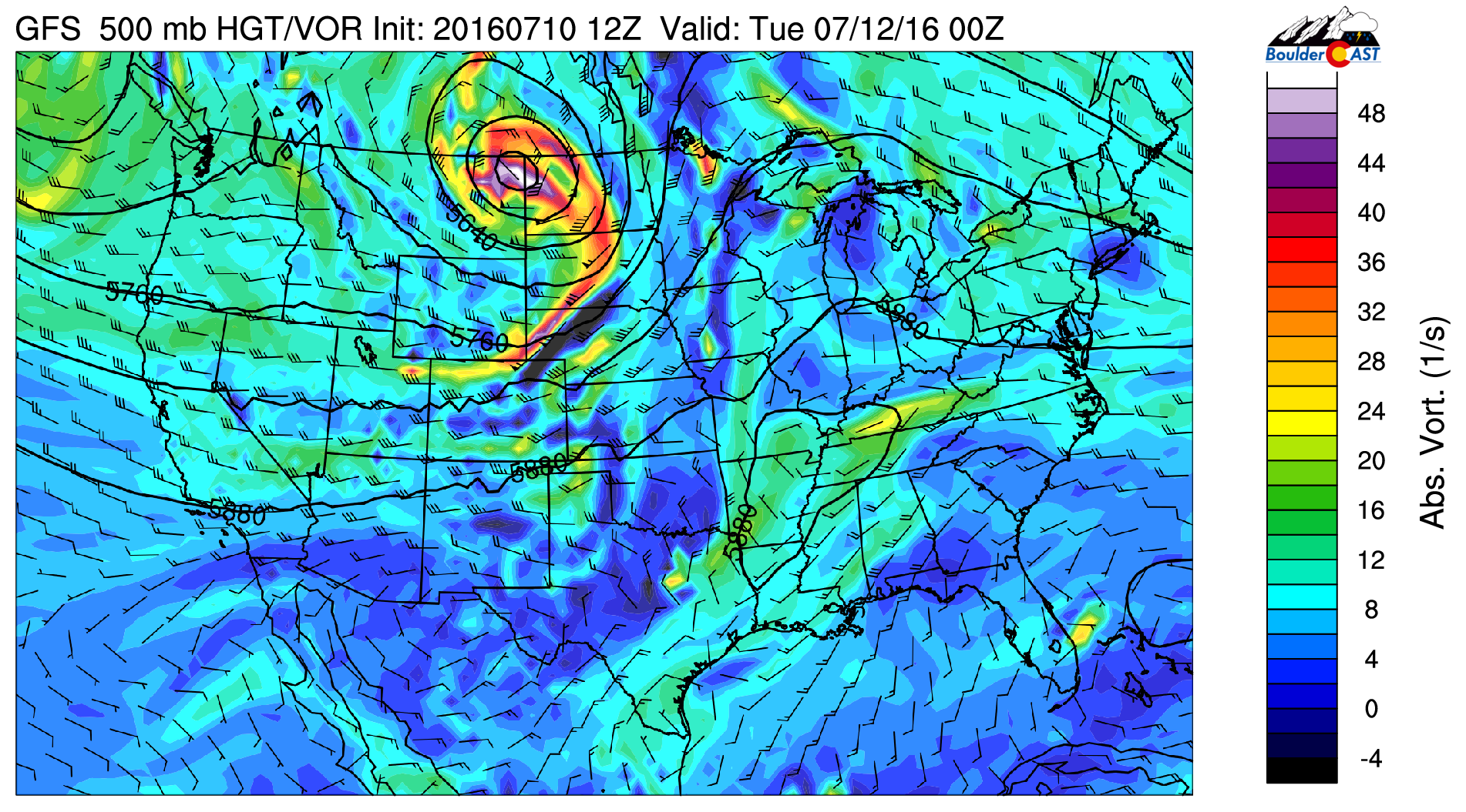
GFS 500 mb vorticity map for Monday
You can see an upper-low centered over eastern Montana, with a trailing trough dipping into northern Colorado. This trough is responsible for the cold front that moved through earlier this morning, and the reason temperatures today will top out only in the mid to upper 80’s (10 to 15 degrees cooler than yesterday)!
Outside of producing gusty winds in the Mountains and Foothills today, the trough and front will pass without much happening across our region. This is because the airmass (both ahead and behind the front) is extremely dry. The precipitable water map below shows this complete lack of moisture.
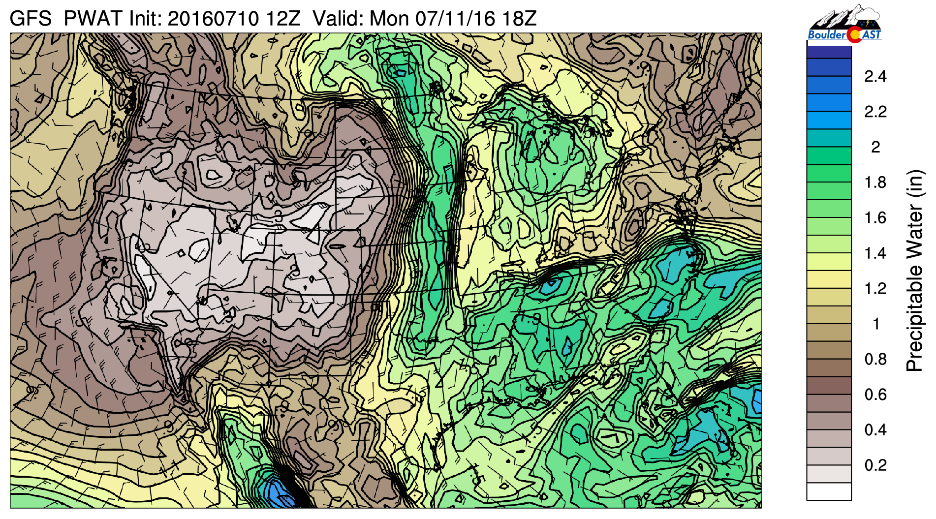
GFS precipitable water forecast for Monday, showing very dry air in place
As we mentioned, the zonal flow will be very persistent. If you focus on Colorado in the 500 mb maps below, not much changes from Tuesday…
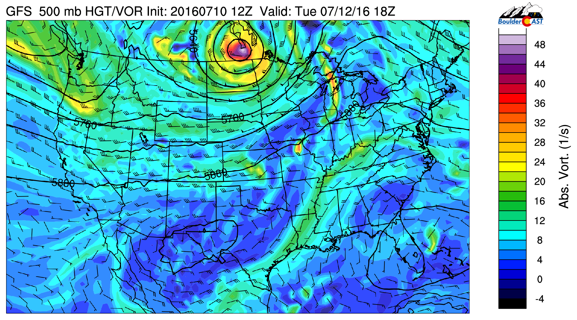
GFS 500 mb vorticity map for Tuesday
into Wednesday….
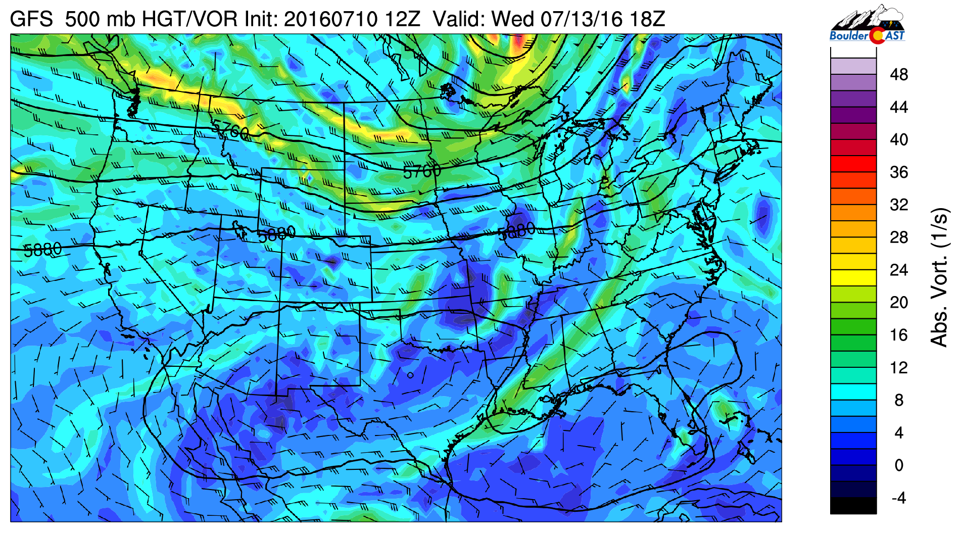
GFS 500 mb vorticity map for Wednesday
into Thursday….

GFS 500 mb vorticity map for Thursday
into Friday…

GFS 500 mb vorticity map for Friday
Nothing but zonal flow across the state.
Each day will experience sunny skies with a some afternoon clouds. High temperatures will be in the low 90’s Tuesday and Wednesday, with upper 80’s Thursday and Friday. We’re not seeing the potential for precipitation anywhere Tuesday or Wednesday. However, Thursday and Friday will see isolated / widely scattered storms across the Foothills and Denver Metro. There will be more substantial storm coverage to the south and east of our immediate area as a bit more moisture advects in at the lower-levels from Kansas. Some of these storms could turn severe near the Kansas border.
The GFS total accumulated precipitation forecast through Saturday morning shows the concerning lack of precipitation for the Front Range.
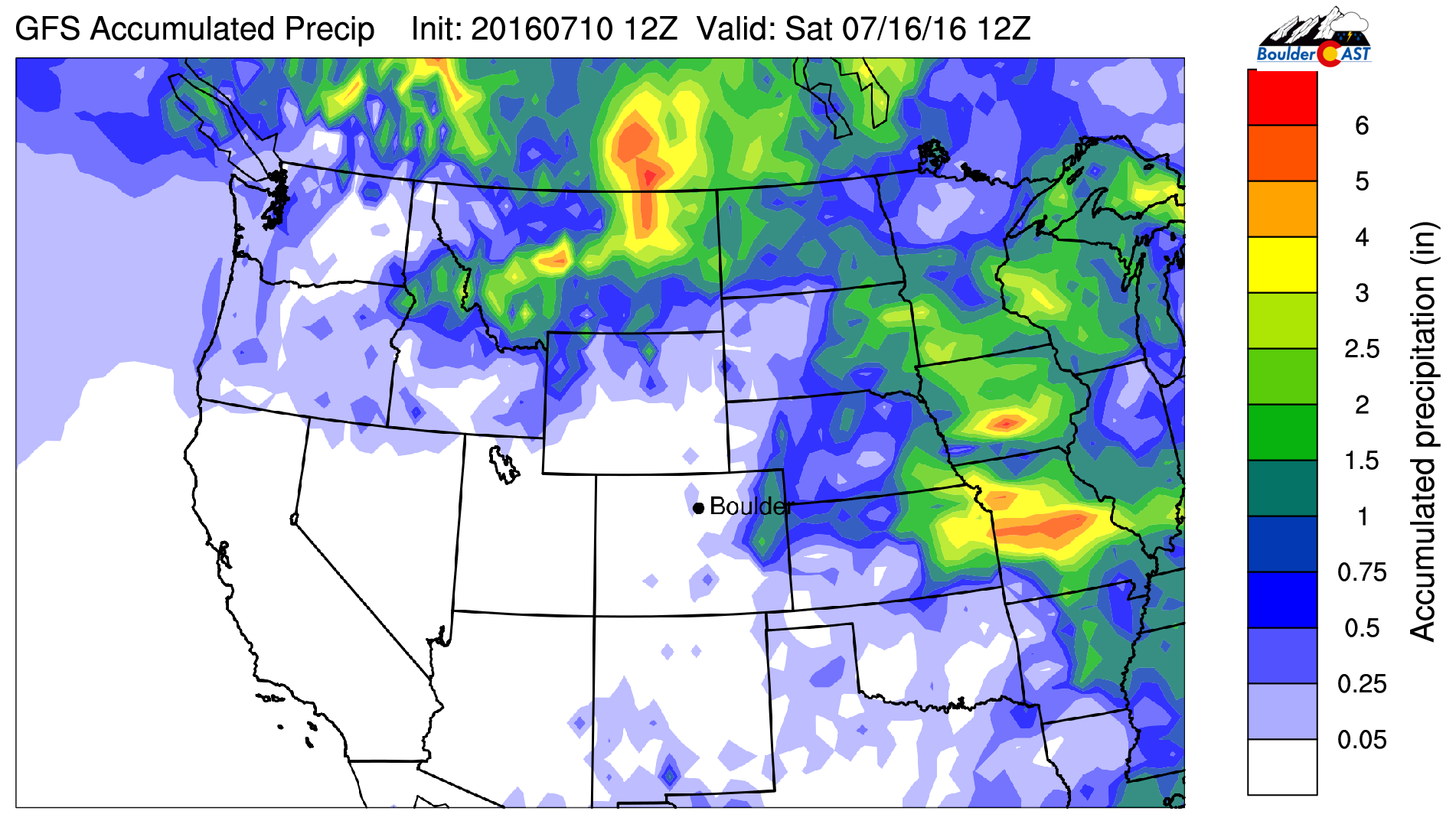
GFS total accumulated precipitation forecast through Saturday morning. Little to no rain is expect across the Front Range
Hang in there and be extra careful with any fiery endeavors in the forest. There are a few hints in the models that the monsoon could return sometime next week, but nothing overly promising. The good news is that that lack of rain eliminates the possibility of lightning igniting any fires. However, we desperately need that rain. Truly one of Mother Nature’s double-edged swords!
Have a great week! Do a little rain-dance if you can!
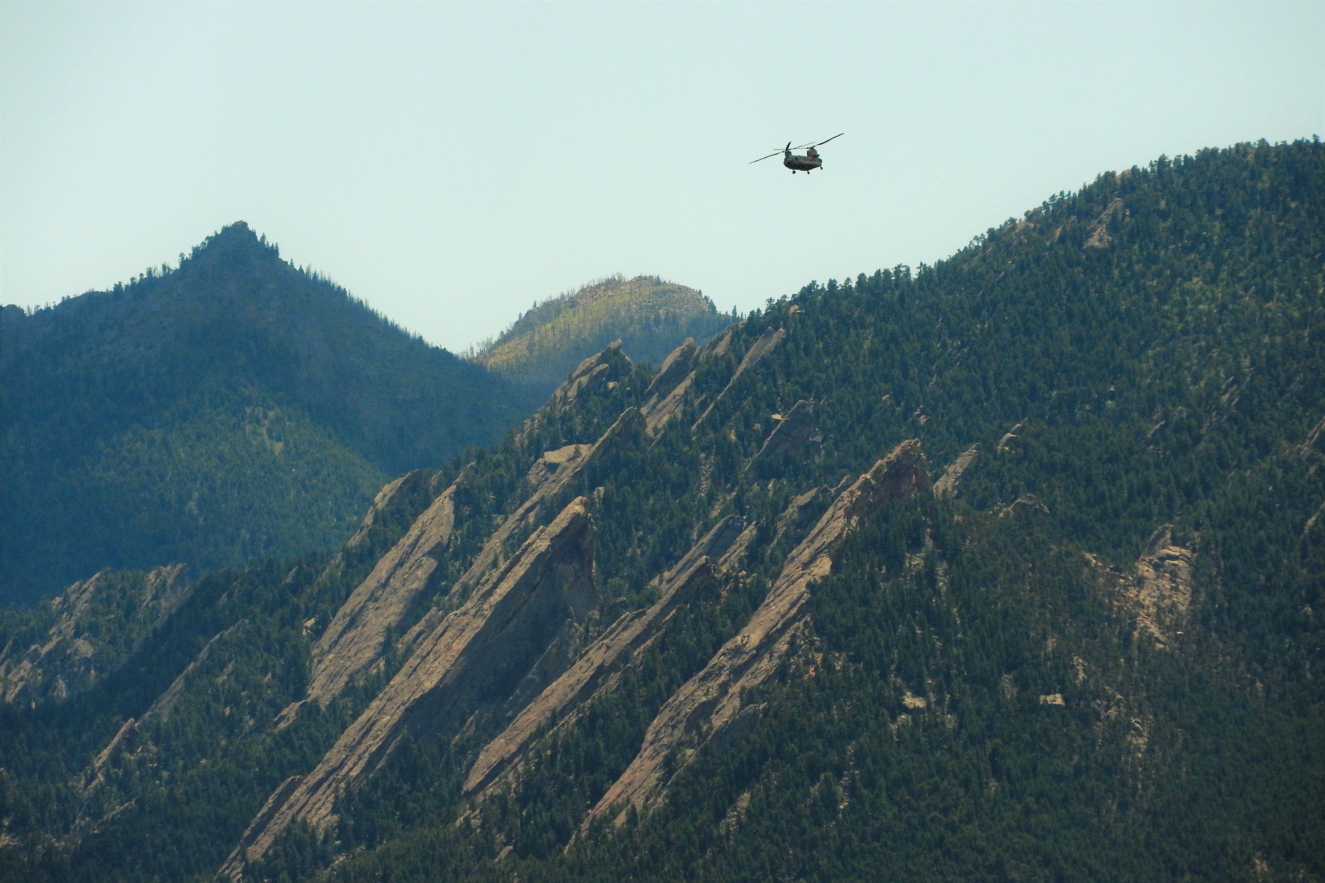
Chinook making a return flight past the Flatirons from the Cold Spring Fire on Sunday, July 10 2016.
Forecast Specifics:
Monday: Mostly sunny and cooler compared to Sunday. Gusty west winds, up to 40 mph, will impact the Foothills during the day, with winds weakening by sunset. Wildfire concerns will be elevated. Highs in the mid to upper 80’s for the Plains and mid 70’s in the Foothills.
Tuesday: Mostly sunny and seasonal. High temperatures near 90 degres on the Plains, with upper 70’s over the Foothills.
Wednesday: Mostly sunny and seasonal. Another dry day. Highs in the low 90’s for the Plains, low 80’s in the Foothills.
Thursday: Sun early, then partly cloudy in the afternoon. Expect isolated afternoon thunderstorms, which will linger towards midnight. Some of these storms could turn severe east of Denver. Temperatures in the upper 80’s on the Plains and upper 70’s in the Foothills.
Friday: Partly cloudy with widely scattered afternoon thunderstorms, particularly east of Denver. Highs in the upper 80’s on the Plains with upper 70’s in the Foothills.
High Country: Warm and sunny conditions across the Mountains for most of the week. Winds will be stiff during the day Monday, gusting up to 50 mph from the west above treeline. A few isolated storms return to the forecast for Thursday and Friday.
Extended: Model forecasts indicate that things won’t change much for the upcoming weekend. It looks like temperatures will be in the 90’s with extremely isolated storms for both Saturday and Sunday in the Foothills. Mostly dry elsewhere.
Mon
Tue
Wed
Thu
Fri


Temperature
87
90
92
89
88


Precip (Plains)
0
0
0
20%
20%


You must be logged in to post a comment.