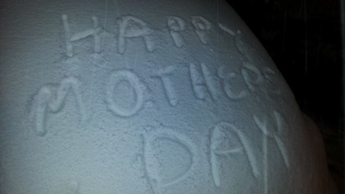
This Mother’s Day will not be forgotten! With the upper-level storm system now pulling northeast away from Colorado, and thousands of residents in the Metro area still without power, let’s take a look at the storm totals for Boulder County for the 4-day period beginning Wednesday morning.

Trees sagging, and at times breaking, under the weight of the heavy, wet May snow.
SNOWFALL:
- Allenspark – 6″
- Nederland – 5″
- Superior – 5″
- Boulder – 4″
- Erie – 3″
- Longmont – 2″
- Lyons – 1.5″
Overall, the northeast part of the county missed out on most of the action. North-northeasterly upslope is not all that favorable there, so places like Longmont and Lyons landed just below our 4 to 8″ forecast for the Plains. The Foothills areas just squeaked into the 5 to 12″ range forecasted by BoulderCAST. The National Weather forecast was actually predicting 5-10″ for the entire Denver area, but that seemed a little overdone to us. Though the uncertainty of the location of heavy banded snow, which we believed would not impact Boulder County, surely influenced their forecast to our east. This brings Boulder’s winter snowfall total to 117.1″, which is nearly 3 feet above the normal value of 85″.
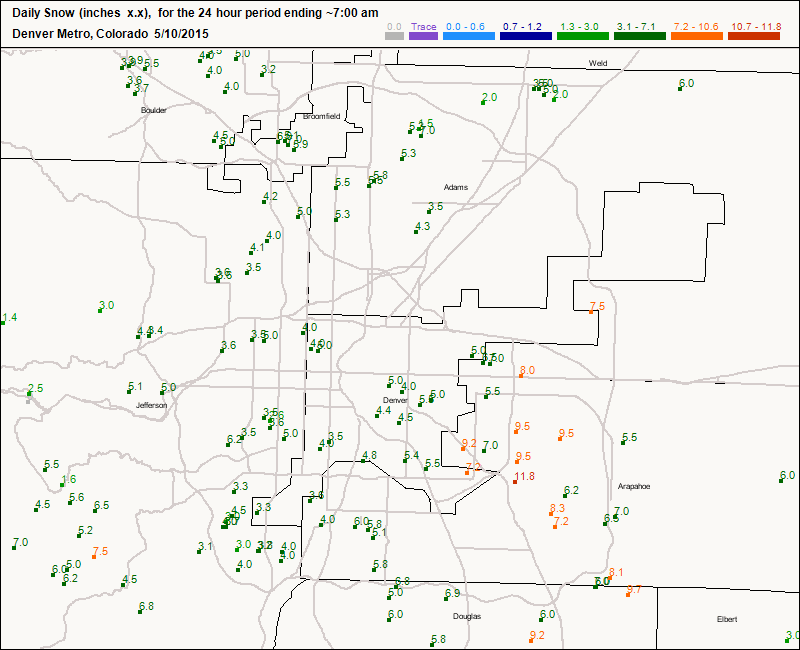
Snowfall totals for 24 hour period ending Sunday at 7am.
The real winner for snowfall in the area from this storm were the south and eastern suburbs of Denver, which received 6-12″ of snow, thanks to a near-stationary band of heavy snow that developed between 7pm and midnight, with snowfall rates at times exceeding 3″ per hour. Consequently, this region was also the hardest hit by power outages overnight.
PRECIPITATION:
- Erie – 3.70″
- Louisville – 3.51″
- Boulder – 3.22″ (Official NWS)
- Lyons – 2.85″
- Longmont – 2.82″
- Nederland – 2.54″
- Allenspark – 2.38″
These precipitation totals solidify this event as the most significant for Boulder County since the great flood in September 2013. Not surprisingly, the pattern and synoptic set-up were quite similar between the two events, with a deep trough over the Four Corners region and a blocking pattern over the center of the country.
Looking forward, northeast Colorado looks much drier than any day in recent memory (measurable precipitation has been recorded in all 10 days of May in Boulder!). There is near certainty that Monday will be completely dry, which we have not been able to say that for a while! Take care of your plants tonight as there is a frost advisory in effect overnight into Monday morning, with temperatures likely to drop into the mid to upper 20s (colder higher up) everywhere.
The drying stretch will continue through the week with just an isolated chance of storms on Tuesday through Thursday afternoons, mostly in the high terrain. Unfortunately, the models indicate another trough approaching our region on Thursday, increasing our chance of storms heading into the weekend.
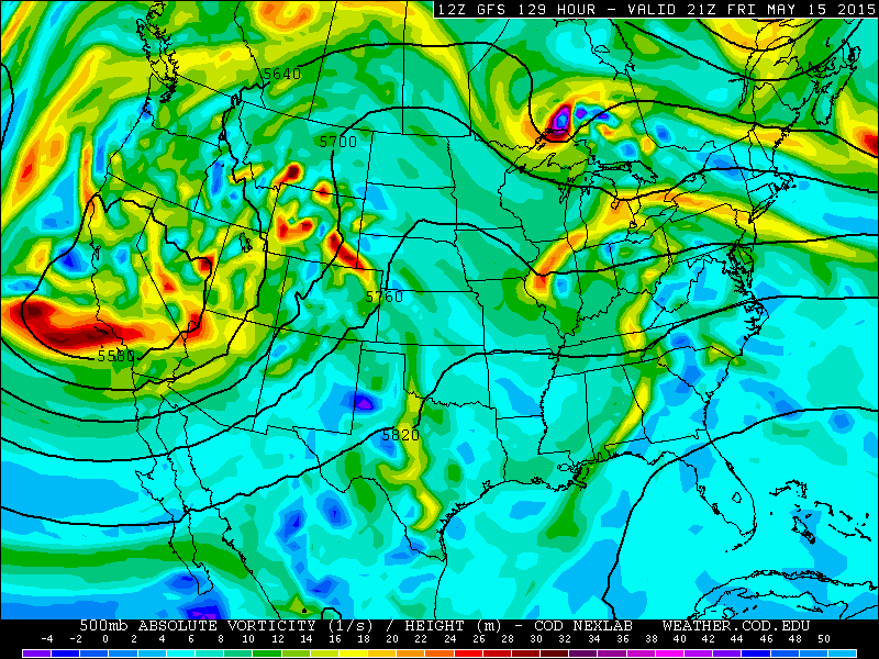
GFS 500mb height and vorticity forecast for Friday afternoon, showing the approach of our next major storm system coming ashore in California.


You must be logged in to post a comment.