Our system remains on track to bring a smattering of rain and snow to northeast Colorado this evening into Saturday morning. We give our final forecast, including when it will rain, when it will change to snow, and how much white stuff everyone can expect.
UPDATE (4am MT Friday 4/29): Last few model runs have been trending drier for Boulder area for the storm, and the change over to snow has been slow. It is likely this storm will be an under-producer. Expect snow totals to only approach the lower end of our forecast ranges. Heaviest precipitation still likely to fall between 9am and 6pm today.
Not much has changed since our last update, so we’ll keep this relatively brief, with an emphasis on the “relatively”. A mix of light rain and snow has been present across the region since early this morning. Morning snow in Boulder has since changed over to drizzle, which will continue through the evening across most of the Denver Metro.
Timing
High-resolution models show scattered pockets of moderate precipitation around through the evening, with more widespread action developing after midnight. Most places will be rain (or a very wet, non-sticking snow) through 10pm. Then, some snow will begin to mix in and eventually everyone should change over to all snow after midnight. It looks like the last spots to make the switch (which may never change over at all) will be the area northeast of Boulder, through Longmont and into Greeley…the same locations that had trouble accumulating snow during the last storm. Most places should pick up an inch or two of snow overnight tonight, possibly up to four inches by sunrise Friday from Denver south.
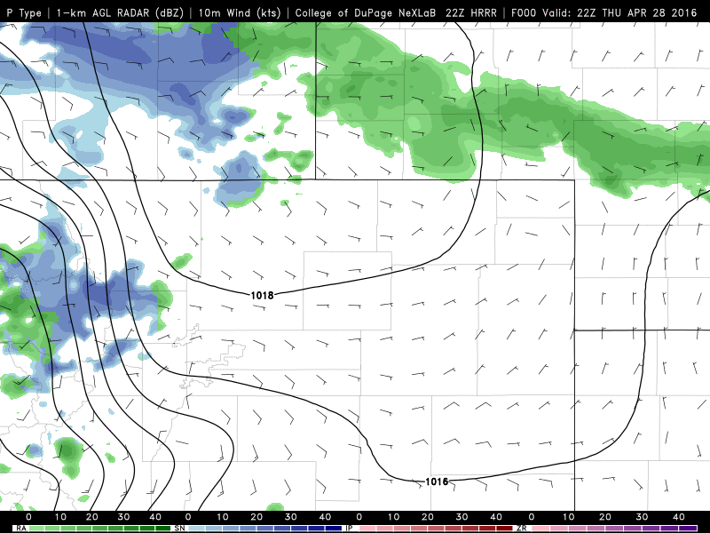
HRRR model precipitation forecast overnight tonight
As Friday wears on, the precipitation will continue, likely mixing with rain in spots (sorry Longmont). Temperatures will hover between 33 and 37 across the region, and with the late April sun, there will be a lot of melting. Despite some heavier precipitation falling late Friday morning into the early evening, it may be too warm for much snow to stick. In fact, whatever fell overnight will probably melt before the end of the day!
The models have agreed to disagree about what will happen towards the tail-end of the storm. The NAM has a break in the action Friday evening, but redevelops light snow later Friday night. The GFS develops it a little less, while the Canadian never fully redevelops the precipitation across the Front Range. Therefore, it is unclear if we’ll have a secondary chance at accumulating snow Friday night. Right now we’re thinking yes, but only a couple of inches more at most.
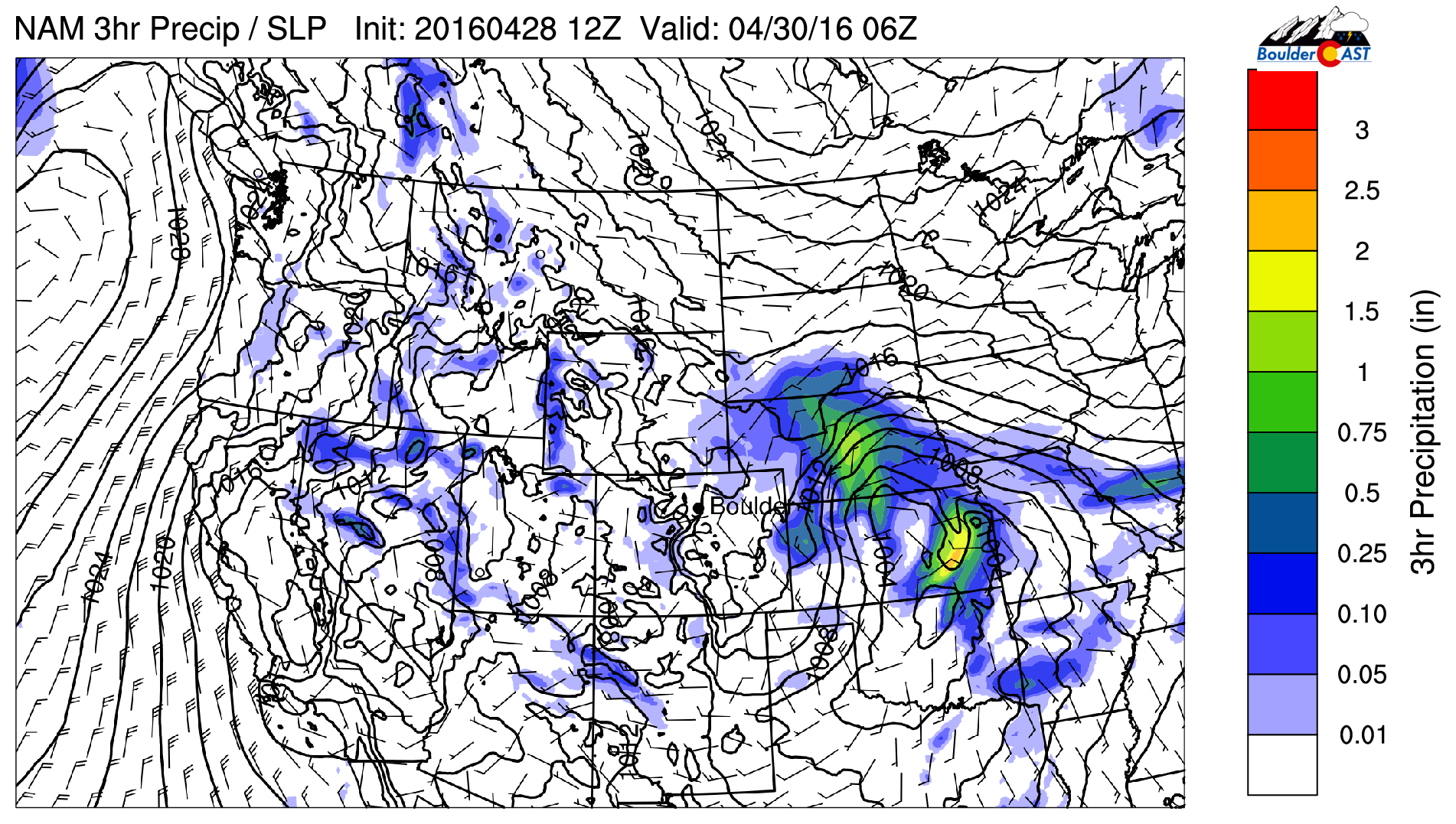
NAM precipitation for midnight Friday night showing a break in the action for our area
In the Foothills, light snow has been falling and already accumulating above 8,000 feet through the day. With cold air in place throughout, the higher Foothills will have no trouble exceeding 8″ of snow from the storm. We’re only forecasting through Saturday afternoon, but there is a good chance snow will continue through much of the weekend, with several inches of additional snow possible by Monday. In the lower Foothills (below 7,000 feet), it will be mostly snow as well. With temperatures in the upper 20’s and low 30’s tonight and Friday, snow totals will be lower than the higher Foothills (some melting/lower snow-to-liquid ratios).
Red flags are waving…
The early onset of today’s precipitation and temperatures remaining only in the 30’s is a bit of a red flag that the models haven’t had a very good grasp on what’s going to happen with this system. There are several distinct pieces of energy interacting, and there are still a lot of inconsistencies model-to-model. With that said, the much wetter GFS has come down a little since yesterday, but is still well above the other models. The trend has been drier for the Boulder area in general, but were still talking 0.6 – 1.4″ of liquid by Saturday afternoon.
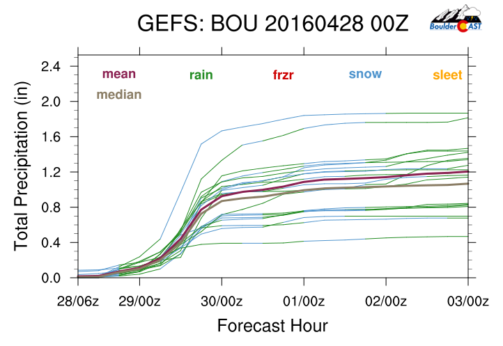
GEFS plume forecast for total precipitation in Boulder.
These crimson flags lend to rather low confidence in the overall forecast. In fact, there are several models which remain relatively insistent on dumping a foot of snow (or more) across the Denver Metro. It’s hard to believe these solutions, though, considering the late April timing of the storm and marginal thermodynamics. There is also some indication the heaviest precipitation could remain east of Denver, with only weak upslope present across the Boulder area. With that said. there is a fair chance for the forecast to bust either way, up or down, as is often the case for these spring storms. There are so many competing factors at play.
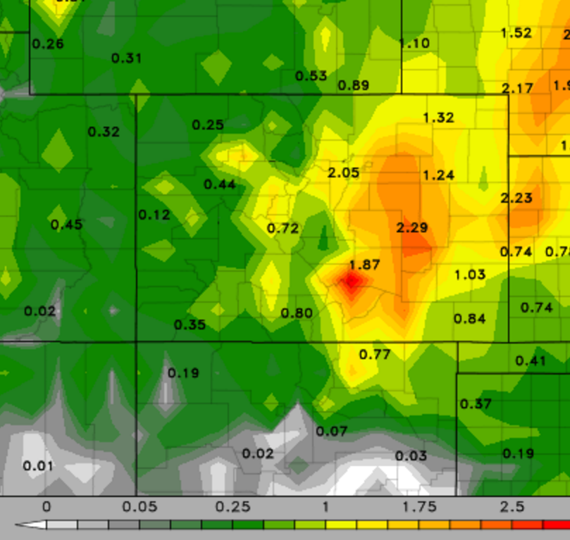
Latest GFS precip accumulation through Saturday afternoon. 1-2″ is indicated, with more east of Denver
Amounts:
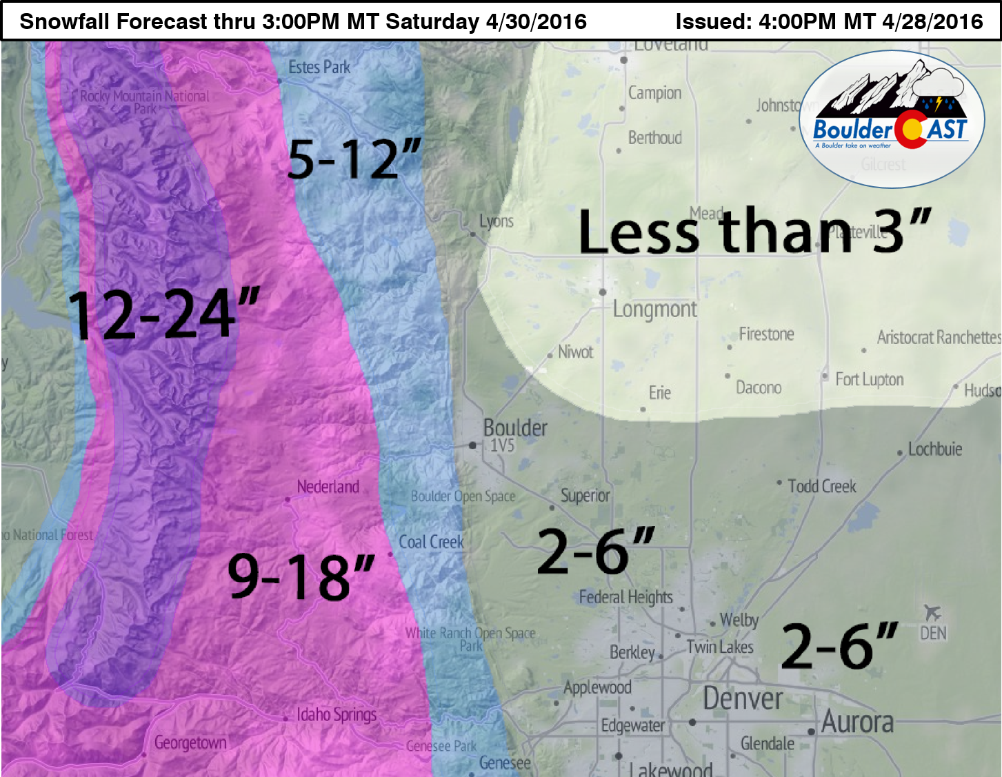
Ah, the million-dollar question! We were hoping for a bit more clarity in today’s models, but that isn’t entirely the case. We think the best odds of accumulating snow will be late tonight into Friday morning. Then, depending on how things evolve the second half of Friday, we could see another period of accumulating snow. In the end, snow totals will likely be less than 6″ across the Plains. It won’t look like much either, as there will be a ton of melting. The roads should remain mostly wet, except higher up where conditions will deteriorate later tonight. The higher elevations are on track for anywhere from 5 to 18″, depending on elevation.
Our final forecast map is below.
Summary:
- Spring storm approaching, bringing near continuous rain and snow to the region through Friday night (and beyond actually for the higher elevations).
- Foothills set for a significnat dumping of spring snow, but not nearly as much as the last storm
- Marginal temperatures and model differences still leave a lot of uncertainty for the Plains, but just about everyone should pick up some snow
- Travel impacts should be minimal, except in the higher elevations at night
Unsettled weather will continue through the weekend and early next week. As of now, nothing looks too substantial, outside of persistent waves of light snow for the higher terrain. On the Plains, conditions will remain cool and cloudy through Tuesday, with a chance of rain and snow here and there.
Let’s hope these frequent April (snow) showers we’ve endured lead to plentiful May flowers! Oh, and TGIF (almost)!


You must be logged in to post a comment.