After the blizzard earlier this week, tonight’s snow seems hardly worth mentioning. A quick-moving system embedded in the northwest flow will produce snow across the region late tonight into early Saturday. However, most of the action will remain to our south, so amounts will be on the light side.
The 31.4″ of snow recorded in Boulder over the last seven days (I know, crazy right?) makes March 2016 the 6th snowiest March on record for the city. With a few more inches, this March can jump up to third place (top spot is 57″ from 1970). We’ve also already eclipsed our normal seasonal snow total. Anything we get from here on out is bonus snow!
The system of interest for tonight can be seen below in the 500mb vorticity map from the NAM model, valid this evening.
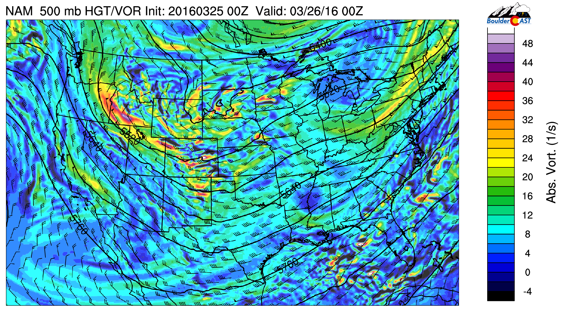
NAM 500mb vorticity map valid Friday evening
There is a large trough across the western United States, with two embedded features that will be impacting Colorado in tandem. The first will be hitting mainly the Mountains during the day today and into this evening (it’s visible above over Colorado). A second, stronger piece of energy can be seen in Idaho. That will be the “main event”, bringing a surge of colder air into eastern Colorado just before sunrise on Saturday. That push can be seen below on Saturday morning’s 800mb temperature map (light green area and NNE winds).
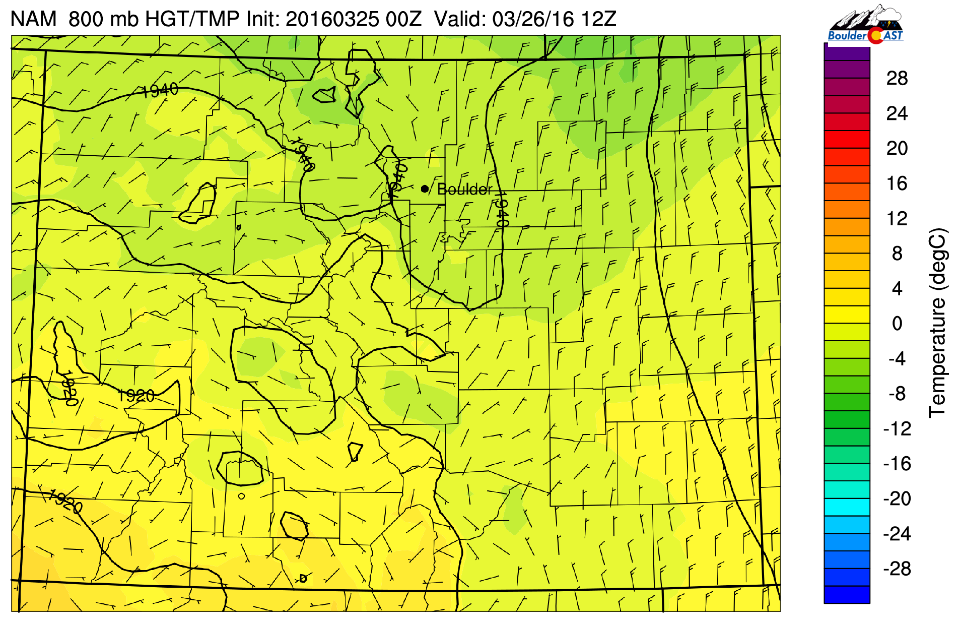
NAM 800mb temperature and wind map for Saturday morning, showing a cold front moving south into NE Colorado
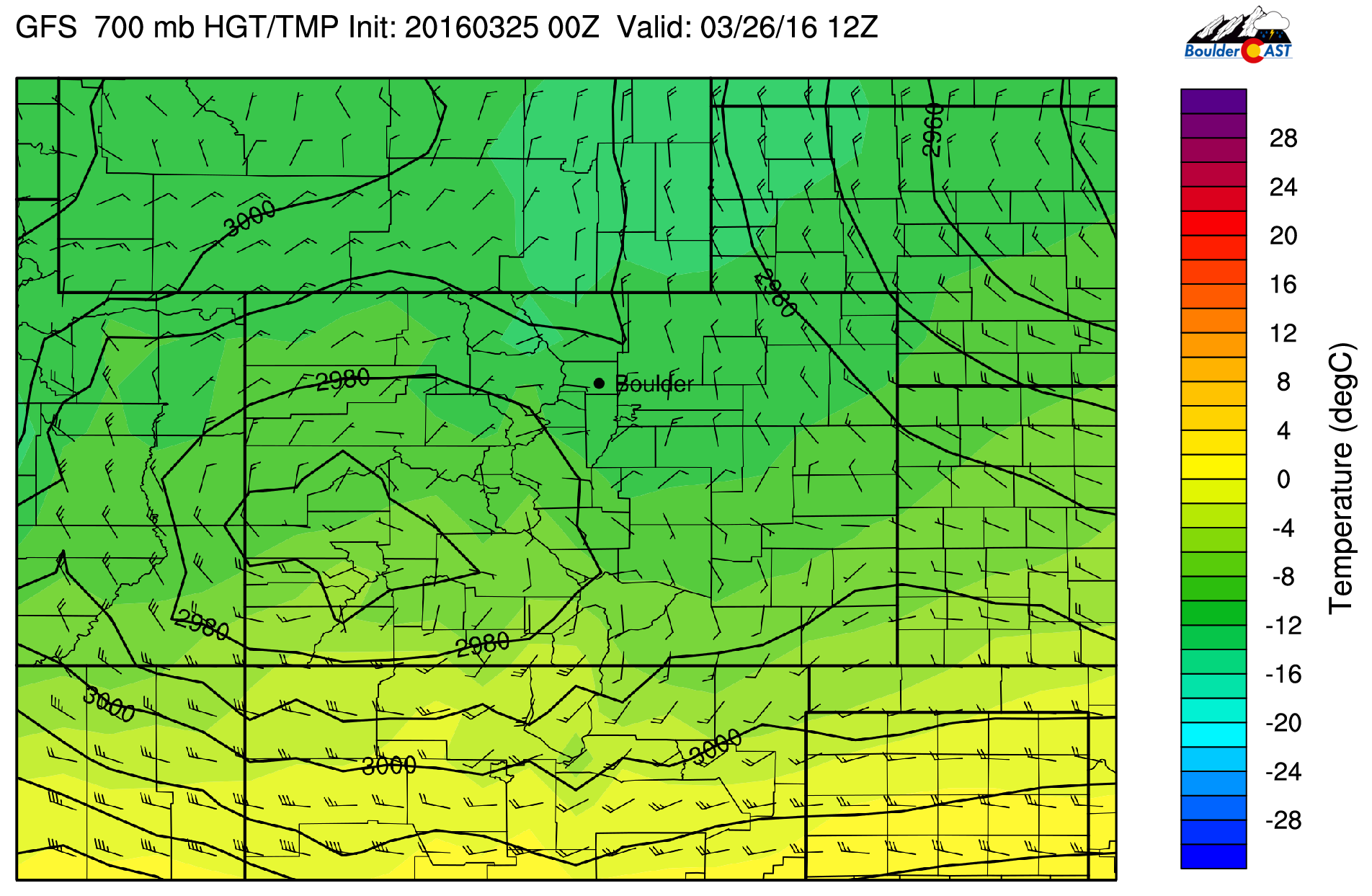
Behind the front, a period of upslope will ensue. It will be more northerly than easterly, and will be weak, so were not expecting huge impacts in the Boulder area. The 700mb winds from the GFS at 6AM Saturday are shown below. Weak NNE 10-15 knot winds are present. More favorable upslope flow remains mostly south of Denver.
Through the week, the models have been trending further and further south with this system. It’s to the point now, that any additional shift will result in only trace amounts of snow in Boulder/Denver. We are right on the fringe.
We will be climbing into the mid 40’s this afternoon (the solar-powered snow-removal team will be in action). Before the front tonight, some light and spotty rain (Foothills snow) showers will be possible this afternoon and into the evening hours. Nothing major or widespread. Our best chance of accumulating snow will be between about 4AM and 11AM on Saturday. Light snow could linger into the afternoon, especially in the Foothills and Mountains.
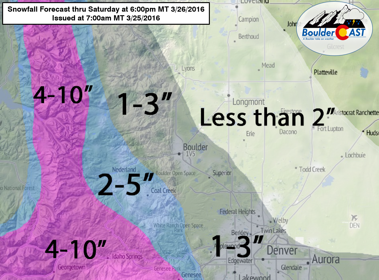
At this point, the GFS model is the furthest north with the system, and thus produces the greatest snow amounts for the Boulder area (which is still only 2-4″). The NAM, Euro, and Canadian have varying degrees of “south”, which generally result in 2″ or less for most of our region. Blending these solutions, our snow map is shown below. With the way things are looking, we’ll probably end up on the low end of the ranges from Denver north.
Skies will begin to clear Saturday evening, with brisk temperatures in the mid to upper 30’s. Sunday will rebound into the 50’s with lots of sunshine.
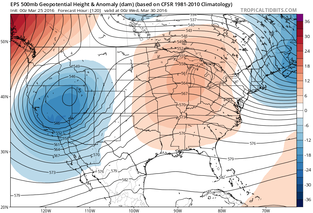
We’re also tracking an intriguing weather system for the middle of next week. Models don’t know what to do with it just yet. Some show it cutting off, others keep it moving along with the jet stream. The European ensemble mean depicts a deep cut-off low across Nevada on Wednesday (below). Definitely something to watch. Consider snow at least possible for the Tuesday into Thursday time-frame. More on that in Monday’s weekly post. Have a great weekend!


Dig this site! Thank you!
Glad you enjoy it, Cynthia!
Thanks for your support!