Last week, Boulder County was under the threat of severe weather on both Wednesday and Thursday. During this rare and historic event, numerous supercell thunderstorms spawned across our area. We take a look back at the atmospheric set-up, what actually happened, and the devastating aftermath.
While it was forecast to be very active day for severe weather on Wednesday, the low-level easterly flow behind a cold front was weaker than projected by the models, reducing the shear values which prevented even a single tornado from forming in Colorado. Boulder County, in particular missed out on almost all of the storm activity. Storms began to initiate around 3pm south of Denver and moved northeastward. The city of Boulder experienced just a few glancing blows from weak storms and picked up less than a tenth of an inch of rain. Hail producing cells did form, mostly from Denver southward, generally with diameters in the 1 to 1.5″ range.
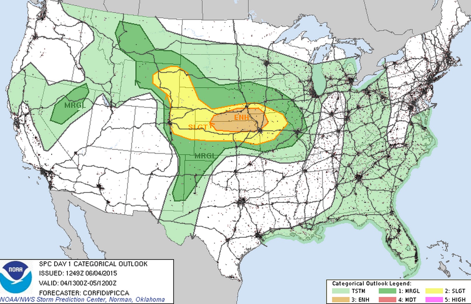
SPC Severe Outlook for Thursday, with all of NE Colorado in “Slight Risk”
Thursday was a different story. All model guidance indicated the overall storm coverage should have been reduced, and with less shear (but still significant), the severity of the storms would be lower than Wednesday. This prediction, however, did not prove to be accurate, especially for our county.

9News Doppler Radar at 8:35pm Thursday evening, showing the location of the tornado and hail reports. The persistent cell still remained over the same general area for two or more hours.
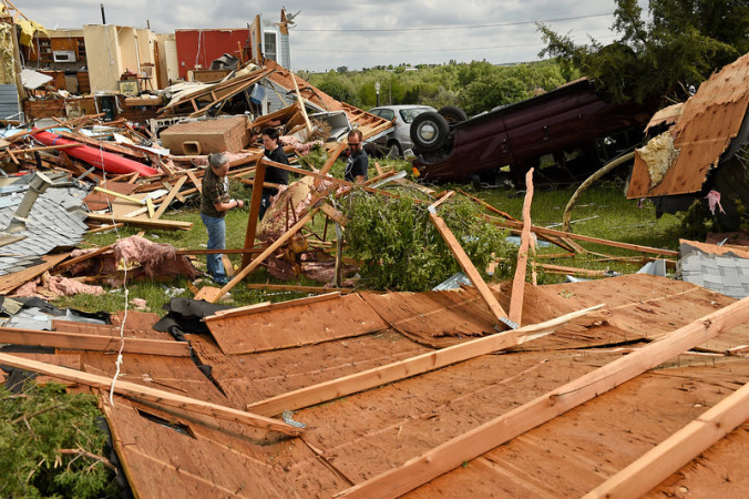
By mid-afternoon Thursday, a few strong, but not severe, storms were already forming near I-25 and to the east. These storms sent out several outflow boundaries, westward toward the Foothills. This provided the additional lift to fire off a split supercell thunderstorm over the far northern extent of Boulder County which remained near-stationary for several hours, as the easterly outflows fought the westerly steering flow aloft. At 6:34pm, reports came in from the sparsely populated area north of Longmont that a tornado had touched down. The twister remained on the ground for 13 minutes, cutting a 5 mile, 200-yard wide track westward, destroying/damaging as many as 30 homes and structures. Thankfully, no major injuries or fatalities occurred.
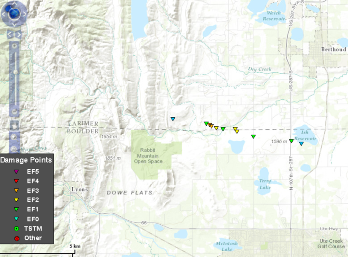
Evaluated strength of the tornado at various points along its track, moving west-northwest between Longmont and Berthoud, flirting with the Boulder and Larimer county line.
Based on the surveyed damage, this tornado became the first EF3 on record in Boulder County, eerily sharing the same atypical strength, “long” track, and westward movement of the May 2008 EF3 Windsor tornado discussed by the hosts in detail during the last BoulderCAST Podcast (Episode 4). In fact, this was the first tornado in the county since June of 1997, when an F1 tornado momentarily touched down near the Baseline Reservoir in east Boulder, damaging a few structures and trees. EF3 tornadoes have 3-second wind gusts of 136 to 165 mph.

The tornado near the height of its strength.
Check out some dash cam footage of last week’s tornado below, compliments of Boulderite YouTube user gcgoods.
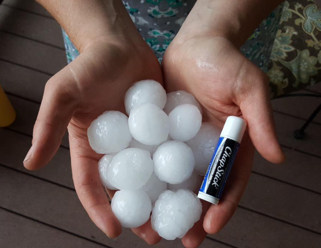
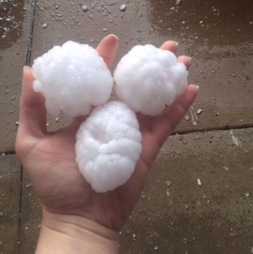
The supercell not only dropped this rare and powerful tornado, but also produced hail ranging in size from quarters to tennis balls, from Longmont to Lyons. In some locations, the hail persisted more than an hour and accumulated up to 8 inches and needed to be plowed from the roadways like snow. Look at some of these unbelievable photos submitted by residents!
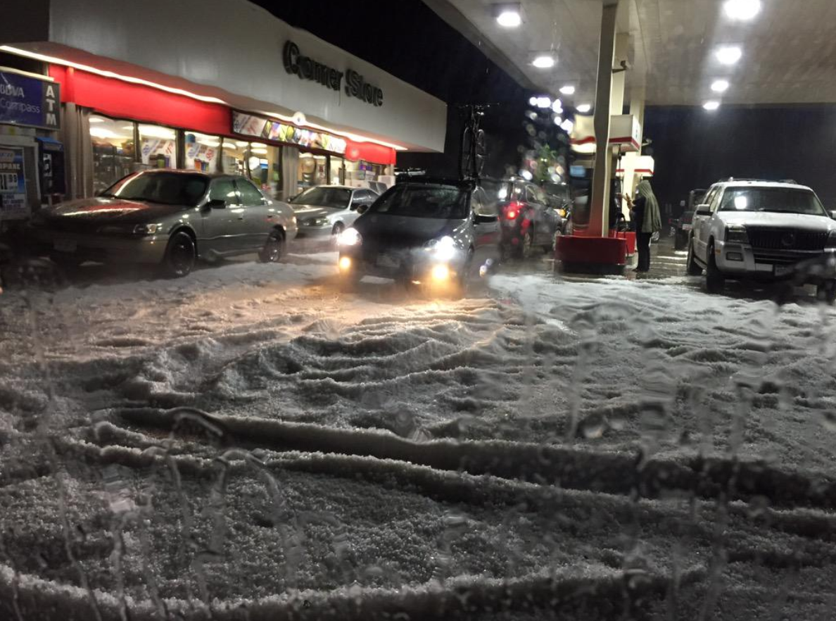
The Diamond Shamrock gas station in Lyons along US 36. Hail piling up like snow, taken by Valerie Deats.
Quarter to half dollar sized hail north of Longmont.
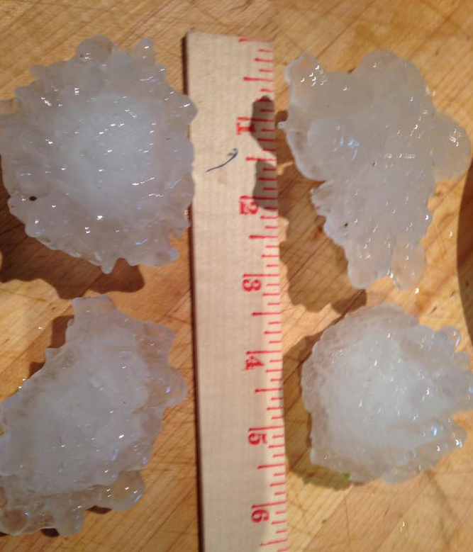
Irregularly-shaped tennis ball sized hail near Lyons. Thanks to @TheGraveWolf.
More 2″+ hail from Lyons, taken by Sherry.
With juicy low-level dew points (mid to upper 50s) and slow storm movement, tremendous amounts of rain were observed alongside the hail and tornado in northern Boulder County, with reports of 1.5 to 3.0″ of rain being common, falling over the course of just a few short hours. This caused some localized flooding from Lyons eastward (see video below), which prompted the NWS to issue a Flash Flood Warning for the area.
Looking back, the computer models and the forecasters that rely on them did their job last week. Tornado Watches were issued by the Storm Prediction Center for all areas in which tornadoes occurred, and the National Weather Service was on top of the rotating storm near Longmont with a Tornado Warning. These precautions may have saved lives!
There is a reason cities like Longmont, Boulder, and Superior have tornado sirens. Despite the lack of tornadoes in their climatology, sometimes Mother Nature provides just the right set of ingredients. June 4, 2015 needs to serve as an important reminder to us all: intense and potentially deadly tornadoes in Boulder County are possible, despite how infrequently they come to stage. Let’s all hope for a quiet transition into the less tornadically-active monsoon season as June progresses across the Front Range!


You must be logged in to post a comment.